Alaska/Canada 2022-22: Doug's Last Meander
August 9-September 9, 2022
We left Doug in the previous post taking pictures of Marilyn's plane as it took off from Skagway, Alaska. A new chapter begins with Doug smiling: he gets to drive the van home!


"That afternoon I arrived at the Native Net Fishing Grounds on the Buckley River near Witset BC, another spot with fond memories. It's a good thing I stopped again, as despite a visit in 2017 alone and in 2019 with Marilyn, we've never posted about it! Life and the next trip can interfere with blogging...
.jpeg)
 Native fishermen were amazing--climbing down steep cliffs & hanging out over the fast-moving river to net salmon swimming upstream. And yes, the salmon do get over that waterfall.
"In 2017, I was lucky to be able to buy fresh-caught salmon and set up camp near the fishing grounds.
.jpeg)
"Not long after I'd bought salmon, a young couple arrived who had biked from California to Alaska and were heading to Ontario, Canada.

"Delighted to have companions, I offered to share camp chairs and the salmon. Then Jose informed me that Kate is a gourmet chef—talk about being lucky! Kate took over meal prep.

"I admit, the salmon was definitely better than what I'd prepared a couple nights before.

The next day took Doug through Prince George and northeast toward Dawson Creek, which is Mile 0 of the Alaska Hwy (the AlCan).

Though it was a bit out of the way, Doug wanted to go to Dawson Creek because, "I wished to re-visit Faking Sanity Bookstore one more time. If ever in Dawson Creek, please visit for great coffee and a wonderful, helpful staff.

"With a new complement of books, I was finally off to Fishtail MT, to visit Linda...except when I stopped for gas and looked at my trusty AAA map, I saw that I could go just a bit further east and visit the province of Saskatchewan and, even better, the town of Saskatoon. Why, you ask? Silly question: I liked the sound of the names! Oh, and further justification, the name of our blog is Meandering the Blue Highways, isn't it?"
The shortest route from the gas station to Saskatoon would be about 11 hrs/680 miles. Doug's route turned out to be 12 hrs/718 miles. Pretty close.

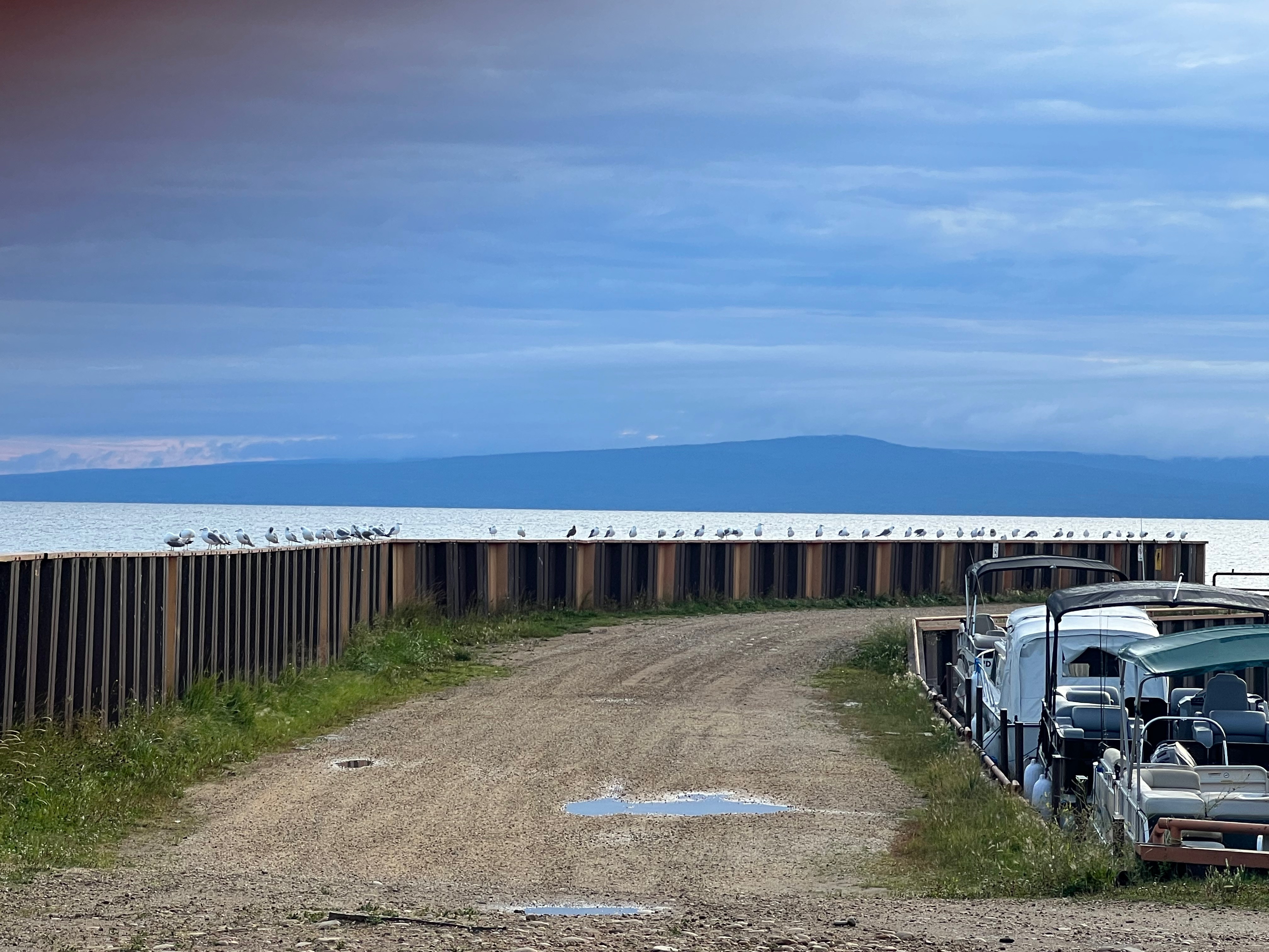
 Seagulls attentive for any stray fish from fishing boats.
The next day Doug discovered the town of Athbasca and Athbasca University. The university began in 1970 as a traditional campus-based institution, but in 1972, it converted to an open, distance-learning university.

Doug spent that night at a great flat spot off the road near Athabasca and in the morning found a place for a delicious breakfast and good conversation. Then it was on to Saskatchewan!
The shortest route from Athabasca is about 6 hrs/382 mi. But Doug needed to see Edmonton, so the route would be a bit—or a lot—longer, as who knew what there was beyond Edmonton?
There aren't any photos of Edmonton, but Doug did arrive in Waskatenau on the last day of Fair Days.

Doug picks up the tale: "The Waskatenau parade was similar to the fair parades I enjoyed growing up in the rural San Joaquin Valley of Central California.

"Continuing south, I came to Bruce and wondered how our friend Bruce came to have a town in Alberta named after him.

"Saskatoon was getting closer, 4 hr/252 mi from Bruce, maybe..."

According to a government website, the province of Saskatchewan is the world's largest exporter of lentils, peas, durum wheat, mustard seed, canola, flaxseed, and oats, as well as being second in cattle-production in Canada.
Saskatoon's original inhabitants were of course First Nations People. Its name derives from a Cree word referring to the sweet, purple berry that grows in the area.

Doug continues: "I had no idea what to expect but found Saskatoon to be a modern, vibrant city. Unfortunately, the traffic was not conducive to stopping, so I headed south and found another river to camp on. In the morning, I continued south for the US border and Montana."

.jpeg)
.jpeg)
.jpeg)
.jpeg)
South of Saskatoon, Doug saw an old run-down house in a field. "Whenever I see such a place, the Kate Wolf song, 'Carolina Pines' comes to mind. I often sing the song and make up stories about the history of a home. With the many abandoned homesteads in the area, I made up a lot of stories."
At 4:30, Doug learned, to his amazement, that the Monchy Border Crossing is only open M-F, 9-5. At least he was there on a weekday, but he was still an hour from the border. Fortunately, in the small town of Val Marie, he found a very clean city camp with showers.
The next morning, he arrived at the border and soon was back in the US. Next stop: our friend Linda's in Fishtail MT.
Fishtail, population about 70, is on the banks of the West Rosebud River in the foothills of the Beartooth Mountains.

Doug says of his three days in Fishtail, "I enjoyed every minute. Linda and her friends were just amazing."


.jpeg)
"After a nice visit at Linda's it was time to head west for my kids and grandson in Washington.


"The plan was to drive to Idaho and stop for the night, but temperatures continued to hover around 95, so I drove across Idaho and kept on going.

"As I approached the Grand Coulee Dam on the Columbia River in Washington, it finally had cooled to the low 80s.
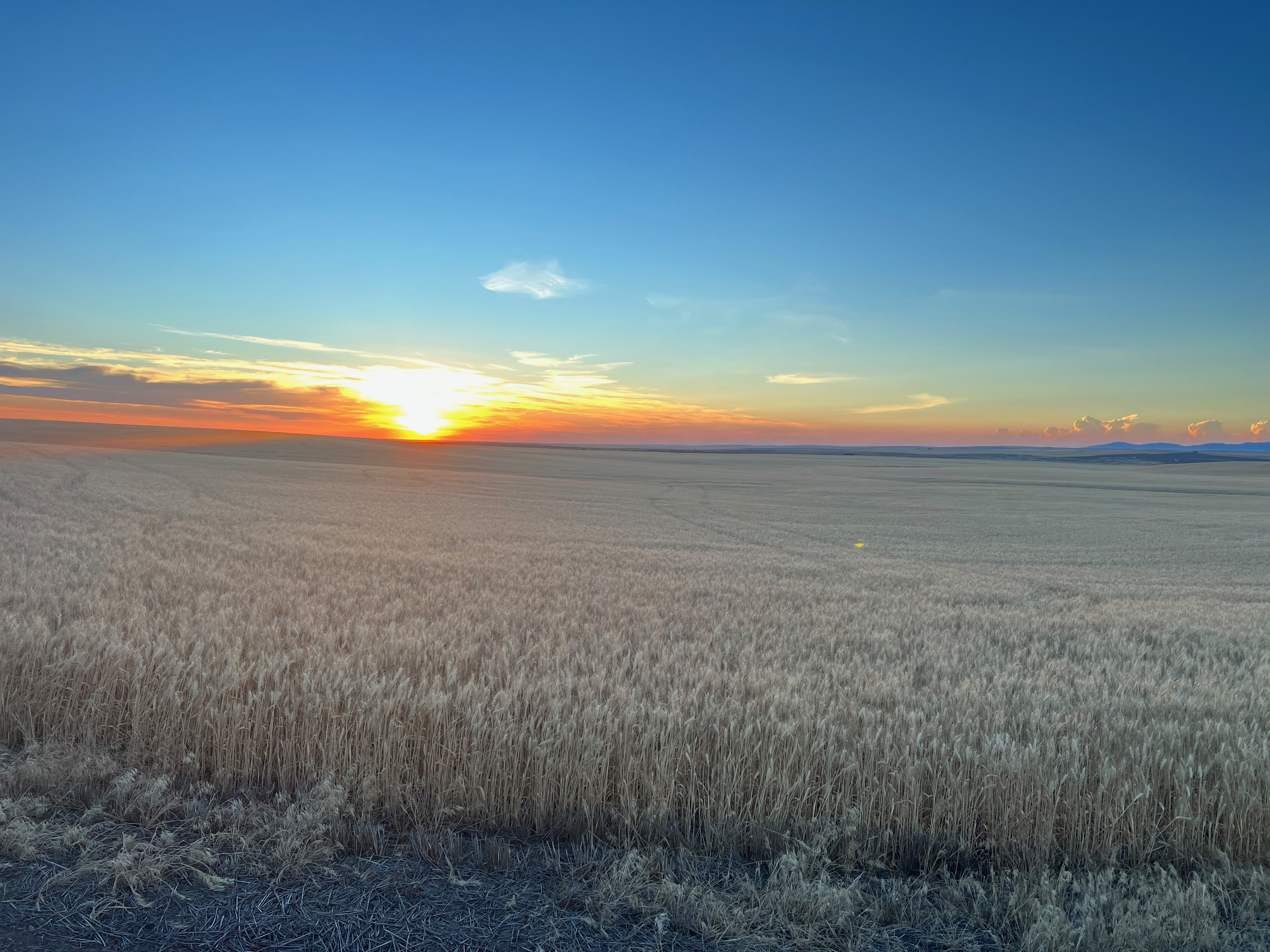
 Sunset.
"I admit, that was probably the hardest drive of the entire trip: 600 miles of freeway driving, which I do not enjoy.
 Spring Canyon Campground, Lake Roosevelt NRA.
"There are few places to just pull over for the night, so it was a campground: Spring Canyon Campground on Lake Roosevelt, just out of Electric City WA."
 Lake Roosevelt, on the Columbia River.
Grand Coulee Dam forms Lake Roosevelt on the Columbia River. The lake extends 152 miles northeast, almost to the Canadian border. We have camped several times to the north at Haag Cove, just off the North Cascades Hwy, and taken the free Colville Confederated Tribes Inchellium-Gifford Ferry across the lake.
 Grand Coulee Dam.
Grand Coulee was constructed from 1931-'36, and, like many dams in the Western US provides power, water storage, and recreation. The dam stands about 550 feet tall, about the height of the Washington Monument and the Space Needle and approaching twice the height of the Statue of Liberty.

The next morning Doug found a coffee shop in Electric City, which sits below Grand Coulee Dam, before heading northwest for one of our favorite drives: the North Cascades Highway, Hwy 20, through North Cascades National Park.
 Driving across the Columbia River one final time.
.jpeg)

.jpeg)
 The Osprey.
The Osprey.
A ltitle west of the Grand Coulee Dam, Doug spotted a group of kayakers on the Columbia River.
.jpeg)
Just as it does from its source in Canada, from Grand Coulee, the Columbia flows north awhile before turning and heading south again, eventually turning west and forming the Washington-Oregon state line.


.jpeg)

After a last night on the road, Doug's 2-week meander east through Canada and back west through Montana, Idaha, and Washington, was over and he headed for Bellingham WA, where his son and daughter-in-law live.
We left Doug in the previous post taking pictures of Marilyn's plane as it took off from Skagway, Alaska. A new chapter begins with Doug smiling: he gets to drive the van home!
Sunset, Creston, WA.
Now, a straight shot from Skagway to Visalia is about 2,570 miles and 45 hours of driving. It would look like this:
.jpeg)
.jpeg)
The quickest route from Skagway AK to Visalia CA.
But knowing Doug, it is obvious he would rather take a route that would allow him to meander hither and yon and see folks, critters, countryside, and towns, while driving 95ish hours and 5,586ish miles. By the time he found home the route looked more or less like this:

Doug recounts his travels: "Just before Marilyn flew out, my daughter in Seattle texted that the three of them had Covid. Plus my son, who lives in Bellingham, was off to a conference. So what to do with two unexpected weeks but meander: go slow, enjoy getting to know new country, and visit a life-long friend. My initial setting was to head southeast on the AlCan, eventual destinations visiting Linda, my childhood friend in Fishtail MT, then spending time with my kids and grandson in Washington.
"But first, to resupply and shower, so from Skagway, I returned north to Whitehorse. With food in the pantry and a few layers of dirt washed away, I reformulated my first plan: drive the AlCan to Watson Lake and then take the Cassiar Highway south. It's less traveled and is the only way to reach Hyder AK, a favorite on past trips.
.jpeg)
"Halfway down the Cassiar I turned west at Meziadin Junction for Stewart BC, and landlocked Hyder AK. The first treat is seeing Bear Glacier curving down the mountain to Bear River.

"In Stewart BC, I found Rainey Creek Campground. The next day would be bear viewing in Hyder AK."

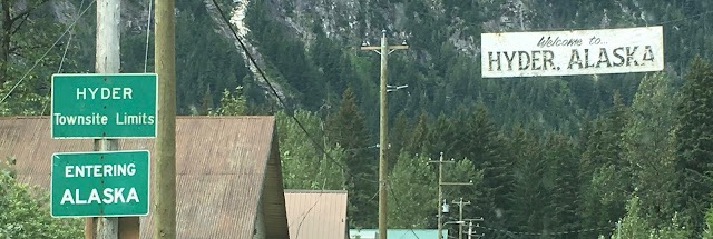
You get to Hyder AK, by going through Stewart BC, thus going from Canada to the US.

It's a bit frustrating that every time you return from Hyder you have to stop at Canadian Customs before you can finish returning to Stewart.


Doug's route from Skagway AK to Visalia CA.
"But first, to resupply and shower, so from Skagway, I returned north to Whitehorse. With food in the pantry and a few layers of dirt washed away, I reformulated my first plan: drive the AlCan to Watson Lake and then take the Cassiar Highway south. It's less traveled and is the only way to reach Hyder AK, a favorite on past trips.
.jpeg)
Camped on a pullout at Simmons Lake along the Cassiar Hwy in BC.

Bear Glacier & River along the Yellowtail Hwy en route to Stewart BC/Hyder AK.

Doug joined an ad hoc Promaster convention at Rainey Creek Campground in Stewart.

Arriving at Hyder, 1 mile from Stewart BC.

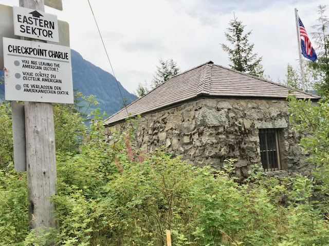
Hyder possesses a sense of humor about itself.

Canadian Customs returning to Stewart BC, from Hyder AK.
The need for the official border crossing may be linked to a time when Canadians were prone to smuggling cigarettes from Hyder. By the same token, during US Prohibition, Alaskans crossed the street to Stewart (then named Hyder BC) to buy liquor, then walked home again. But the US didn't make the border crossing official, and the Alaskans have a bit of fun with their Canadian neighbors.
You might cross the border 10 times a day, and by the 3rd time, Canadian Customs Agents probably recognize your vehicle, if not you. Doesn't matter. After a few trips through, you can answer the questions before they are asked. Fortunately, the agents are polite and understanding.

You might ask, Why would you go to Hyder 10 times a day? Three reasons:
1) Salmon Glacier up a gnarly dirt road (if it's not fogged in).

Signs such this make me realize there are all kinds of questions I haven't even thought to ask, like, Just what is a glacier? From the sign: a large slow moving river of ice, formed from compacted layers of snow. Glacier ice is the largest reservoir of fresh water on Earth and second only to oceans as the largest reservoir of total water.

The ominious-looking blockhouse was constructed by the Army Corps of Engineers as a storehouse in 1896.
You might ask, Why would you go to Hyder 10 times a day? Three reasons:
1) Salmon Glacier up a gnarly dirt road (if it's not fogged in).

You can drive to the toe of Salmon Glacier, though you may not see it.

Signs such this make me realize there are all kinds of questions I haven't even thought to ask, like, Just what is a glacier? From the sign: a large slow moving river of ice, formed from compacted layers of snow. Glacier ice is the largest reservoir of fresh water on Earth and second only to oceans as the largest reservoir of total water.
And, What makes glaciers move? Gravity, internal deformation, and basal slip. The latter happens when ice slides over the bed on a film of water.
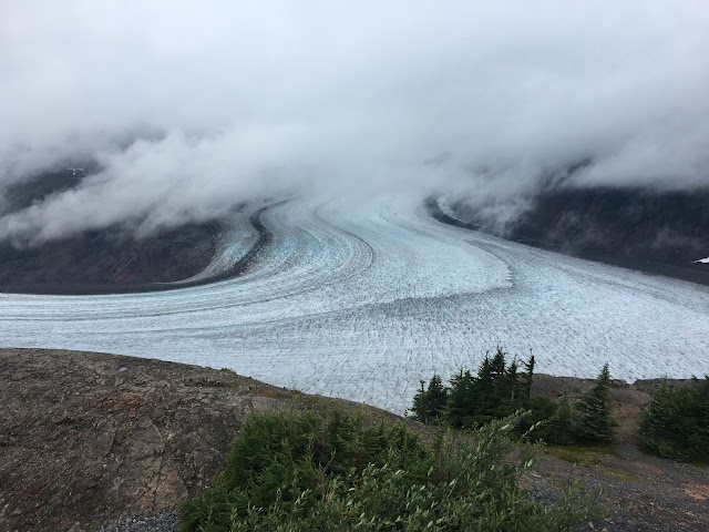
Salmon Glacier is the 5th largest glacier in North America and is located in BC, bordering Alaska. From 4,300 feet it descends to sea level. The toe, also called glacier snout and terminus, is the lowest end of a glacier. Kettles are the small ponds below the toe, formed when blocks of ice break off a glacier and create a depression. Minerals suspended in the water create the color.
.jpeg)
Next on reasons to cross the road from Stewart to Hyder:
2) Fish Creek Viewing Platform. You never know if the salmon are running on a given day or time, so you keep returning to see if the grizzlies and black bears are fishing.


And another reason to go to Hyder:
3) The Bus, where you can dine on fresh halibut cooked and served by the owner from her old bus converted to a kitchen. She's likely to put you in your place, as well.
Salmon Glacier is the 5th largest glacier in North America and is located in BC, bordering Alaska. From 4,300 feet it descends to sea level. The toe, also called glacier snout and terminus, is the lowest end of a glacier. Kettles are the small ponds below the toe, formed when blocks of ice break off a glacier and create a depression. Minerals suspended in the water create the color.
.jpeg)
An old picture of a 20-horse train ascending Salmon Glacier.
Next on reasons to cross the road from Stewart to Hyder:
2) Fish Creek Viewing Platform. You never know if the salmon are running on a given day or time, so you keep returning to see if the grizzlies and black bears are fishing.

Fish Creek Viewing Platform, Tongass National Forest, Hyder AK.

Salmon swimming upstream to spawn.
Bear fishing: Doug's first visit to Stewart/Hyder, 2017.

Shoulder hump identifies this as a grizzly, 2022.
And another reason to go to Hyder:
3) The Bus, where you can dine on fresh halibut cooked and served by the owner from her old bus converted to a kitchen. She's likely to put you in your place, as well.
Doug picks up the tale: "After a day of viewing a grizzly feasting on salmon and a great dinner of fresh halibut at the Bus, it was time to leave Stewart/Hyder. A quick shower in the morning, and I headed east, which, absent a boat or plane, is the only way you can go from there.

Doug's route from Hyder AK/Stewart BC to US/CA border in Saskatchewan.
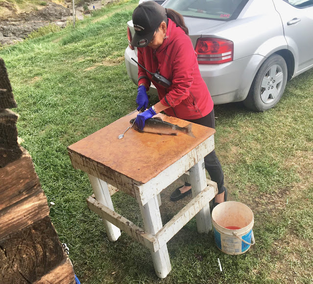
"That afternoon I arrived at the Native Net Fishing Grounds on the Buckley River near Witset BC, another spot with fond memories. It's a good thing I stopped again, as despite a visit in 2017 alone and in 2019 with Marilyn, we've never posted about it! Life and the next trip can interfere with blogging...
.jpeg)
First Peoples Net Fishing site on Buckley River near Witset, BC.
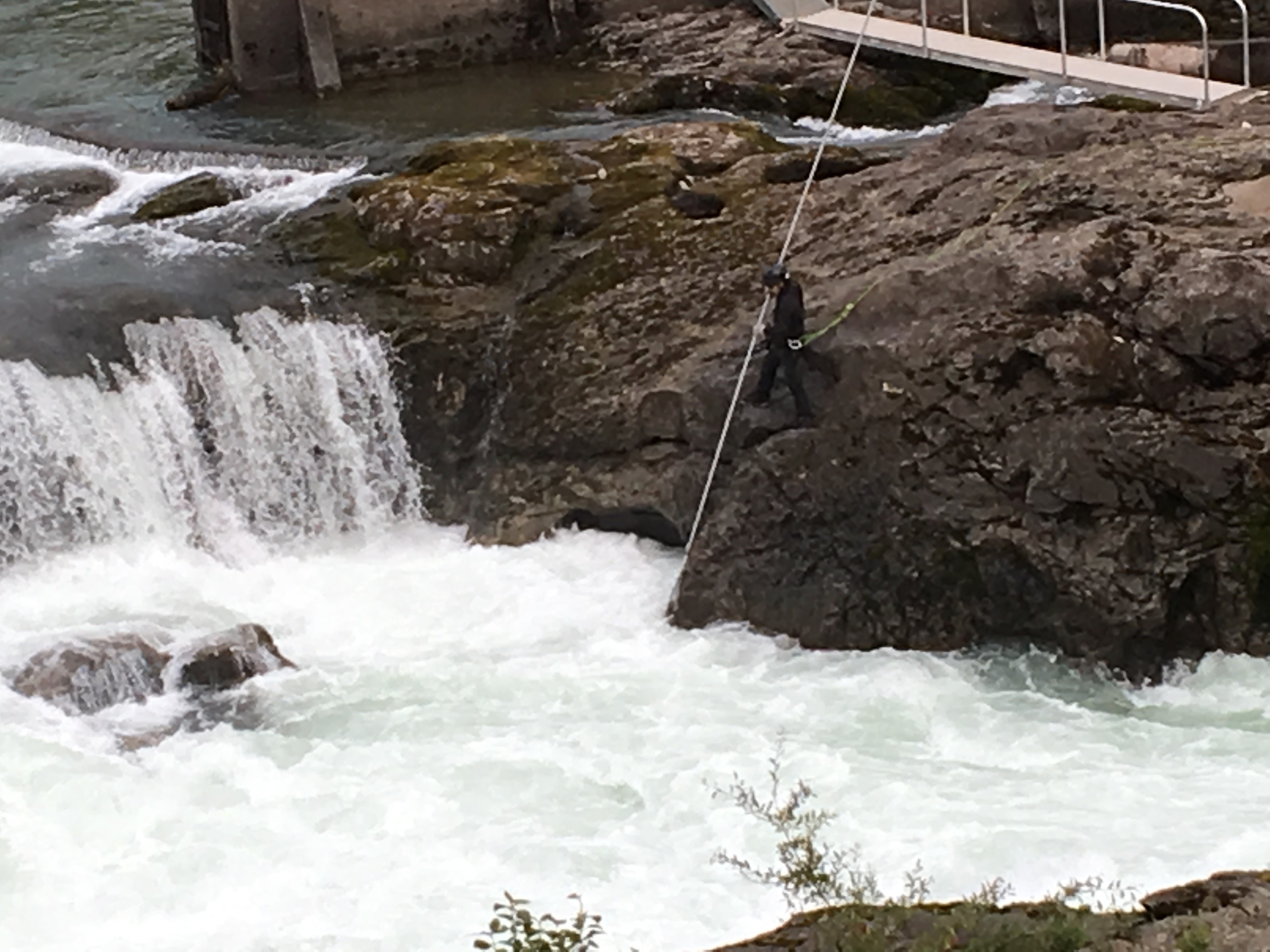 Native fishermen were amazing--climbing down steep cliffs & hanging out over the fast-moving river to net salmon swimming upstream. And yes, the salmon do get over that waterfall.
 Net Fishing, 2017.

Buying freshly netted salmon..
.jpeg)
Another find, a free campground along the river above the First Peoples Net Fishing Grounds.

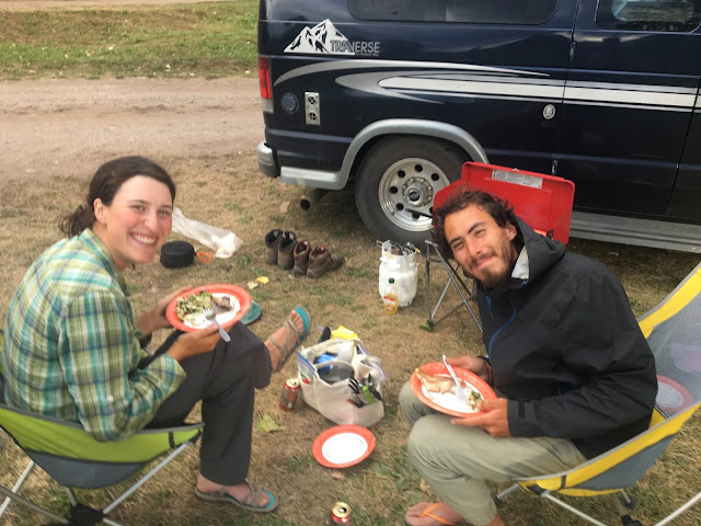
Jose, from Chile, & Kate, from Ontario CA.

Kate preparing dinner for us next to Mz Agnes, our former van, a PleasureWay Traverse poptop (like a VW Westy on steroids).

My delightful companions for the evening.

Net fishing from both sides of the river, 2019.
The next day took Doug through Prince George and northeast toward Dawson Creek, which is Mile 0 of the Alaska Hwy (the AlCan).

Boondocking off the road at Azouzetta Lake, near Pine LeMoray Provincial Park, en route to Dawson Creek BC.
Though it was a bit out of the way, Doug wanted to go to Dawson Creek because, "I wished to re-visit Faking Sanity Bookstore one more time. If ever in Dawson Creek, please visit for great coffee and a wonderful, helpful staff.

Dawson Creek: British Columbia, Canada, & Alberta flags.
The shortest route from the gas station to Saskatoon would be about 11 hrs/680 miles. Doug's route turned out to be 12 hrs/718 miles. Pretty close.
To continue Doug's tale: "Not far from Dawson Creek, I crossed into Alberta, and things got exciting.
.jpeg) BC/Alberta border, 10 miles from Dawson Creek BC.
BC/Alberta border, 10 miles from Dawson Creek BC.
"Back in the Yukon, it wasn't until the last 20 miles of our 530-mile-roundtrip to the Arctic Circle on the dirt Dempster Hwy that a rock found the van windshield and left a lovely spider on the driver's side.
 Windshield spider from the Dempster Hwy.
"We'd added another 700 miles of dirt roads after that, with nary a meeting of rock and windshield. But in less than 2 hours on Alberta's paved roads, what might as well have been a 90-mph baseball definitely got my attention when it hit the passenger side of the windshield."

Before the afternoon was out, the windshield had also acquired a bird flying in front of Doug.

At the end of the road for the day was a peaceful campsite and wonderful shower on Lesser Slave Lake. The name "Slave" comes from the Cree name for the Dene, whom the Cree sometimes enslaved. The Cree call the lake "Beaver Lake," while the Dene ("the People," what Athabascans call themselves) know it as "Beaver People Were Over There, Living There."

The Athabascan people are in large part identified by their language, which is spoken not only in Alaska and Canada, but also on the Pacific Coast and in the American Southwest.
.jpeg) BC/Alberta border, 10 miles from Dawson Creek BC.
BC/Alberta border, 10 miles from Dawson Creek BC."Back in the Yukon, it wasn't until the last 20 miles of our 530-mile-roundtrip to the Arctic Circle on the dirt Dempster Hwy that a rock found the van windshield and left a lovely spider on the driver's side.
 Windshield spider from the Dempster Hwy.
"We'd added another 700 miles of dirt roads after that, with nary a meeting of rock and windshield. But in less than 2 hours on Alberta's paved roads, what might as well have been a 90-mph baseball definitely got my attention when it hit the passenger side of the windshield."

1st Alberta rock & windshield collision.
Before the afternoon was out, the windshield had also acquired a bird flying in front of Doug.

2nd Alberta rock & windshield collision.
At the end of the road for the day was a peaceful campsite and wonderful shower on Lesser Slave Lake. The name "Slave" comes from the Cree name for the Dene, whom the Cree sometimes enslaved. The Cree call the lake "Beaver Lake," while the Dene ("the People," what Athabascans call themselves) know it as "Beaver People Were Over There, Living There."

Sunset over Lesser Slave Lake.
 Seagulls attentive for any stray fish from fishing boats.
The next day Doug discovered the town of Athbasca and Athbasca University. The university began in 1970 as a traditional campus-based institution, but in 1972, it converted to an open, distance-learning university.

An open, distance-learning university.
Doug spent that night at a great flat spot off the road near Athabasca and in the morning found a place for a delicious breakfast and good conversation. Then it was on to Saskatchewan!
The shortest route from Athabasca is about 6 hrs/382 mi. But Doug needed to see Edmonton, so the route would be a bit—or a lot—longer, as who knew what there was beyond Edmonton?
There aren't any photos of Edmonton, but Doug did arrive in Waskatenau on the last day of Fair Days.

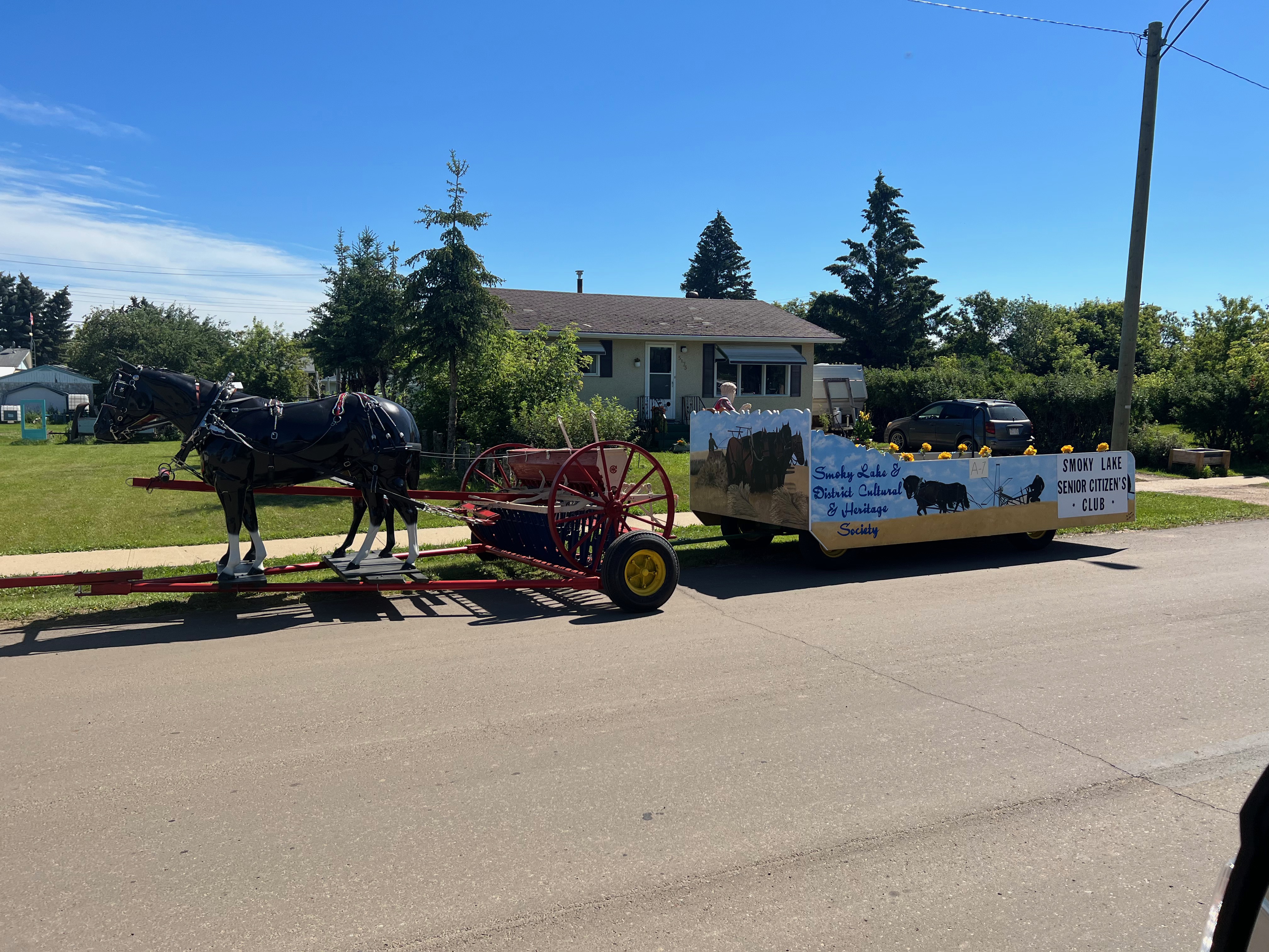
A "horse" pulls what appears to be an old alfalfa dump rake.

Doug got a picture of the sign marking the Alberta/Saskatchewan border, but no pics of Saskatoon.

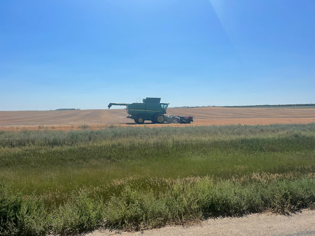
A combine after harvesting wheat.
Saskatoon's original inhabitants were of course First Nations People. Its name derives from a Cree word referring to the sweet, purple berry that grows in the area.

Saskatoon sits on both sides of the South Saskatoon River.

Antelope herd.
.jpeg)
.jpeg)
Though already in the previous Saskatchewan post, Doug loves these place names. Who was Lilly?
.jpeg)
.jpeg)
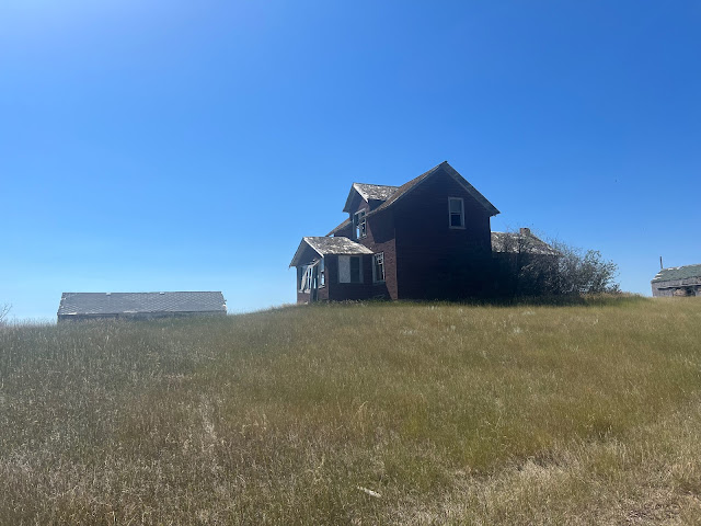
South of Saskatoon, Doug saw an old run-down house in a field. "Whenever I see such a place, the Kate Wolf song, 'Carolina Pines' comes to mind. I often sing the song and make up stories about the history of a home. With the many abandoned homesteads in the area, I made up a lot of stories."

A large abandoned home near the border. Oh, the stories it could tell!
At 4:30, Doug learned, to his amazement, that the Monchy Border Crossing is only open M-F, 9-5. At least he was there on a weekday, but he was still an hour from the border. Fortunately, in the small town of Val Marie, he found a very clean city camp with showers.
The next morning, he arrived at the border and soon was back in the US. Next stop: our friend Linda's in Fishtail MT.
Fishtail, population about 70, is on the banks of the West Rosebud River in the foothills of the Beartooth Mountains.

In case you didn't understand the name of the town: Fishtail. Next to the Library that hosts the fish tail is the Fishtail General Store.

The Fishtail School.
Doug says of his three days in Fishtail, "I enjoyed every minute. Linda and her friends were just amazing."

Linda & Newman at home.

Linda in front of her friends' log home.
.jpeg)
Quilt Shop in Absarokee, near Fishtail. Apparently Doug wants Marilyn to spend money when she gets there.
"After a nice visit at Linda's it was time to head west for my kids and grandson in Washington.

Did I take a wrong turn??? Montana towns off I-90.

The final leg of Doug's meander home.
"The plan was to drive to Idaho and stop for the night, but temperatures continued to hover around 95, so I drove across Idaho and kept on going.

Thunderstorms on the horizon & still 95 degrees.
"As I approached the Grand Coulee Dam on the Columbia River in Washington, it finally had cooled to the low 80s.
 Sunset.
 Spring Canyon Campground, Lake Roosevelt NRA.
 "There are few places to just pull over for the night, so it was a campground: Spring Canyon Campground on Lake Roosevelt, just out of Electric City WA."
 Lake Roosevelt, on the Columbia River.
Grand Coulee Dam forms Lake Roosevelt on the Columbia River. The lake extends 152 miles northeast, almost to the Canadian border. We have camped several times to the north at Haag Cove, just off the North Cascades Hwy, and taken the free Colville Confederated Tribes Inchellium-Gifford Ferry across the lake.
 Grand Coulee Dam.
Electric City, on the left, sits below Grand Coulee Dam.
The next morning Doug found a coffee shop in Electric City, which sits below Grand Coulee Dam, before heading northwest for one of our favorite drives: the North Cascades Highway, Hwy 20, through North Cascades National Park.
 Driving across the Columbia River one final time.
.jpeg)
Looking upriver.

Doug's route from Grand Coulee Dam & across North Cascades Hwy, which he took across WA.
.jpeg)
Osprey Nest on top of a pole.
.jpeg) The Osprey.
The Osprey.A ltitle west of the Grand Coulee Dam, Doug spotted a group of kayakers on the Columbia River.
.jpeg)
Kayakers on Columbia River.
Just as it does from its source in Canada, from Grand Coulee, the Columbia flows north awhile before turning and heading south again, eventually turning west and forming the Washington-Oregon state line.

In Twisp, Doug spotted another quilt shop for Marilyn, The Quilting Hive.

Camped at a wide spot on a river, off Highway 20 near Mazama.

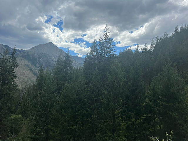
The scenery along the N Cascades Hwy is breathtaking.
.jpeg)

Skagit River Roadside Park, where Doug camped, near Concrete WA.
After a last night on the road, Doug's 2-week meander east through Canada and back west through Montana, Idaha, and Washington, was over and he headed for Bellingham WA, where his son and daughter-in-law live.
It was time to give Uncle Robert (aka Conchita), our Promaster van, some much needed TLC. We cannot say enough about the Promaster and the VanWorks, out of Fort Collins CO, conversion.


"After a few days enjoying Bellingham," Doug continues, "it was down to Seattle to see my daughter, her husband, and their son. Need I say, having achieved Grandfather status 10 months earlier, the visit was very special.

TLC for Uncle Robert: washing off a few layers of dirt & an oil change.

A favorite spot in Bellingham, Whatcom Falls Park, about a 3/4-mile walk from my son and daughter-in-law's home.

Heat & drought had greatly reduced the flow in Whatcom Falls & Creek.

Whatcom Creek.
Looking toward Lummi Island from Bellingham Marina.
"After a few days enjoying Bellingham," Doug continues, "it was down to Seattle to see my daughter, her husband, and their son. Need I say, having achieved Grandfather status 10 months earlier, the visit was very special.
As I pushed the stroller, I soon realized how 'not flat' Seattle is and how out of shape I had become. But for this 76 year old it was all grand.
"Leaving children and grandchildren is always a very reluctant departure, but after a few grand days in Seattle, it was time to leave and head home. The final leg was direct, I-5 south.
"On September 9, I pulled into our driveway. Other than a windshield decorated with at least 4 rock impacts, the 3 months had gone smoothly. The van and I had driven 12,600 miles, 1,400 of them on dirt roads, and had averaged an amazing 19.2 mpg. Another grand road trip was history."
Stay tuned for our next adventures! As always, thank you for following us, and we love reading your comments on our travels.
Great photos, stories and memories!!
ReplyDeleteThanks for the interesting travel journal. ~Linda
Great as always. So the meandering was all new sights?
ReplyDeleteThank you! Some new, some old:-)
DeleteIt's wonderful to travel with you, albeit in vicarious fashion. The photos and descriptions provide a landscape of meandering! Thank you so much.
ReplyDeleteThank you, Tim. Glad you can "be" there, too.
DeleteAmazing adventures.....great stories. Thanks for sharing....Brian
ReplyDelete