Southwest 2025-3: New Mexico: Chaco Canyon, Bisti/De-Na-Zin, El Malpais, Aldo Leopold Wilderness
April 23-25, 2025
How were the ancient inhabitants of these lands able to travel between sacred places like Ship Rock and Chaco Canyon over 1,200 years ago?

We did it in our trusty 17.6-foot Promaster Van converted by VanWorks in Fort Collins CO, covering the 116 miles in about 3 hours.

We'd toured Chaco Canyon a number of years ago. It was well worth a second visit. (1,2)

Once off the main road near Nageezi & on the 27-mile-long road to Chaco Canyon the pavement soon turned to...
...washboard, but we were happy to realize it was smoother than last time, though "smoother" is relative...
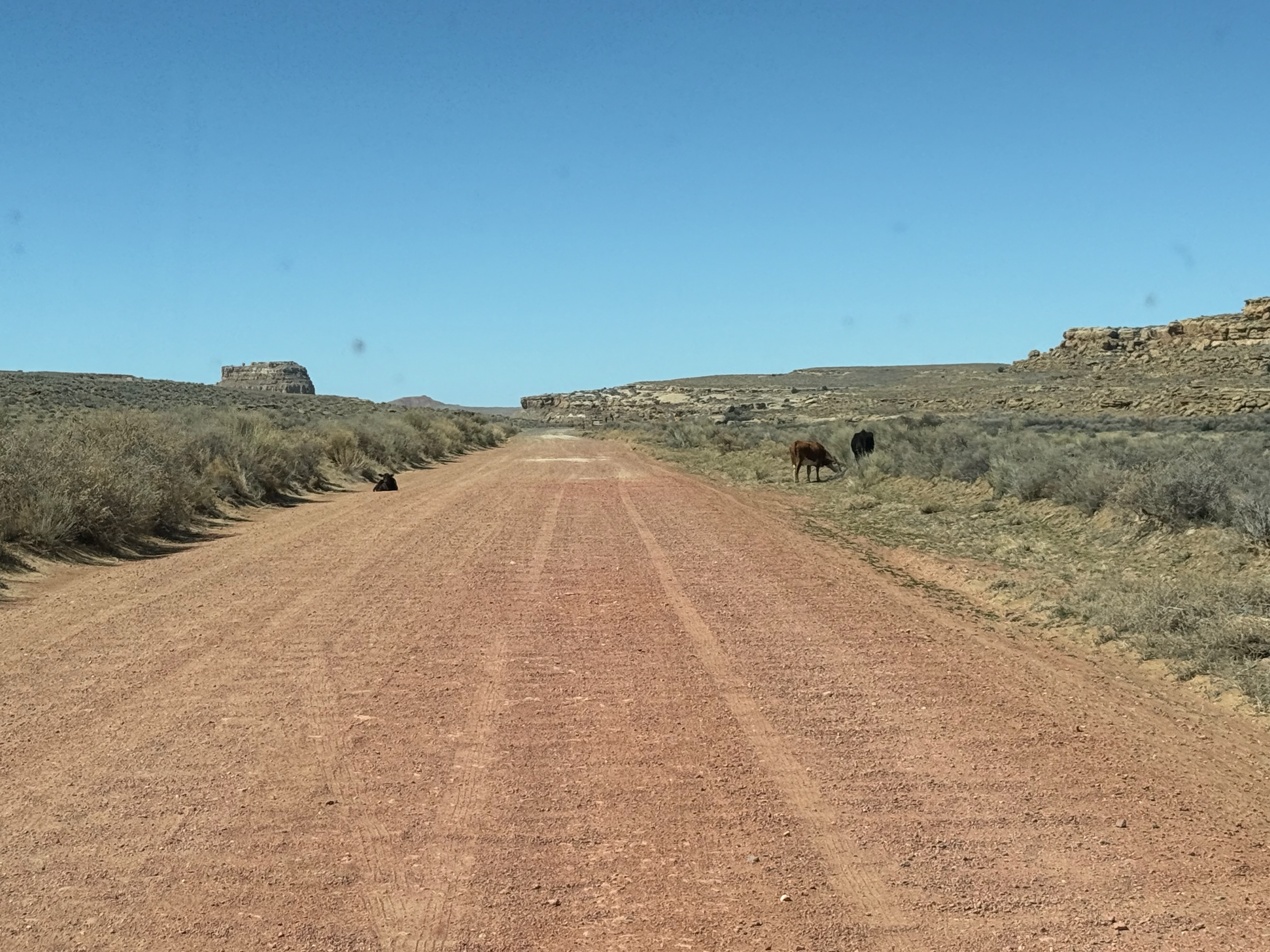
Much of cattle country is open range, which means constant vigilance is required to spot cows on the side of the road...

...& sometimes on the road. Our Greeting Party???

The first view arriving in Chaco Canyon is Fajada Butte. Petroglyphs on its face behind 3 rock slabs marked the solstices & equinoxes before the slabs shifted.

Gallo Campground, Chaco Canyon.

Under the cliffs near the campground are the remains of a farmer's dwelling

Cliffs behind Gallo Campground.

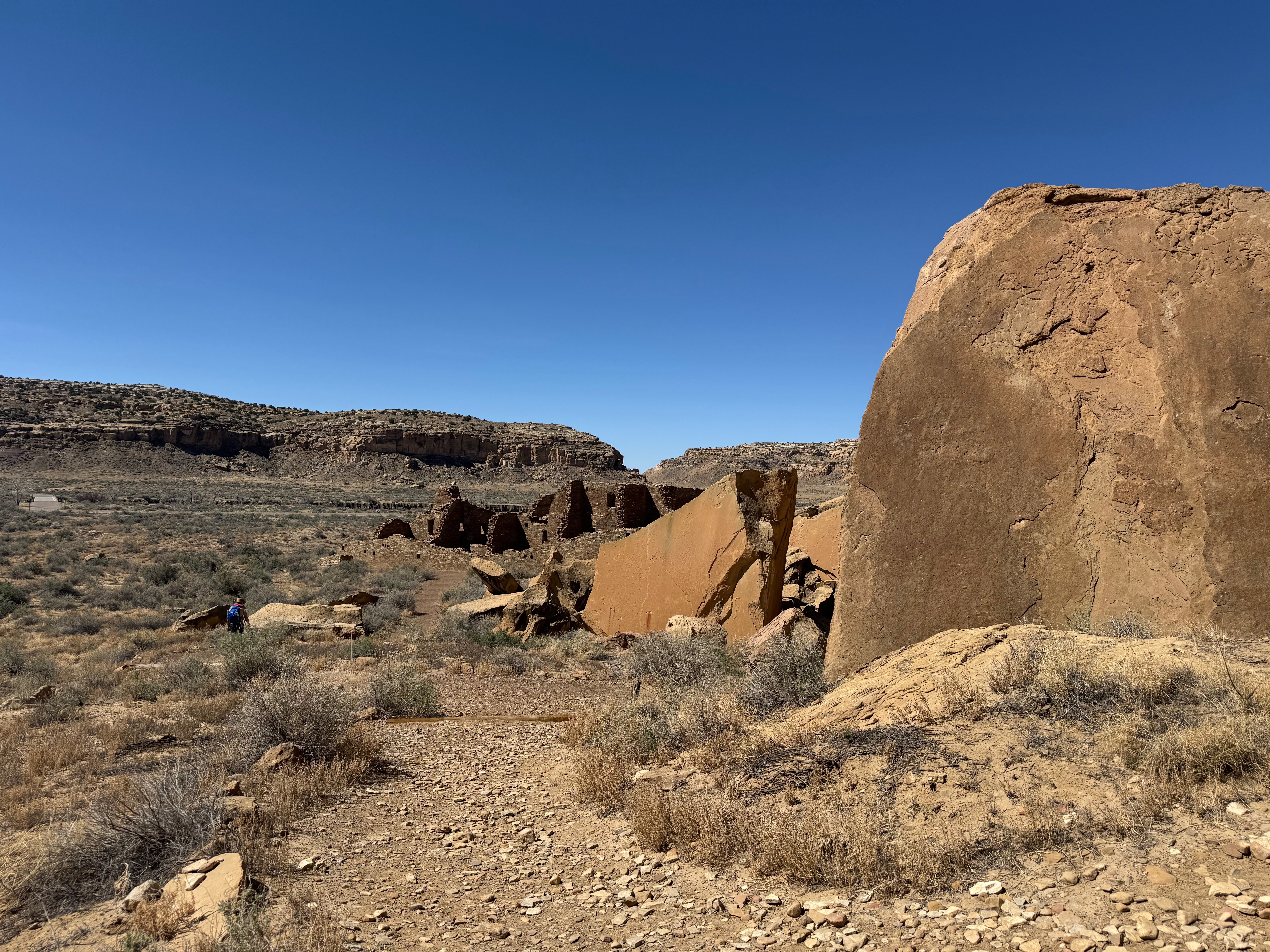
Built between 850 and 1150, Pueblo Bonito was a Great House, consisting of multi-story buildings, plazas, and Great Kivas. Great Houses were not residential but rather used for ceremonies and commerce.

Front of Pueblo Bonito.

Placement of this window is an example of the Chacoans' engineering prowess.

Keyhole openings are typical both of North & South American First peoples.

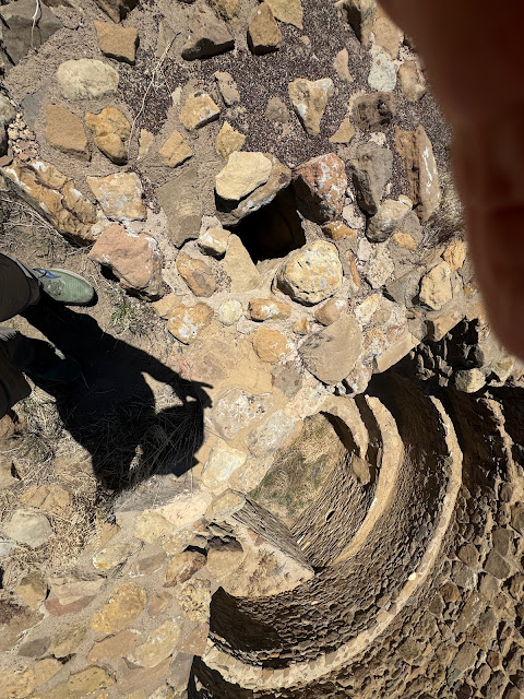
One of many kivas in Pueblo Bonito, places of worship and community meetings.
Kivas were built underground. Entry was via ladders in hatchways in a flat roof. A bench ran around the interior.

Note Doug's height compared to door height. Archeologists did not excavate down to the original floor.

Metate & mano on floor of room. Note logs placed as supports between floors.
Research shows over 200,000 trees were used in Chaco Canyon as roof, upper story, and window supports. One wonders how they were hauled 60 miles, as Chacoans had no beasts of burden. Research (3) done in 2023 at U of Colorado Boulder suggests the trees were much lighter than originally thought, 200 not 600 pounds, and were carried with tumplines, slings across the forehead to haul a load on the back.(3)

Note decreasing thickness of wall from bottom to top.
We marveled at how smooth the exterior of the wall was with the majority comprised of small flat rocks.

Supports have been placed at the back of Pueblo Bonito to keep it erect.

Chacoans built a retaining wall beneath a massive sandstone slab at the back of Pueblo Bonito. The rock stayed put until 1941 when it fell, crushing more than 30 rooms of Pueblo Bonito with its massive weight.

Pueblo Bonito.
A guidebook helped us find petroglyphs on the canyon walls along the trail between Pueblo Bonito and Chetro Ketl.

How would you interpret them?


Also a Great House, Chetro Ketl had 500 rooms on 3 stories.

Chetro Ketl Great House.


Multiple kivas in Chetro Ketl plaza.

Interior of kiva. A stone bench runs around the interior.
While we were at Chetro Ketl, members of the Ancestral Lands Conservation Corps were painstakingly repairing the walls.
Casa Rinconada
The Great Kiva at Casa Rinconada sits on a hilltop. Below were once numerous small villages.
.jpeg)
Casa Rinconada Great Kiva is the largest excavated in Chaco Canyon.

Looking down into a smaller kiva.
.jpeg)
Casa Rinconada.

Sunrise between cliffs at entrance to Chaco Canyon.
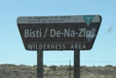
We'd long heard of Bisti Badlands due west of Chaco Canyon and decided why not? The most direct road however is 4WD, so our options were exit Chaco north as we'd entered or drive out the south end.

Road out south end of Chaco Canyon. Do you need to ask if we went north or south?

It appeared nothing but washboard lay ahead, no big deal.

And more washboard.

The Southwest's amazing formations are everywhere. Note the fence construction of wire stretched between tree branches, a very common practice in the region.


We were warned especially of the cattle guards, of which there were many, as some apparently had parts of the grill sticking up. Fortunately, we did not encounter any spikes.
About 3 miles from the end a woman driving the opposite direction flagged us down. She asked—for the benefit of her passengers, as she seemed to be having a grand time—if the road got any better. We assured her it was fine and off she went. Then coming over the crown of a hill we saw this:

The next 3 miles were the worst section of the road & she'd already conquered it. Yes, she'd have smooth sailing the rest of the way.

Giant bull statue announcing a cattle ranch.

Indian warrior lookout?

Miniature Mexican Hat.

We made it to the pavement! Note, to the locals "Thoreau" is "Throw."

Another former homestead.
On BLM and Navajo land, Bisti is "a fantasy world of strange rock formations made of interbedded sandstone, shale, mudstone, coal, and silt." In Navajo, Bisti means "a large area of shale hills." De-Na-Zin derives from the Navajo for "cranes."
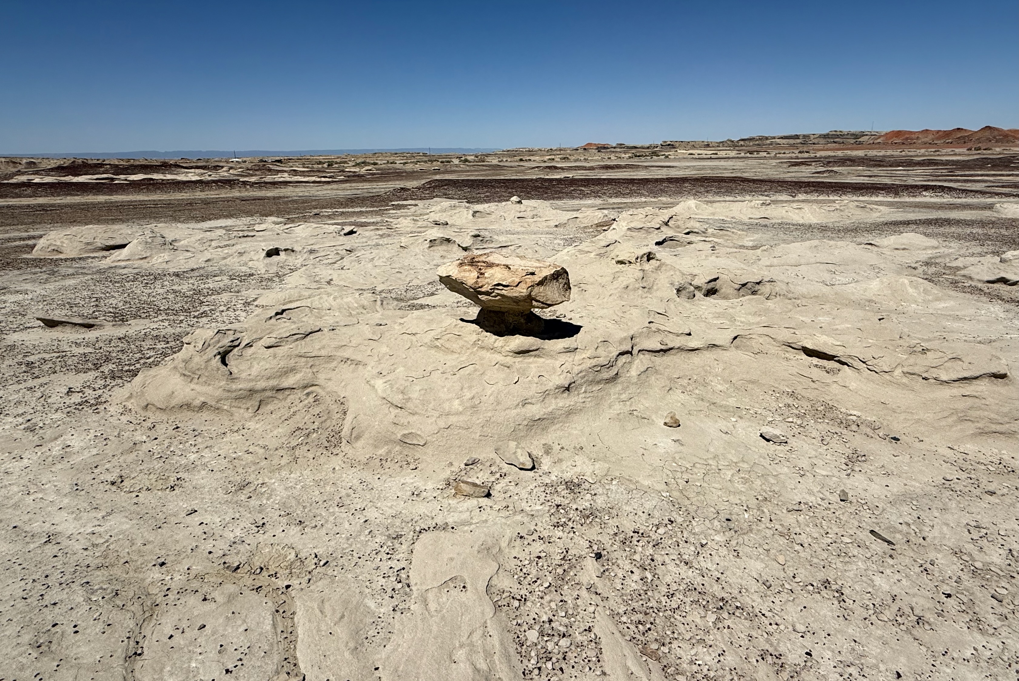
The elements shape sandstone into "hoodoos."


Mom & child mushrooms.
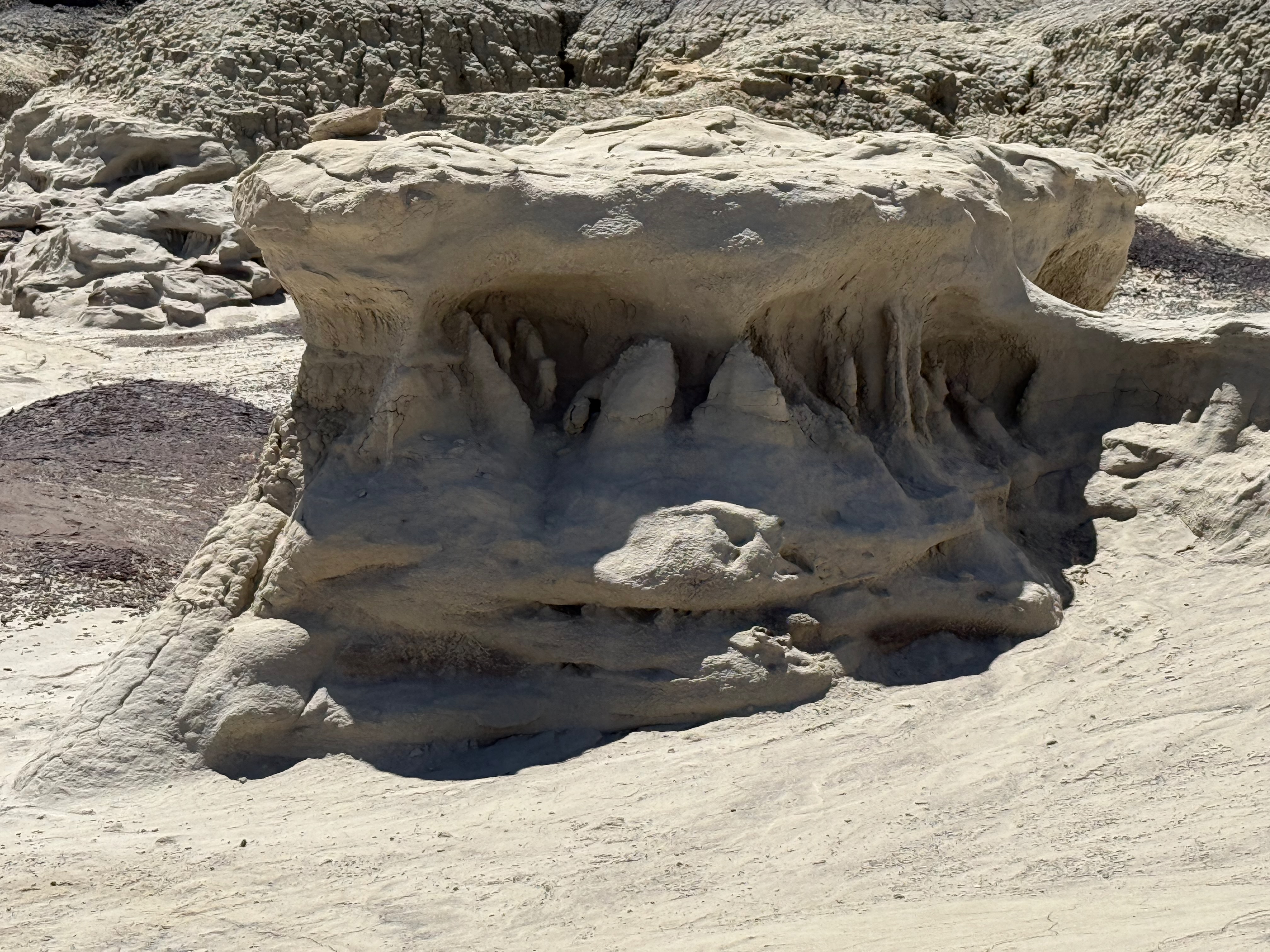
Formations like these remind Marilyn of the carvings on the front of cathedrals.

Line up for recess!

Red is left by coal burning naturally.

Marilyn stayed close by the parking lot, but Doug ventured further out & up, getting views of the varied landscape.


Reminiscent of Goblin Valley in Utah.


Bisti Badlands.
Heading south from Bisti, we entered El Malpais, "The Badlands."(4)


Malpais Lava Flow, Valley of Fires NM, one of several lava flows within El Malpais.

It may be the "badlands" but the scenery of badlands never disappoints.


What a backyard that is. I'm envious

We saw many abandoned homesteads throughout our travels in the Southwest.


We stopped at the KOA in Grants for the night for laundry & showers. Staying in the cottage next to us was a motorcyclist whose dog traveled on the trailer. Both seemed happy.

After Grants we had an option, the fast route or the windy. As usual we took the windy and were rewarded with more beauty


A camel lying down.

We soon saw a sign saying La Ventana (Window) Arch on the left, so.... We walked the short path up to the arch. It's composed mostly of Jurassic Zuni Sandstone.
La Ventana is in the Sandstone Bluffs area of El Malpais, made up of Jurassic Zuni Sandstone, deposited as sand dunes 160 million years, and Cretaceous Dakota Sandstone left by an inland sea 96 million years ago.

Arches are formed by cycles of freezing & thawing that cause rock fragments to fall awy. La Ventana is 135 feet across & 25 feet thick at its thinnest part.


Marilyn contemplating.
Our next destination was Pie Town. We stopped at Quemado, a typical small Southwest town that has seen hard times, where Marilyn dropped off some postcards at the post office—hopefully the recipients will appreciate the unusual postmark.

The town was named Quemado, "Burned," due to its location in an extinct volcano. It was at one time famous for the rodeo cowboys who lived south of town.
In Pie Town we picked up an apple and a strawberry-rhubarb pie for later enjoyment.

Leaving Pie Town, we once again crossed the Continental Divide.(5)

About an hour later, we crossed it again. Doug would merely say it is part of the joy of wandering.

Did we know that Joshua trees grow outside California? Though native to the Mojave Desert, they grow in similar conditions in the Southwest.

Crossing the Continental once again, near Silver City.

Mountains of copper mine tailings around Silver City. Since the 1800s gold, lead, zinc, silver, iron ore, manganese, & copper have been mined in the area at various times.
We lost the race with the clock on the steep climb to Emory Pass, maneuvering the 2-lane road's curves, twists, and switchbacks in the dark.

Mr. Dash Moose stayed on the lookout for animals & obstacles.

Looking toward Silver City from the overlook at Emory Pass, 8,828 feet.
Lightning storm.

We boondocked in the large parking area.

During our wanderings, we were at 5,000 feet & often more, up to 11,300, and had a lot of weather. Hmm, was that rain, snow, hail, or wind at Emory Pass?

The overlook is within the Aldo Leopold Wilderness section of Gila National Forest. Author of A San County Almanac, Leopold is viewed as the father of wildlife and wilderness management.

Also at the overlook is a commemoration of the 2013 Silver Fire. Steep terrain, plentiful fuel, due to years of fire suppression, & dead trees, due to the bark beetle, allowed fast growth of the fire. In its aftermath, experts reassessed forest management techniques.

So there's a cow around the curve?
Southwest 2025-3: 3 days/698 mi
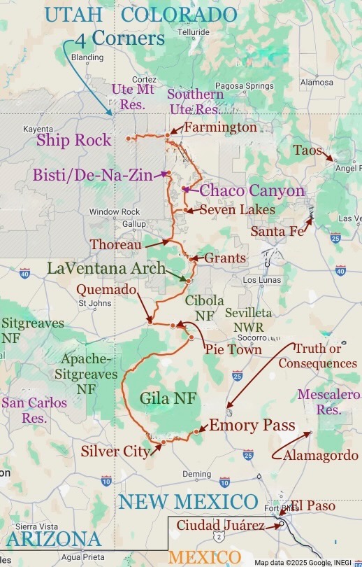
Map of this section of the trip. Southwest 2025-3: 698 miles.
Our entire Southwest 2025 trip: 6.5 weeks/6,274 mi.
 Southwest 2025: 6-1/2 weeks. 6,273.5 miles. (1) Visalia CA-Green River UT. (2) Green River-Ship Rock NM. (3) Ship Rock-Aldo Leopold Wilderness. (4) Leopold-Carrizozo. (5) Carrizozo-Taos. (6) Taos-Grand Villa CO. (7) Grand Villa-Green River UT. (8) Green River-Kanab. (9) Kanab-Kanab. (10) Kanab-Bridgeport CA. (11) Bridgeport-Visalia.
* * *
Puebloan cultures—Anasazi, Mogollon, Hohokam—arose in the Southwest around 1500 BCE. Puebloans began to farm around 500 CE. As a result of not wandering as much, they built dwellings and villages. Areas such as Chaco Canyon became cultural centers, with Great Houses, kivas, multiple villages, irrigation, roads, and distinctive pottery. Puebloans thrived until about 1300 CE.
It is thought that the Navajo (Diné) and Apache are descendants of Athabaskans who migrated to the Southwest from Alaska and Canada between 1100 and 1500 CE . The theory is that draught and competition for resources between the Puebloans, Navajo, and Apache may have led to the dispersement of the Puebloans around 1300.
Because of the scattering of tribes, modern Puebloans, such as the Hopi, Zuni, and Acoma, descend from a variety of Puebloan branches. Their story begins around 1600 with the arrival of the Spanish.
Today there are 19 Pueblo tribes in New Mexico, among them Taos, Zuni, Santo Domingo, San Felipe, and Acoma. Though each is a sovereign nation, they share core values. One way to distinguish the tribes is their unique art forms.
(2) A Brief & Hopefully Accurate History of Chaco Canyon
Today there are 19 Pueblo tribes in New Mexico, among them Taos, Zuni, Santo Domingo, San Felipe, and Acoma. Though each is a sovereign nation, they share core values. One way to distinguish the tribes is their unique art forms.
(2) A Brief & Hopefully Accurate History of Chaco Canyon
Humans have been present in Chaco Canyon for 10,000 years, but its heyday was 850 to 1150. Its architecture was grandiose, with buildings having hundreds of rooms and sometimes taking hundreds of years to build. Chacoans understood astronomy and oriented buildings to solar, lunar, and cardinal directions. Communication was facilitated by lines of sight between the dozens of Great Houses.
Chaco Canyon was a center for ceremony, administration, and economy, with over 400 miles of roads within and beyond its communities. Excavated artifacts indicate trade with societies as distant as Central Mexico.
Chaco Canyon was a center for ceremony, administration, and economy, with over 400 miles of roads within and beyond its communities. Excavated artifacts indicate trade with societies as distant as Central Mexico.
Chacoan culture united diverse peoples and influenced other Indian societies, such as Mesa Verde. Eventually focus shifted to other Chacoan regions, but Chaco Canyon remains sacred to Southwest tribes.
(3) Tumplines
A tumpline is a strap that goes across the forehead to carry a load on the back. It's thought that this is how Chacoans were able to bring logs 60 miles from the forest to their villages.

(4) A Brief & Hopefully Accurate Description of El MalPais
Researchers walked 15 miles carrying a 130-pound log with tumplines. Patrick Campbell/CU Boulder.

Patrick Campbell/CU Boulder.
Layers of lava flows and sandstone bluffs give El Malpais, "the badlands," its name.
The oldest lava flow dates to 115,000 years ago, the youngest to a mere 3,900 years back. Sandstone bluffs, another feature of El Malpais, were created by wind-blown Jurassic Zune Sand 160,000 million years ago and water-borne Cretaceous Dakota Sand 96,000 million years ago.
The arrival of the railroad in the late 19th century led to settlements, sheep and cattle raising, and logging in the area. The Great Depression brought more settlers to the area, as New Mexico was one of the last places where land could be claimed and built on under the Homestead Act. Many of these homesteads were abandoned when making a living proved difficult.
(5) A Brief & Hopefully Accurate Look at the Continental Divide, with a Visual Aid

Note there are additional divides. The Great Basin is surrounded by a divide—no water leaves it.
* * *
Up Next: More of New Mexico: Valley of Fires, Carrizozo, Santa Fe, Taos, the Rio Grande Gorge.
Wow! Glad I can follow your trip because I wouldn’t much enjoy visiting those areas myself. I like to visit those wide open unpopulated places from afar. The badlands is Cormac McCarthy territory…….his bleak stories set there match the landscape. K. Parker
ReplyDeleteHaha. I haven't been able to read McCarthy--his writing style is so harsh. I should try again. Thanks for commenting!
DeleteI really enjoyed the vicarious travel! It's been 40 years since seeing Chaco!!
ReplyDeleteWelcome. Thanks for commenting! I don't think Chaco has changed much:-)
DeleteI liked the tumpline info. Patagonia ued to. sell them. Steve
ReplyDeleteInteresting.
DeleteWonderful places I did not have a chance to visit. So much to see, so much to learn.
ReplyDeleteToujours.
Delete