US-Canada 2024-8: Nova Scotia—Cape Breton Island: Baddeck to Meat Cove
While planning our trip, Doug did quite a bit of research on the 298-kilometer Cabot Trail on Nova Scotia's Cape Breton Island. In particular he wanted to figure out whether to drive it clockwise or counterclockwise. Ultimately he opted for counterclockwise as best for the Promaster—we'd be going down, rather than up, the steepest parts.
Lobster boat & sea shanty, Capstick, Cape Breton Island.
Unbeknownst to me, Doug's main goal was to give me the Cabot Trail: he wanted me on the coast side so I'd see all the amazing views.
17 Days in Nova Scotia. Purple: Yarmouth-Peggy's Cove. Green: Halifax & Grand Desert. Eastern Shore to Cape Breton Island. Baddeck to Meat Cove. Red: Cabot Trail & Bras d'Or Lake. Louisbourg, Louisbrick & the Big Fiddle. Blue: Last day in Nova Scotia.
The Cabot Trail officially begins in Baddeck, where we camped the night before embarking on the famous route.
Beginning of the Cabot Trail.
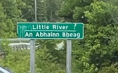
I initially thought the road signs along the Cabot Trail were in English & Celtic...
...but they're actually in English & Gaelic.
The Gaelic College in St Ann's, offers classes in the "culture, music, language, crafts, customs, and traditions of the immigrants from the Highlands of Scotland."
A very basic definition is that "Gaelic" refers to the group of Celtic languages and cultures of Scotland, Ireland, and the Isle of Man. The Scots failed in their 1620s endeavor in Nova Scotia but after England took over, they came by the thousands, and Gaelic became an official language. Perhaps of note, "whiskey" derives from the Gaelic "usquebaugh," meaning water of life.
The Cabot Trail is indeed steep Here, the road climbs to run along the cliff at the top of the photo.
Note: There is little undergrounding of lines and cables in Nova Scotia, so more often than they're in our photos.
Curious why both "French River" & "Birch Plain" translate in part to "Frangach."
Backing up a bit historically (very basically), the original inhabitants of Nova Scotia were of course a First Nation, the Mi'kmaq. For over 10,000 years prior to the arrival of European explorers and fishermen, the Mi'kmaq lived in present day Nova Scotia, New Brunswick, PEI, Newfoundland, Maine, and Massachusetts. Giovanni Caboto, aka John Cabot, landed in 1497, perhaps on Cape Breton Island, but thought he was on the coast of Asia. Nevertheless, the Cabot Trail was named for him.
In 1605 under Champlain, the French established Port Royal, now Annapolis Royal, on the Nova Scotia peninsula. Thus began the French colony of Acadia.
The French and English of course battled over Nova Scotia for years, with England expelling the Acadians in the 1750s and eventually winning out. England did not have the final say on the Acadian culture in Atlantic Canada nor the Acadian diaspora.
Meanwhile, back on the Cabot Trail...
In Ingonish, we stopped at Cape Breton Highlands National Park & bought Parks Canada passes (which we would later find don't work in national parks in Quebec's as "national" parks there are provincial parks).
Probably due to its being a national park, sign is English-French, not English-Gaelic.
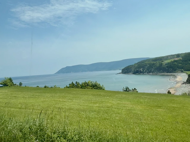
Cabot Trail along the North Atlantic.
Nails Harbor Lighthouse.
St Andrews Anglican Church, with lighthouse replica.
A wrong turn took us to the charming village of Six Ports Harbor...
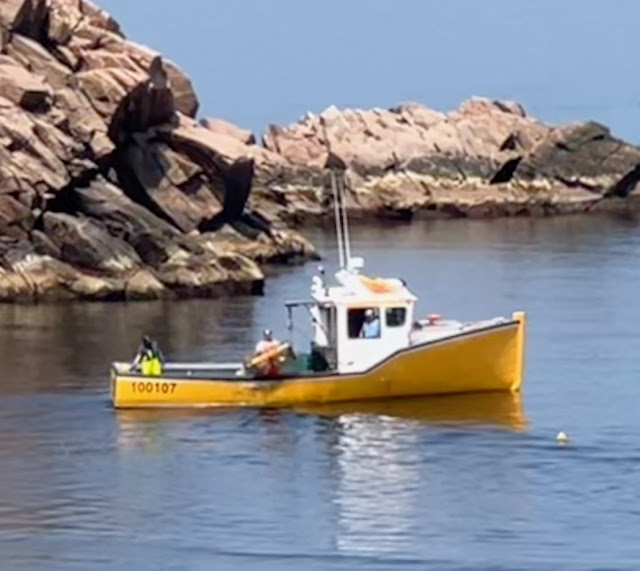
...where a lobster boat was bringing up traps.
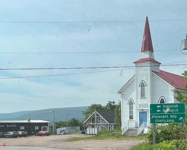
Cape North Church & Cemetery. Red roofs are popular for all kinds of buildings.
Bridge over North Aspy River.
Apparently the 2023 headlines got the ball rolling on road repairs. The road to Meat Cove was hilly, windy, narrow, and largely washboard, with a few deep potholes and asphalt patches on washouts. But the road had been graded, and nearing Meat Cove, the steeper portions were paved. It's an interesting drive, fun and not a problem as long as you keep your speed down.
Despite being assured we'd have a campsite, a little beyond Capstick we passed a CanaDream rental van that was going "too" slowly.
We thanked the CanaDream driver for allowing us to pass. He responded they liked to take their time...
Paved Bay St Lawrence Rd, North Cape to St Margaret Village.
North Harbour.
There were numerous small churches with cemeteries. (Apologies for the blur, but I liked the church.)

St Margaret Village.

Bay of St Lawrence along Meat Cove Rd, from St Margaret to Meat Cove.

Only 8 kilometers to go.
.jpeg)
Lobster fishing in Bay of St. Lawrence.
Unfortunately, due to the road conditions & curves, the driver, aka Doug, got to spend less time enjoying the amazing vistas than his passenger, aka the most fortunate Marilyn.

Note the lobster boat.
While on asphalt, we passed homesteads and small communities. Once the asphalt ended, there were no more homes or churches.
Bay of St Lawrence.
Meat Cove Rd between Capstick & Black Point.

White dots are buoys marking lobster traps.

No looking out at the ocean for Doug here.

Meat Cove Campground is toward top left.
Town boundary.
It's thought that Meat Cove's name derives from it being popular with hunters for dressing carcasses in earlier times.
Meat Cove Campground, another couple kilometers & hills away.
Steeply curved paved downhill.
Meat Cove Campground lies at northern tip of Cape Breton Island.
Meat Cove is not the furthest north we've been in our travels, but it is the furthest east. As the crow flies, it's only 76.5 miles from Newfoundland. (So many people urged us to go to Newfoundland, but it requires over 2 weeks minimum to appreciate, so it wasn't in the cards for this trip.)

A somewhat quirky campground employee ushered us to our choice of campsites on the hillside.
The folks in the CanaDream arrived soon after us & also secured a site.
RVs, vans, and cars continued to arrive throughout the afternoon, though some looked at the mountainside campground and turned around.

Camped on cliff above Meat Cove.

Meat Cove Beach on the right.
It was a bit warm, but Marilyn opted for the free showers with plenty of cold water to cool off over a hike to the beach. The uphill walk to the showers provided exercise, too....
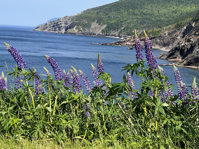
Purple, pink, white lupine were ubiquitous along roads & in fields from Maine on.
Lobster boats arrived during the day and evening and early the next morning. It was like a dance as the pilot maneuvered the boat around each buoy while others lowered a hook to haul each trap up and into the hold.

Pulling up lobster traps, 6:45 AM.

Sunrise, 4:45 AM.
Meat Cove, 5:00 AM.
How often to we say we left reluctantly? Meat Cove was one of the most awesome campgrounds we have been in. It was hands down worth the drive, not only for the campground but also for the incredible surroundings all along the drive.
Morrison's Restaurant on left.
Back in North Cape, we stopped at Morrison's Restaurant, a family owned restaurant that had recently reopened after renovations. The staff, all family members, couldn't have been more friendly, provided better service, or been better chefs.
And hello to Dave and Deb, whom we met in the parking lot after breakfast! We had a wonderful conversation and showed them the van.
Then we were off to tour the western portion of the Cabot Trail.
June 18-19, 2024




.jpeg)
.jpeg)
.jpeg)

.jpeg)




.jpeg)


Lovely tour! I have Scottish ancestry, so very fun to hear about Gaelic. K. Parker
ReplyDeleteGlad we could "educate." It really was lovely!
DeleteWhat a spectacular trip you two have taken. Always enjoy the photos and maps!
ReplyDeleteThanks! It really was amazing! We went into it expecting to spend maybe 5 days or so in Nova Scotia--ended up there for 2.5 weeks!
Delete