Spring 2024: Death Valley part 2- An Interesting Drive Home & Flora
Our earlier Death Valley post saw our wonderful days with Drew and Devon, Doug's son and daughter-in-law, in Death Valley ending as they headed to Joshua Tree and we headed to Lone Pine.


We didn't camp in the Alabama Hills as we have many times in the past and as Doug and Drew did in 2023, but we did have an amazing breakfast at the Alabama Hills Cafe. If you're ever traveling 395 on the East Side of the Sierras, you'll want to stop there. More importantly you'll want to explore the Alabama Hills, too.

We decided to mix it up and take 5,246-foot Walker Pass home, rather than continuing south and going through Tehachapi.


Out of Lake Isabella we decided to take 155, which proved interesting.


Back to Death Valley for some flora:
Wildflowers greeted us most everywhere we went, and I tried to get pictures of all of them. Now to ID them. Do you know how many flowers look like a yellow daisy? It comes down to petals, leaves, stamen—details. Take my labels with a grain of salt.

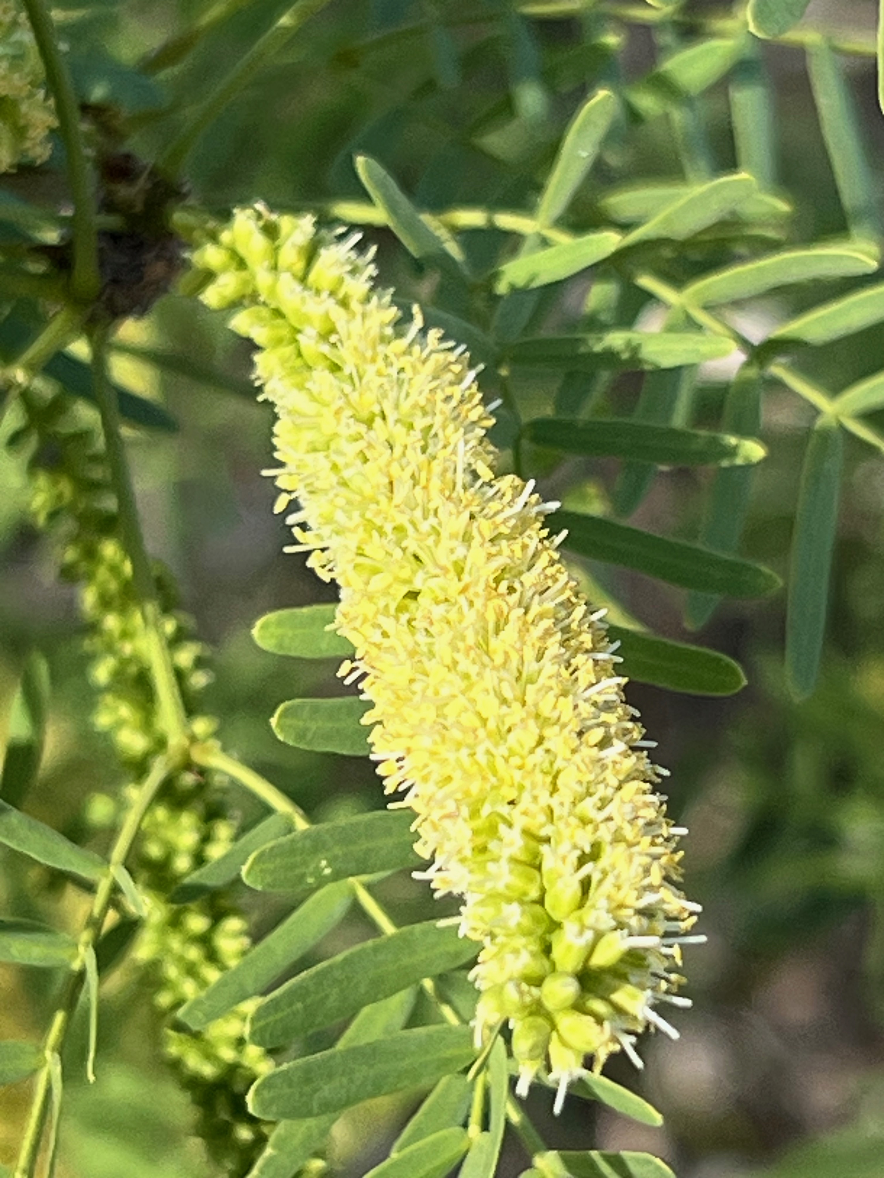
Prince's Plume.
.jpeg)


.jpeg)
.jpeg)
.jpeg)

.jpeg)
.jpeg)
.jpeg)


.jpeg)
.jpeg)

Wouldn't want to run into this plant! Yerba mansa.

Amargosa niterwort.
.jpeg)
.jpeg)
.jpeg)
.jpeg)


.jpeg)

.jpeg)
.jpeg)


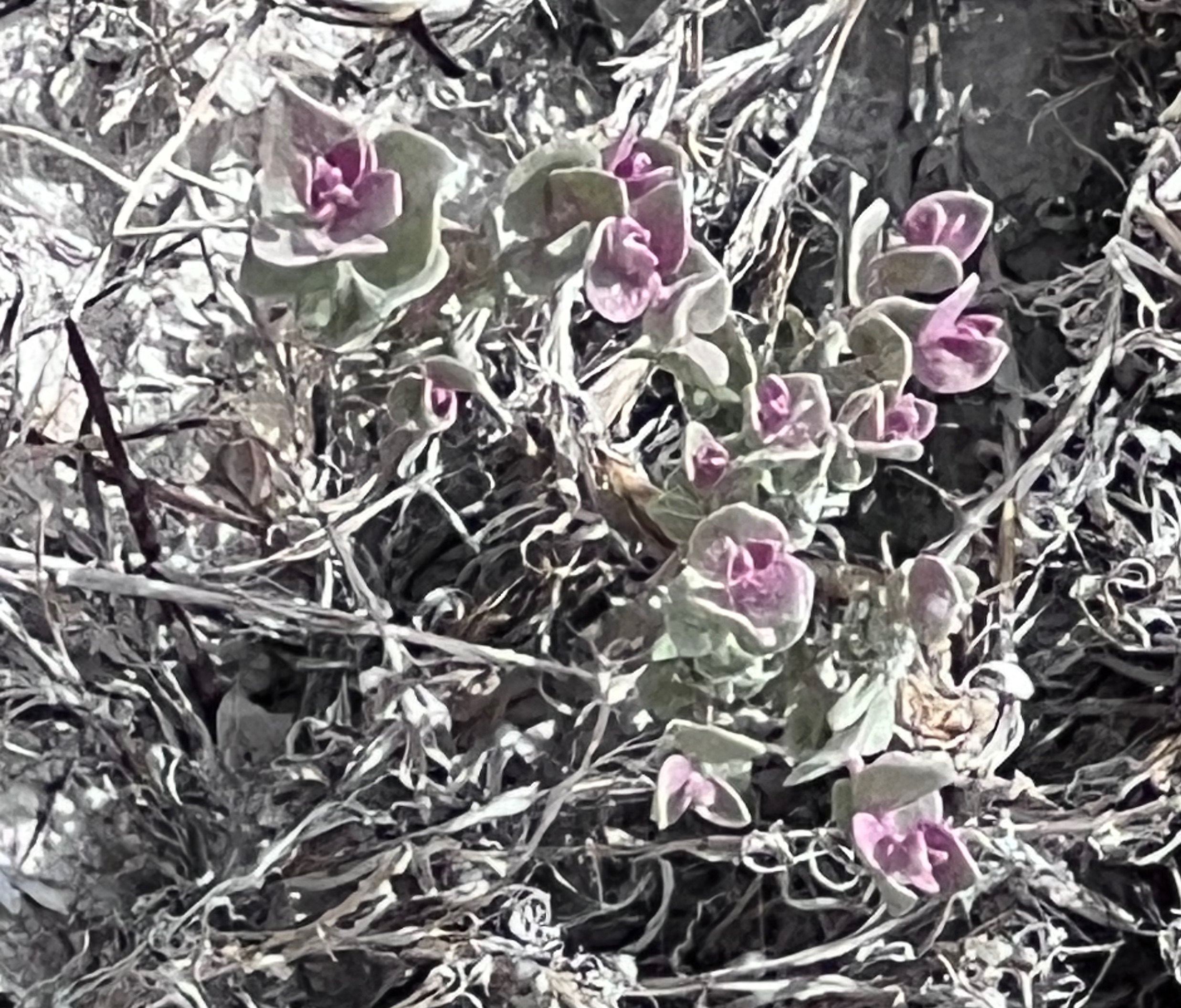
Thick-sepal cat's eye.

Heading up out of Death Valley on 190.
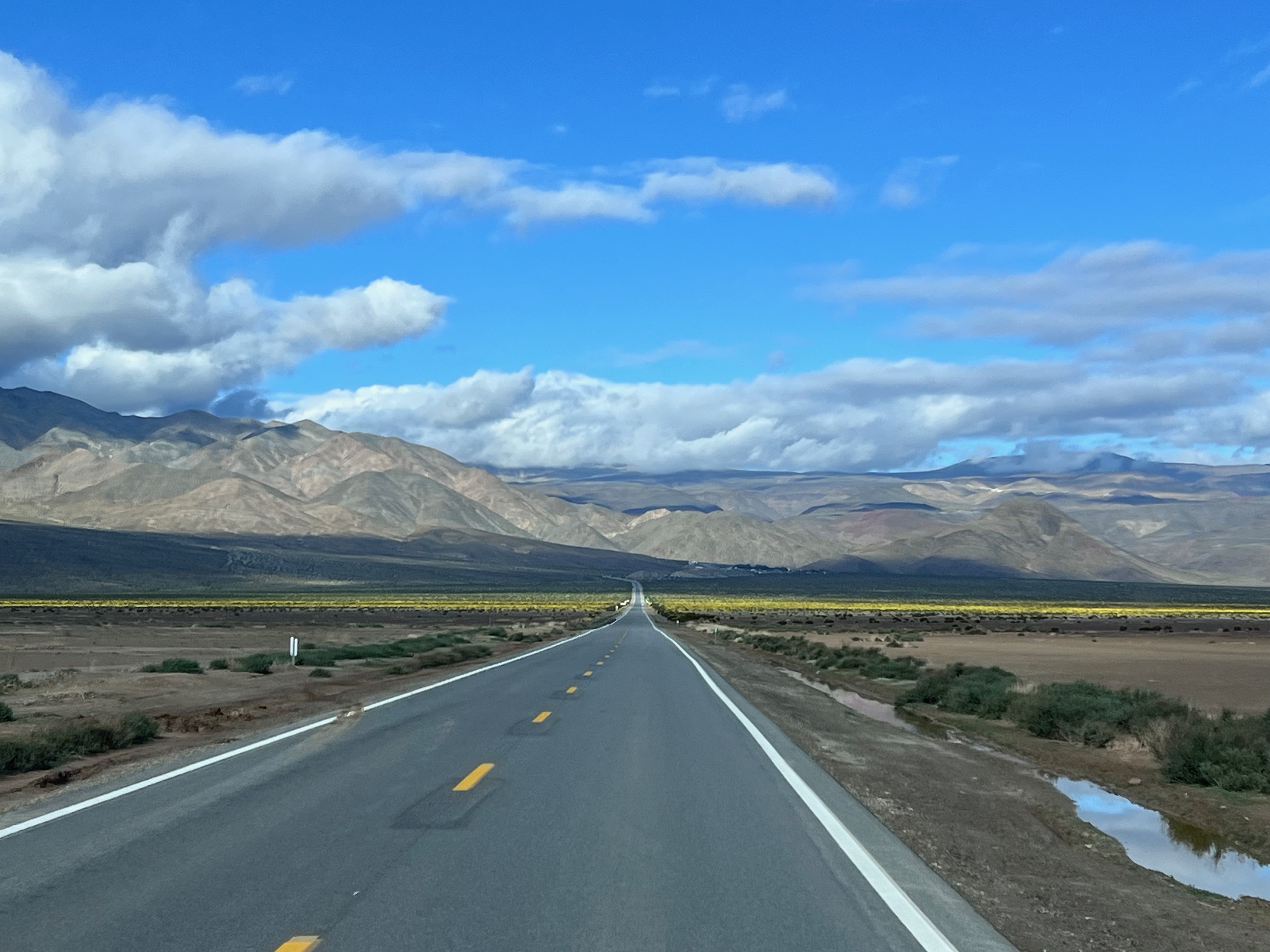
Down into Panamint Valley, alive with wildflowers.

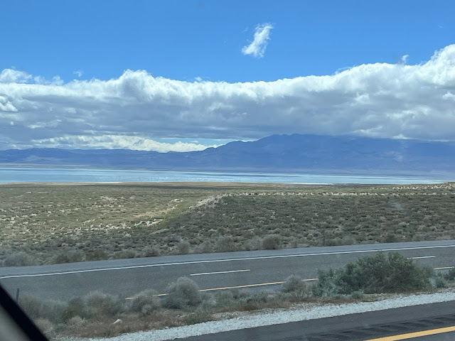
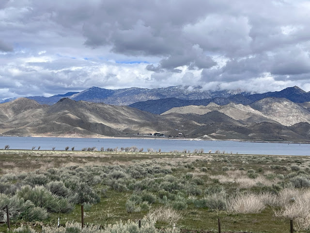
White Mountains.

East Side of Sierra Nevada Mountains—Mt Whitney, highest point in the 48 Lower States is in the mix, but not what appears to be the highest—those are closer.
We didn't camp in the Alabama Hills as we have many times in the past and as Doug and Drew did in 2023, but we did have an amazing breakfast at the Alabama Hills Cafe. If you're ever traveling 395 on the East Side of the Sierras, you'll want to stop there. More importantly you'll want to explore the Alabama Hills, too.


Snow level was down about 4,000 feet in the Owens River Valley.
We decided to mix it up and take 5,246-foot Walker Pass home, rather than continuing south and going through Tehachapi.

Blue: route to Death Valley via Tehachapi. Purple: route home via Walker Pass.

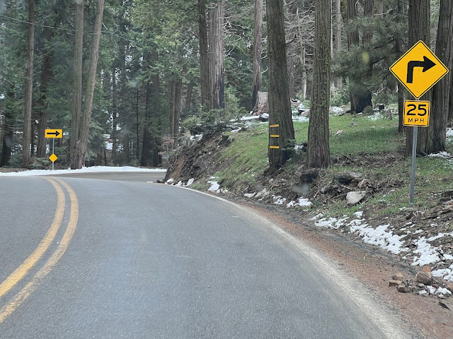
Walker Pass: wildflowers, Joshua trees, & snow.

Out of Lake Isabella we decided to take 155, which proved interesting.

The area had seen fire in recent years.

For 54 miles up, down, and around, from Lake Isabella through Wofford Heights, Alta Sierra, Glenville, and Woody to the intersection with 65, there must have been at least 100 road signs for curves, corners, speeds, hairpins, and zigzags.

Plus there was snow, hail, & rain.
Hopefully you'll be able to share the drive with us in the above video (Blogger hasn't been cooperating with it...).

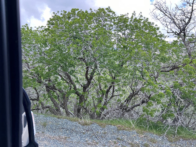
Buckeyes, which go dormant in summer, were just leafing out in their bright green.
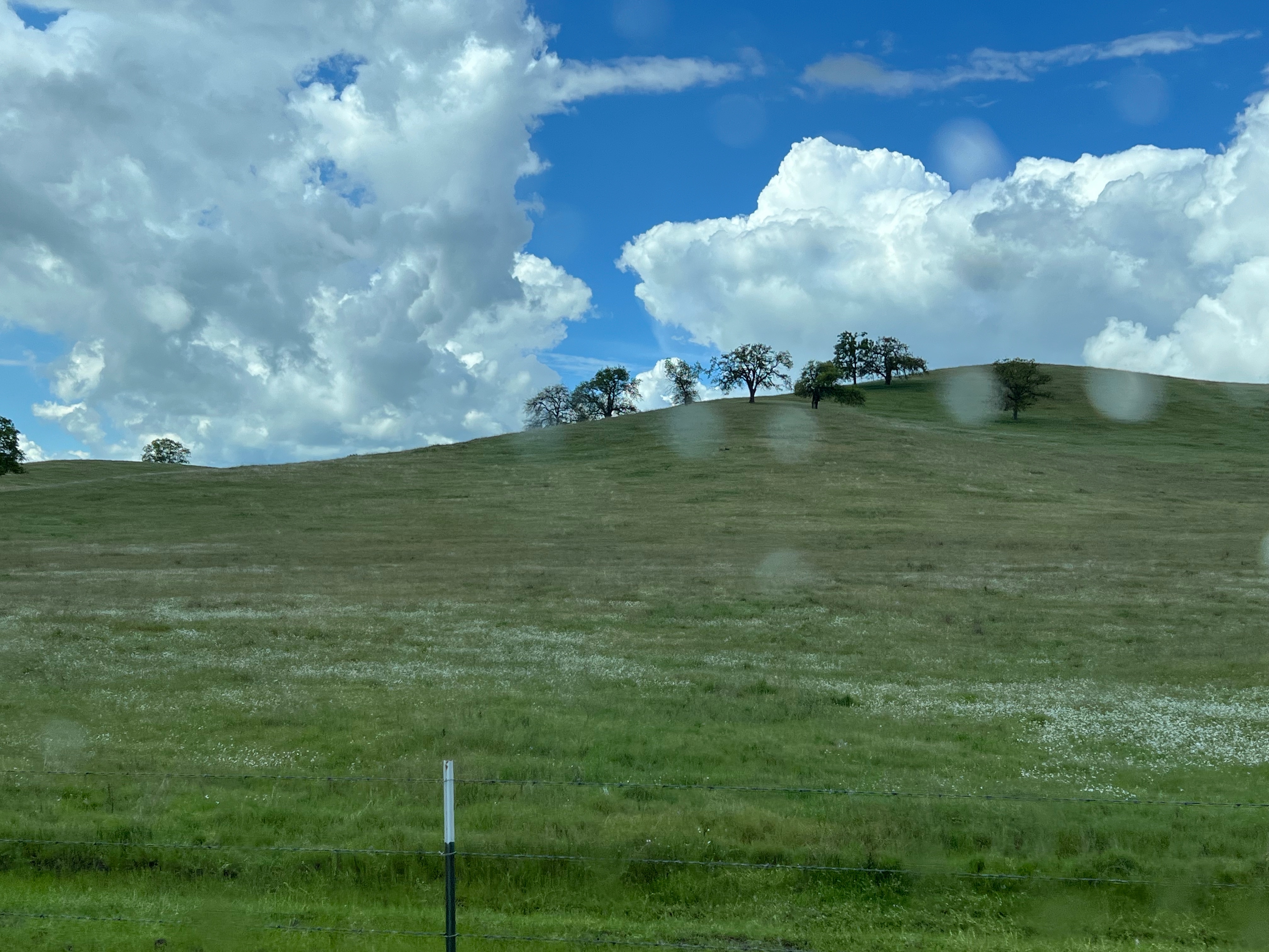
Done with the curves—phew! Typical Sierra Nevada foothill scenes with oak trees...

...and happy California cows.

On the Valley floor, citrus groves were in various stages of picking.

Fields were green with winter wheat & alfalfa.

Pistachio & other nut orchards hadn't yet blossomed.

Solar farms proliferate.
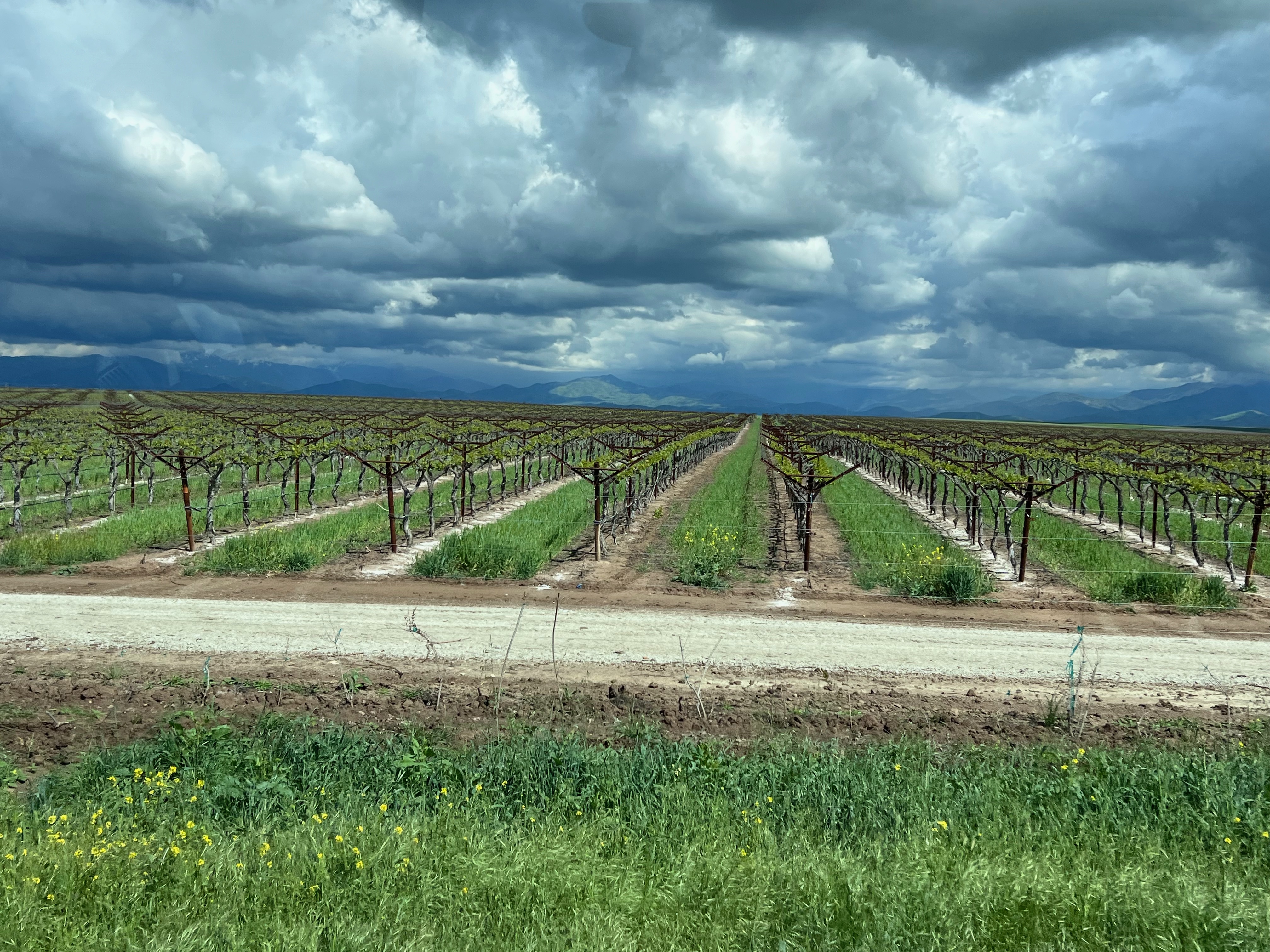
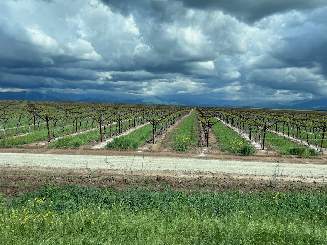
Dormant vineyards.

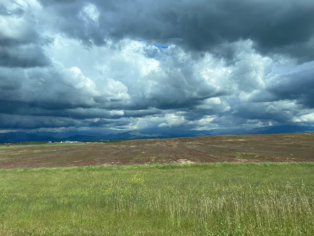
Fields just greening up. Those clouds!

Mandarins netted to prevent cross-pollination.

At home California poppies were doing their best to take over the front yard.
Back to Death Valley for some flora:
Wildflowers greeted us most everywhere we went, and I tried to get pictures of all of them. Now to ID them. Do you know how many flowers look like a yellow daisy? It comes down to petals, leaves, stamen—details. Take my labels with a grain of salt.

Prince's Plume.
.jpeg)
Velvet mesquite.

.jpeg)
Golden Evening Primrose.
.jpeg)
.jpeg)
Bristly Fiddleneck.

.jpeg)
Greenstem Paperflower.
.jpeg)
.jpeg)


Desert Gold.

.jpeg)
Brittlebush.
.jpeg)

Wouldn't want to run into this plant! Yerba mansa.
Amargosa niterwort.
.jpeg)
.jpeg)
Caltha-leaved Phacelia.
.jpeg)
.jpeg)
Purple Mat.


Brown-eyed primrose.

.jpeg)

.jpeg)
Desert Sand Verbena.
.jpeg)

Booth's evening primrose.


Woody bottle washer.

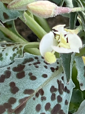
Thick-sepal cat's eye.
Coming soon: Joshua Tree with Marilyn's son and daughter-in-law.
Great pics as usual, and the map was perfect. I was able to view the video (was using a Windows desktop to read/view).
ReplyDeleteThanks for video feedback. Yea, I finally got it to stay! Glad you like the map. I like making them:-)
DeleteBeautiful pictures. Coming from MS. I take I-40 to I-15 to CAL 58 to Bakersfield to 99 to 198 to Visalia. You had a much more beautiful ride as the pictures showed.
ReplyDeleteNot sure 155 is a route will take again, but it was interesting! There are lots of ways to get where you're going:-)
DeleteThe trip I want to take. Steve
ReplyDeleteHope you do!
Delete