Alaska/Canada 2022-18: McCarthy Road & Base Camp Kennicott
July 25-29, 2022
It's hard to explain how every day in Alaska feels like a world unto itself, other than to say it's only been 4 days since we left Valdez, yet it feels like a lifetime ago.

We tore ourselves away from Valdez after 4 grand days and by mid-morning were at the turnoff to McCarthy 80 miles north.


.jpeg)


Fortunately for us, the bridge was "modernized" with guard rails in 1988.


It's an exhilarating crossing. Doug enjoyed it though he was rather focused on the road due to his interesting fear of heights. Yea, he was a Navy Pilot, but he says that is different.
.jpeg)
.jpeg)


And then we were at the end of the road. In the Base Camp Kennicott campground office, we were initiated into the mixture of federal, state, private, and tribal land that is Wrangell-St Elias National Park. The campground aims to maintain its status as private land to avoid the paving, regulations, and increased tourism that government ownership would bring.
.jpeg)
.jpeg)
.jpeg)
Sport hunting, fishing, and trapping are permitted to everyone on national preserve land. Subsistence hunting, fishing, and trapping by local residents only are allowed in both the park and preserve.

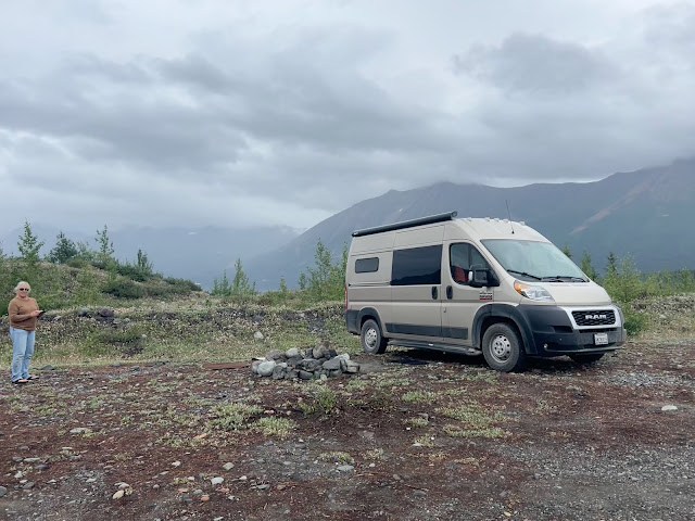
Base Camp Kennicott has no hook-ups—our kind of campground, but it gives new meaning to "undeveloped." There are some fire rings and the occasional picnic table, but only a few, mostly primitive, outhouses, no drinking water, and no showers. You camp wherever you want. Roads and sites are rough. The upriver side was recommended as having bigger sites and being less crowded, so we proceeded to ease the van around rocks and holes, through dips and over bumps, and onto a site--not the perfect one, as it was already taken, but the views were still breath-taking.
.jpeg)


The weather was perfect, the surroundings spectacular. Is it any wonder we'd wake up each morning and say, "Let's stay another day"?


Returning from McCarthy and Kennicott one day, Doug looked for an alternate way back to the campground. He ended up at the raft launch.


From the ramp launch, he made his way to the shuttle road downstream from the campground.


We also had entertainment:


It's hard to explain how every day in Alaska feels like a world unto itself, other than to say it's only been 4 days since we left Valdez, yet it feels like a lifetime ago.

Base Camp Kennicott Campground: Kennicott River & Glacier
We tore ourselves away from Valdez after 4 grand days and by mid-morning were at the turnoff to McCarthy 80 miles north.

It's 33 miles of paved road to the Wrangell-St Elias boundary, & the town of Chitina (population 71 in 2020)...

...and the road rolled out into the distance...

...but it's another 61 miles of dirt road from Chitina to McCarthy.
.jpeg)
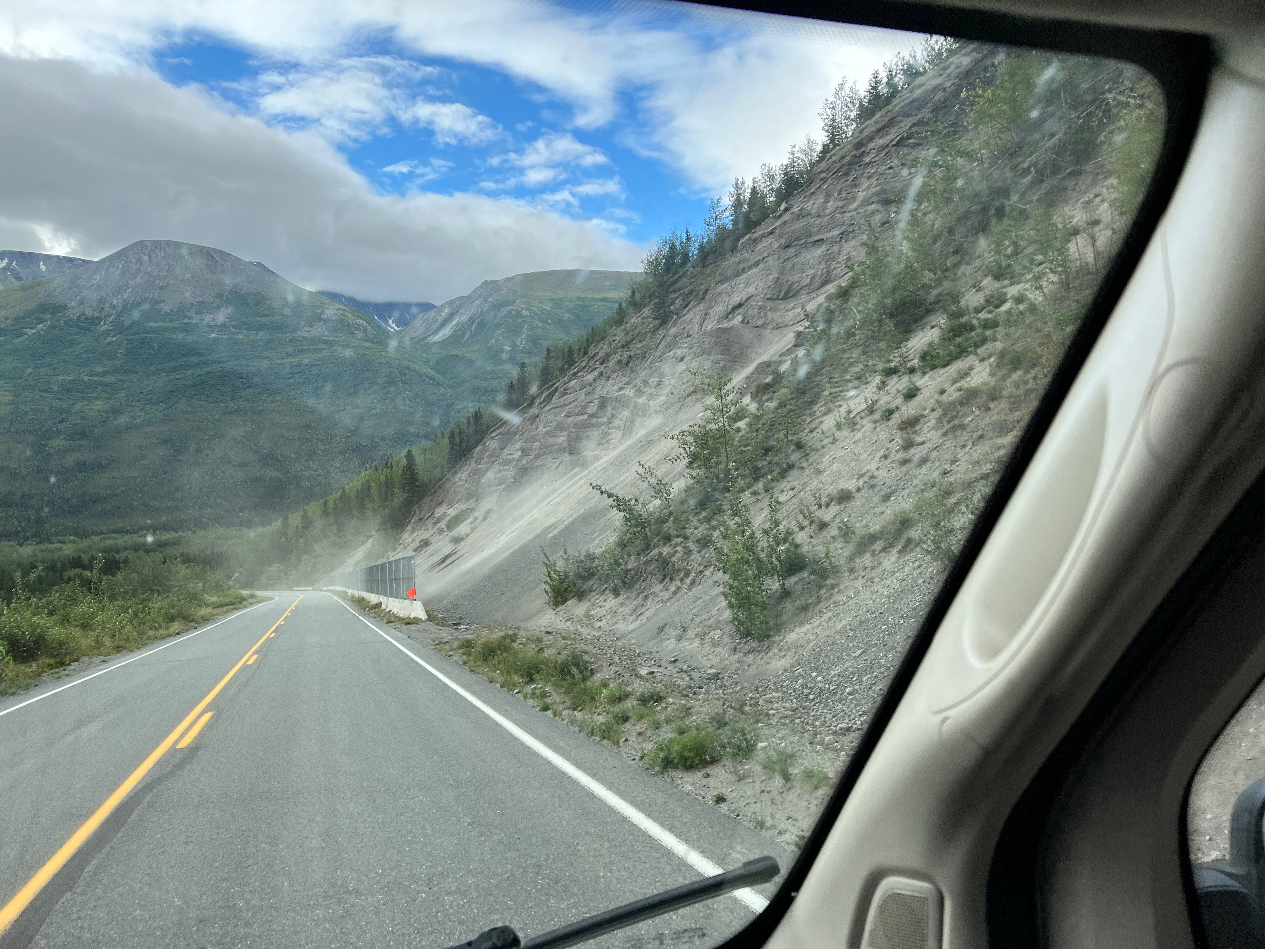
Good thing there was already a barrier to catch the rock slide.

Permafrost wreaks havoc on Alaska roads, uplifting them when the weather warms.

Tonsina River, one of numerous river crossings.

In Chitina, we had an important mission: mailing home boxes of Marilyn's fabric from all the quilt shops Doug made her go to.

Then it was the moment of decision...

The"Cut" marks the beginning of the 61 miles of dirt road to McCarthy.
On our previous visit in 2017, we drove through the Cut, decided the road was too rough, and following a tip in the Mile Post drove 3 miles down a side road toward O'Brien Creek. There, as promised, was an amazing campsite on the Copper River.
This year we'd already driven 1,000-miles of the dirt Dempster Highway from Dawson City to the Arctic Circle and back—another 120 miles of dirt road would be nothing!


Driving through the Cut.
The Cut was blasted through rock in 1909 to accommodate the Copper River & Northwestern Railway (CRNR). From 1911 to 1938, trains hauled copper from the Kennicott Mines the 60 miles to Chitina then south 196 miles to Cordova on the Gulf of Alaska.


"Watch for loose railroad spikes." Such warnings were the reason we carried a full-size spare tire.
In 1971, the old rail bed was covered with gravel to create the McCarthy Road. Rails and ties continue to come to the surface when the road is graded each year.

Copper River at confluence with Chitina River. "Chitina" comes form the Ahtna words for copper and river.

Chitina River
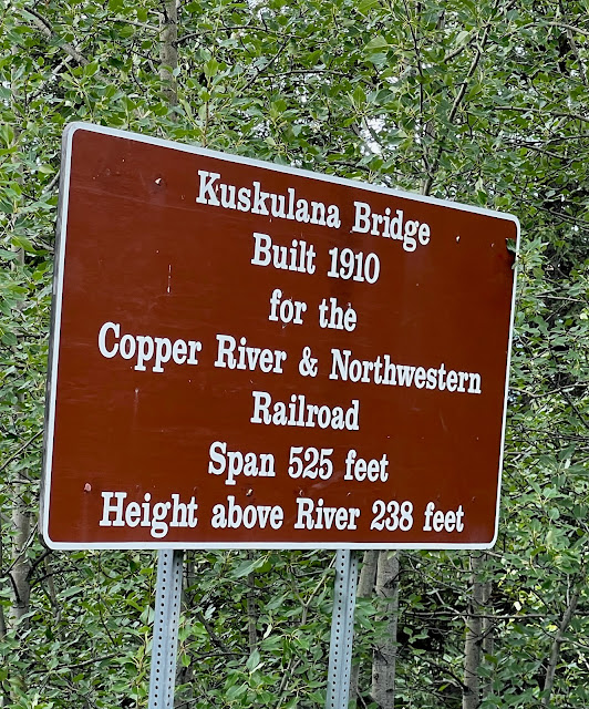
We approached the famed Kuskulana Bridge with some trepidation, having heard from Mary Nan while we were in Palmer how high and narrow the bridge is—and she crossed when it had no guard rails!


Kuskulana River Bridge.
Crossing the Kuskulana River Bridge.
It's an exhilarating crossing. Doug enjoyed it though he was rather focused on the road due to his interesting fear of heights. Yea, he was a Navy Pilot, but he says that is different.
.jpeg)
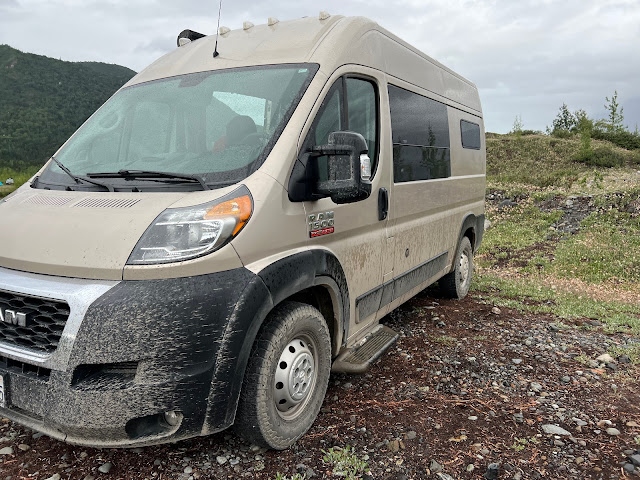
Fortunately we didn't encounter any tire-piercing spikes, but there was plenty of washboard.
.jpeg)
Remains of Gilahina River train trestles.
Crossing the Lakina River.

Grading created berms to further complicate navigation.
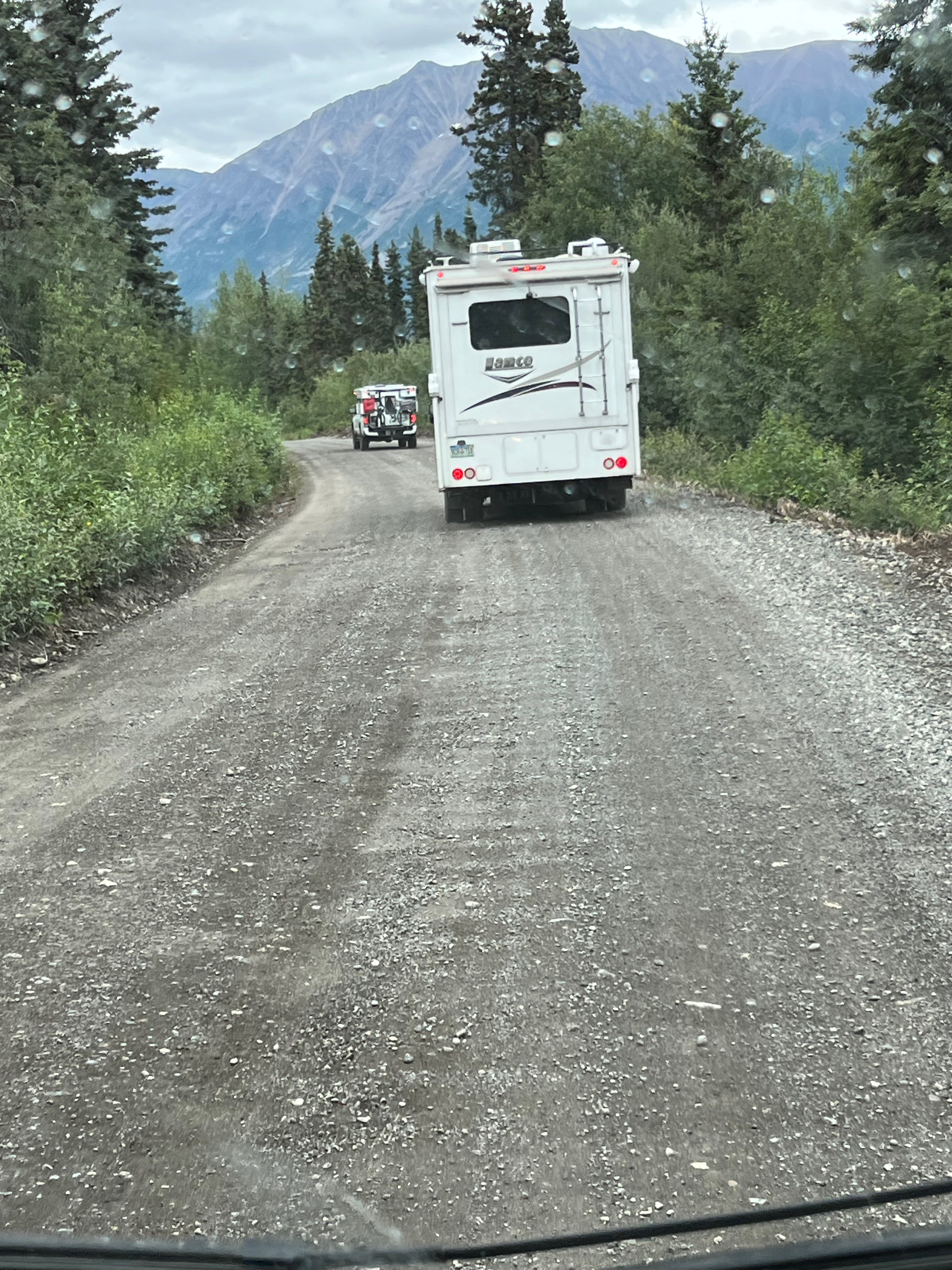
As we neared Base Camp Kennicott, we picked up a couple of fellow travelers
Land Use: Wrangell-St Elias National Park
.jpeg)
.jpeg)
.jpeg)

Footbridge from Base Camp Kennicott (buildings) to McCarthy.
Base Camp Kennicott has no hook-ups—our kind of campground, but it gives new meaning to "undeveloped." There are some fire rings and the occasional picnic table, but only a few, mostly primitive, outhouses, no drinking water, and no showers. You camp wherever you want. Roads and sites are rough. The upriver side was recommended as having bigger sites and being less crowded, so we proceeded to ease the van around rocks and holes, through dips and over bumps, and onto a site--not the perfect one, as it was already taken, but the views were still breath-taking.
.jpeg)
1st night camp site at Base Camp Kennicott.

We put the rug out to dry from the Valdez rain, & Doug repaired the table leg.

It was rainy & cold--but that would end the next day.

The van was beginning to turn solid brown again.
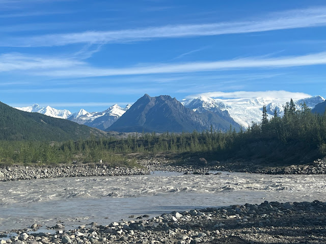
Morning brought clear skies and temperatures in the mid-70s. We decided to investigate the downriver side of the campground. It didn't take long to discover its appeal: sites on the Kennicott River and views of Kennicott Glacier.

Looking downstream from a flat spot on the river...

... and upstream toward the footbridge...

...and Kennicott Glacier.

The van didn't move for the next 4 days.

View from footbridge to our campsite.
The Lay of the Land.
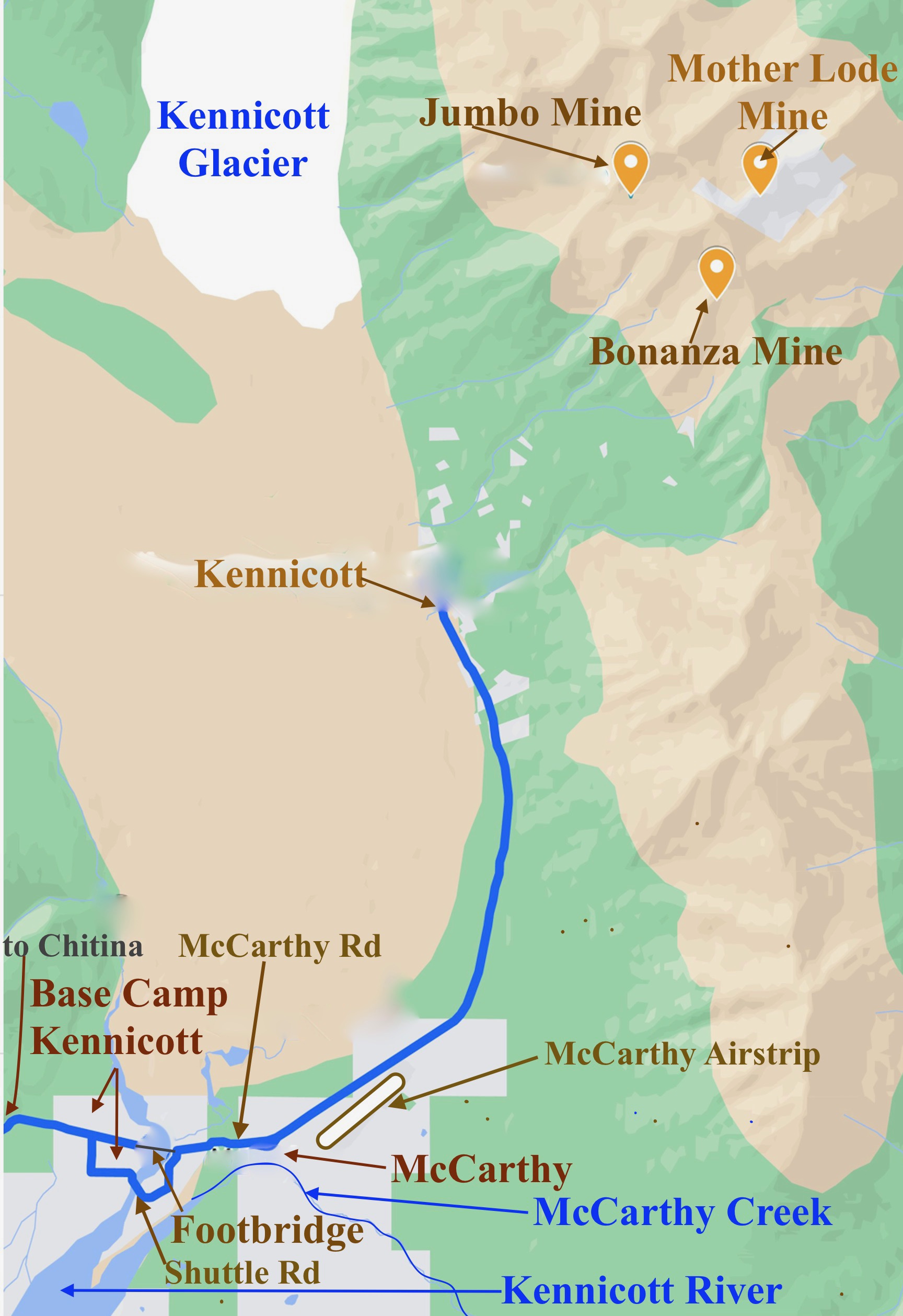
Our campsite was on the river between the footbridge & the shuttle road.

Kennicott viewed from our campsite.
The weather was perfect, the surroundings spectacular. Is it any wonder we'd wake up each morning and say, "Let's stay another day"?

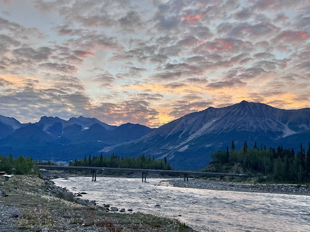
We had skies like this at 4:30 PM...
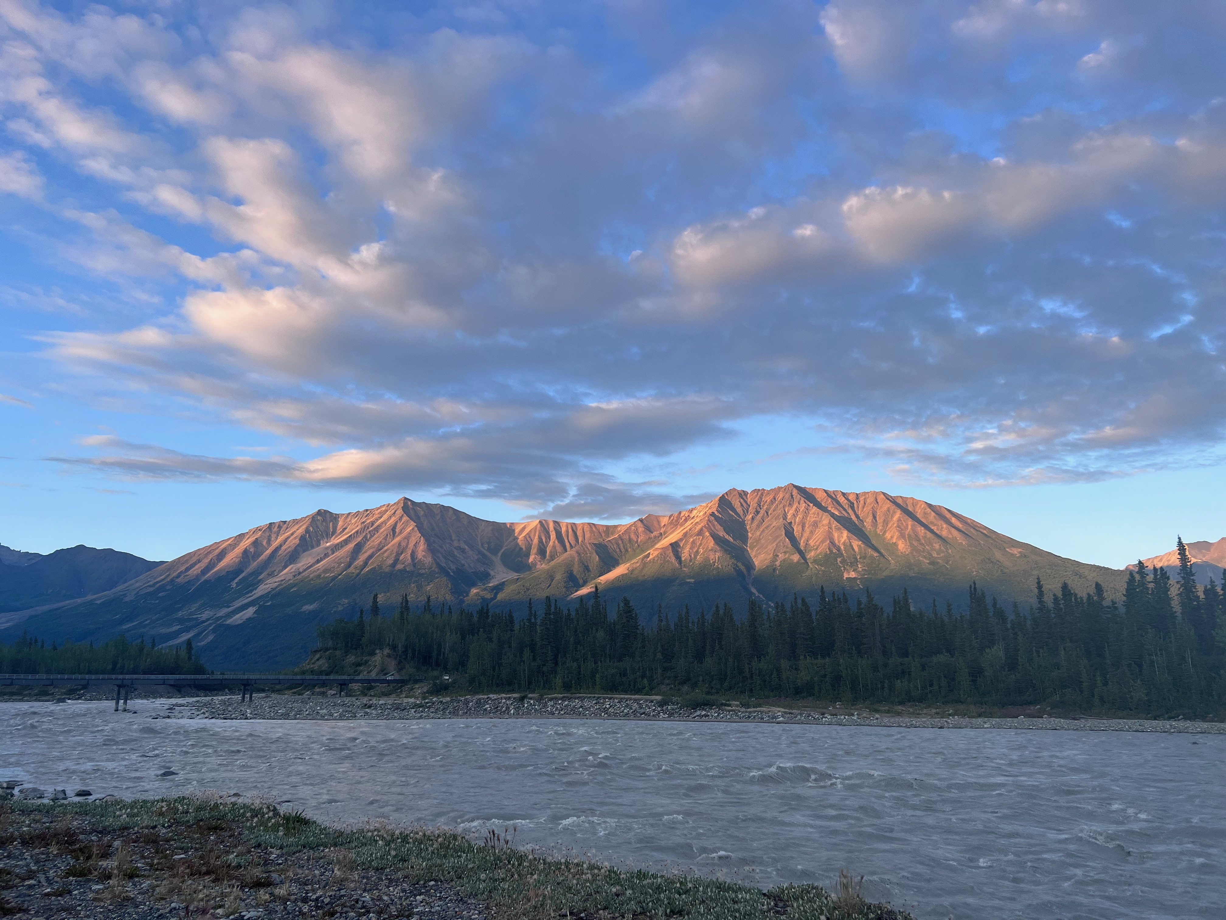
...and like this at 9:41 PM...

...and like this at 4:54 AM.

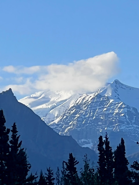
And always there was Kennicott Glacier.
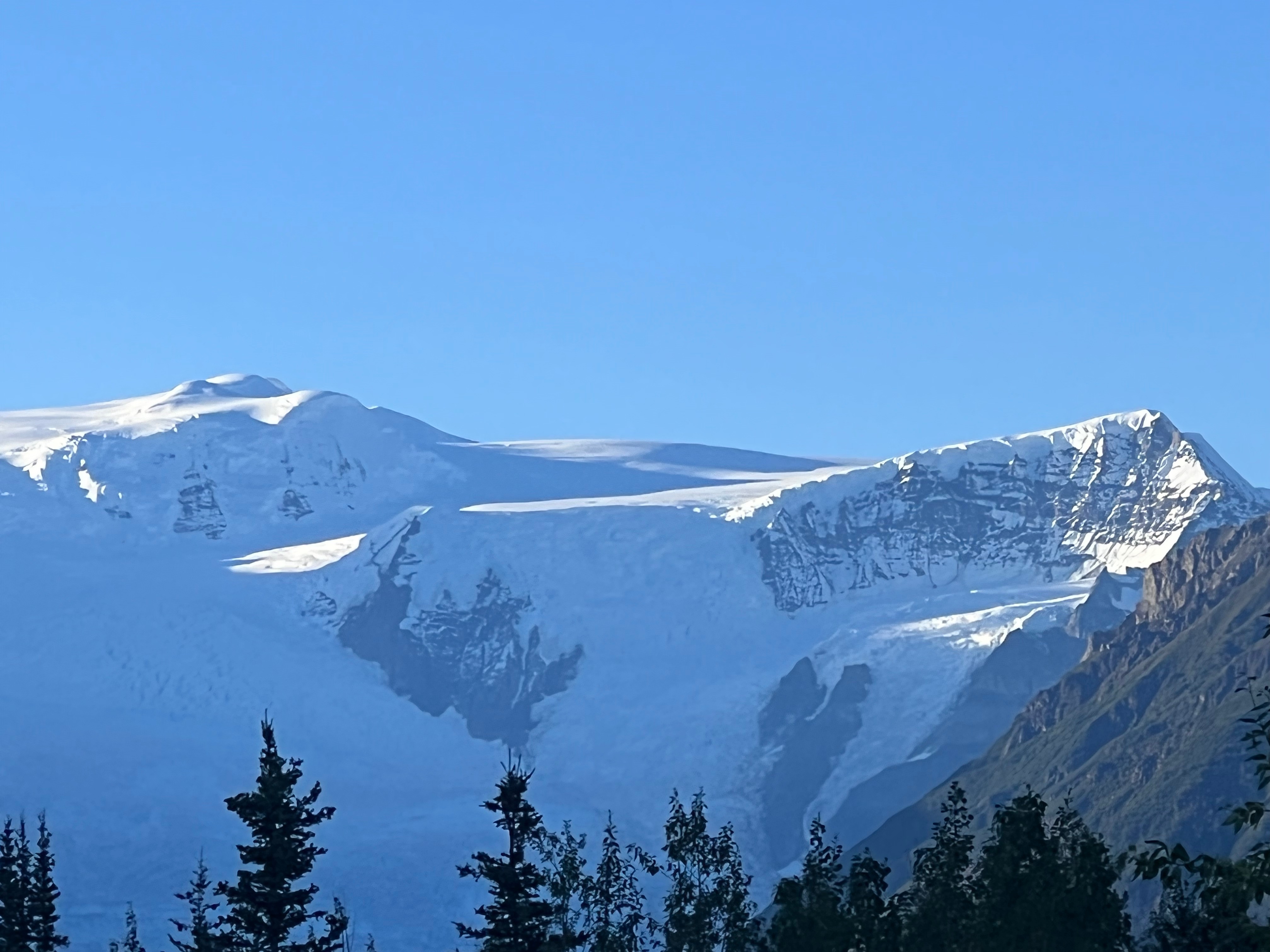
Kennicott Glacier.
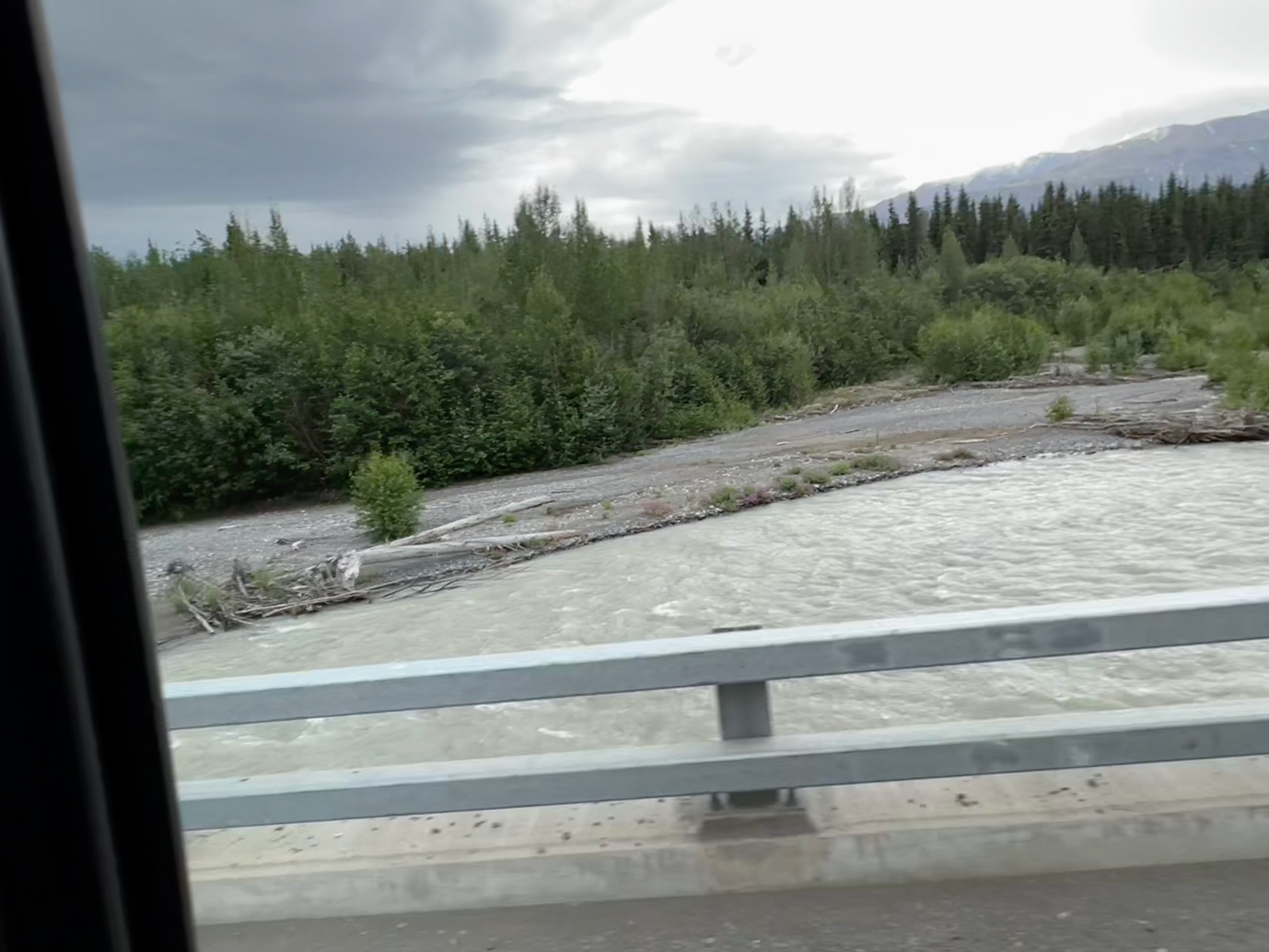
The roaring Kennicott River was full of glacial silt, but Marilyn still had to find a path she took down to it several times a day to fill her bucket and dump the icy water over her head.

So refreshing, though her hair and skin were a bit gritty afterward.
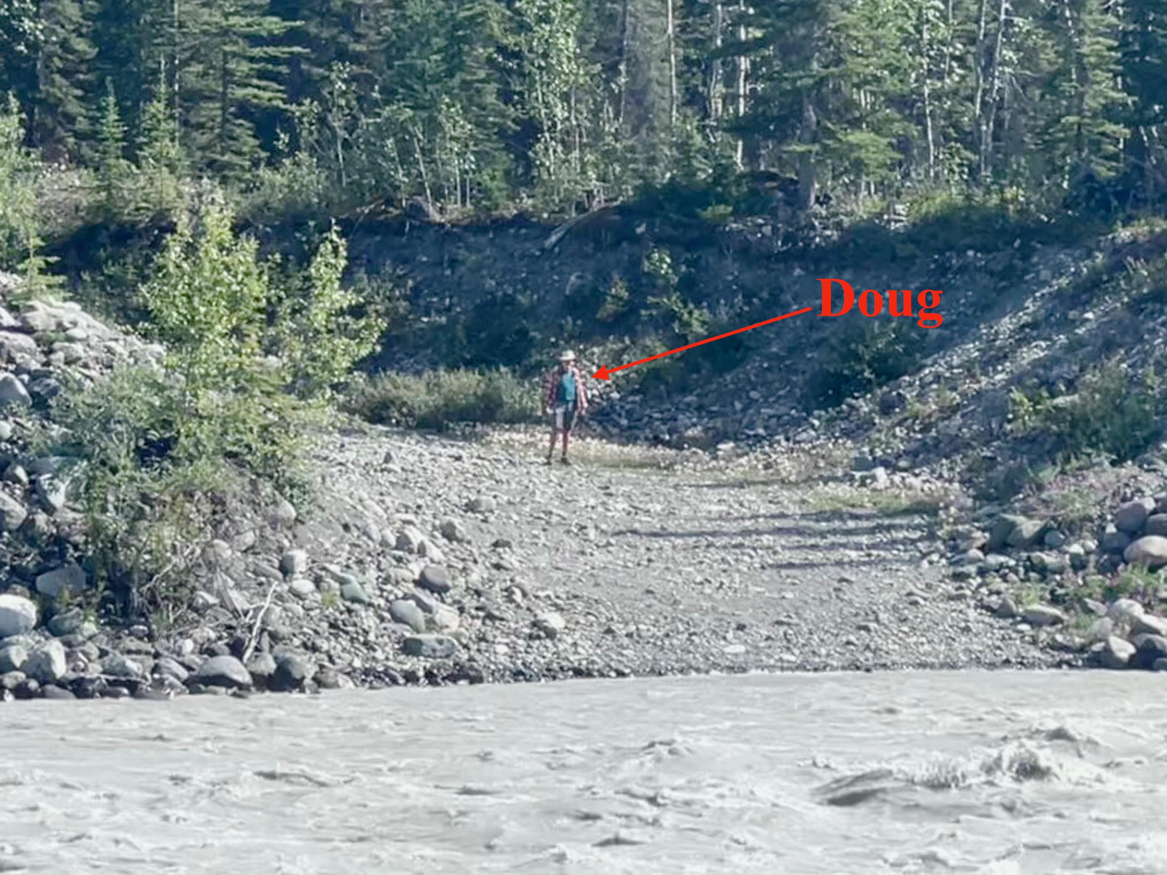
Returning from McCarthy and Kennicott one day, Doug looked for an alternate way back to the campground. He ended up at the raft launch.
Hm, where's my kayak?

Doug's view upstream from the boat launch.
From the ramp launch, he made his way to the shuttle road downstream from the campground.

Van on campsite & shuttle road downstream.

Kennicott Glacier.

Riverside campsite.

Dump truck negotiating the narrow shuttle bridge.

Likewise a humongous RV.
We never have been able to figure out the appeal of Man and Earth Roamer RVs. We are so comfortable in our 17.5-foot van! And the cost of gas?

Flowers as always entertained Marilyn.


Look close: a helicopter is slinging a small plane...

...and a truck.
Doug was enthralled, as he did some sling work in Vietnam. He pointed out that the helo was flying sideways to keep the plane's nose into the wind. Great airmanship.

Rafters entering the rushing cold Kennicott River.
A guide in a kayak followed.

We had cell service!!!

The neighbors' dog hung out with Doug.

We crossed the footbridge & walked the 1/2 mile to McCarthy at least once a day, starting with breakfast at the Potato.

View upriver from footbridge...

...and downriver.
But mostly, we relaxed.

Doug reading. Kennicott Glacier, off the right side of the van.

Perfect footrest, looking downstream toward the shuttle road.

Doug heating water on the wonderful stove set-up he created on one of our garage drawers.

Marilyn attempting to blog—the weather & setting prevented getting very far.
More great National Geographic photos! And that video! Doug, watch the road!
ReplyDeleteThanks! Doug the pilot sees 10 time what I do on the road even when I'm the passenger!
DeleteGlorious!!
ReplyDeleteThank you! Oh, it was.
Delete