Alaska/Canada 2022-16: Lazy Mountain, Hatcher Pass, & Matanuska Glacier
July 18-21, 2022
After 3 grand days in Seward on the Kenai Peninsula, we returned to family camp at JBER, the military base on the north side of Anchorage, to do laundry. The next morning, we drove the short 43 miles northeast to Palmer, where Marilyn's brother-in-law David spent much of his youth. We were going to visit his sister, Mary Nan, and her husband, John, who now live in the family home.
Mary Nan had recommended we drive up Hatcher Pass, but folks in town said driving the steep, 1-lane, curvy road that day, what with the fog and rain, would be too dangerous.

So Marilyn whiled away the time in the local quilt shop (hm, wonder if she spent any money...) while Doug walked about town in the rain and found a used book store.
Palmer is in the rich Matanuska-Susitna, or Mat-Su, Valley. Those gigantic Alaska cabbages we've all seen in pictures? They're from the Mat-Su Valley. Take fertile soil, add nearly 24-hour-a-day sunshine for a few months, and voila! The world record for largest cabbage, set in 2012 at the Alaska State Fair, which takes place in Palmer each fall, still stands: 138.25 pounds.

At the 2022 state fair, the winner weighed in at a mere 84.05 lb.
Palmer has about 6,000 residents, making it a pretty large town by Alaska standards. Remember, Alaska is huge--it's as wide as the entire lower 48. Texas, California, and Montana fit inside it, with room to spare. But the state has only 750,000 residents. Half of them live in Anchorage.

Under the 1930s New Deal, the federal government moved 200-plus farming families from Michigan, Wisconsin, and Minnesota to the Mat-Su Valley. They were provided a home, a barn, 40 acres, and a $3,000 loan.
David and Mary Nan's parents arrived in Palmer much later, moving from Minnesota in 1963--just in time for the 1964 earthquake. It was Good Friday, 5:30 PM, when the largest earthquake ever recorded in North America, a 9.2, struck Alaska.

The earthquake and subsequent tsunami caused destruction from Alaska to Los Angeles and led to the establishment of the West Coast and Alaska Tsunami Warning Center in Palmer. We'll write a little more about the earthquake in our post on Valdez.

In late afternoon, we left Palmer, crossed the Matanuska River, which empties into the Knik Arm of Cook Inlet, and drove up to Lazy Mountain. It was here that David, Mary Nan, and two more brothers grew up, their dad the town’s GP, and their mom an occupational therapist.
The spacious home and yard were built by their parents for Alaska's long days of summer and long nights of winter.

Mary Nan has an amazing green thumb.


.jpeg)
After an amazing wild salmon dinner and hours of wonderful conversation and stories of Mary Nan and John's experiences growing up, living, and working in Alaska, we headed to bed in the van. We were parked in their driveway turnaround, a wonderful flat spot...

...surrounded by gardens...

...with the sound of the stream trickling muscially behind us all night long.

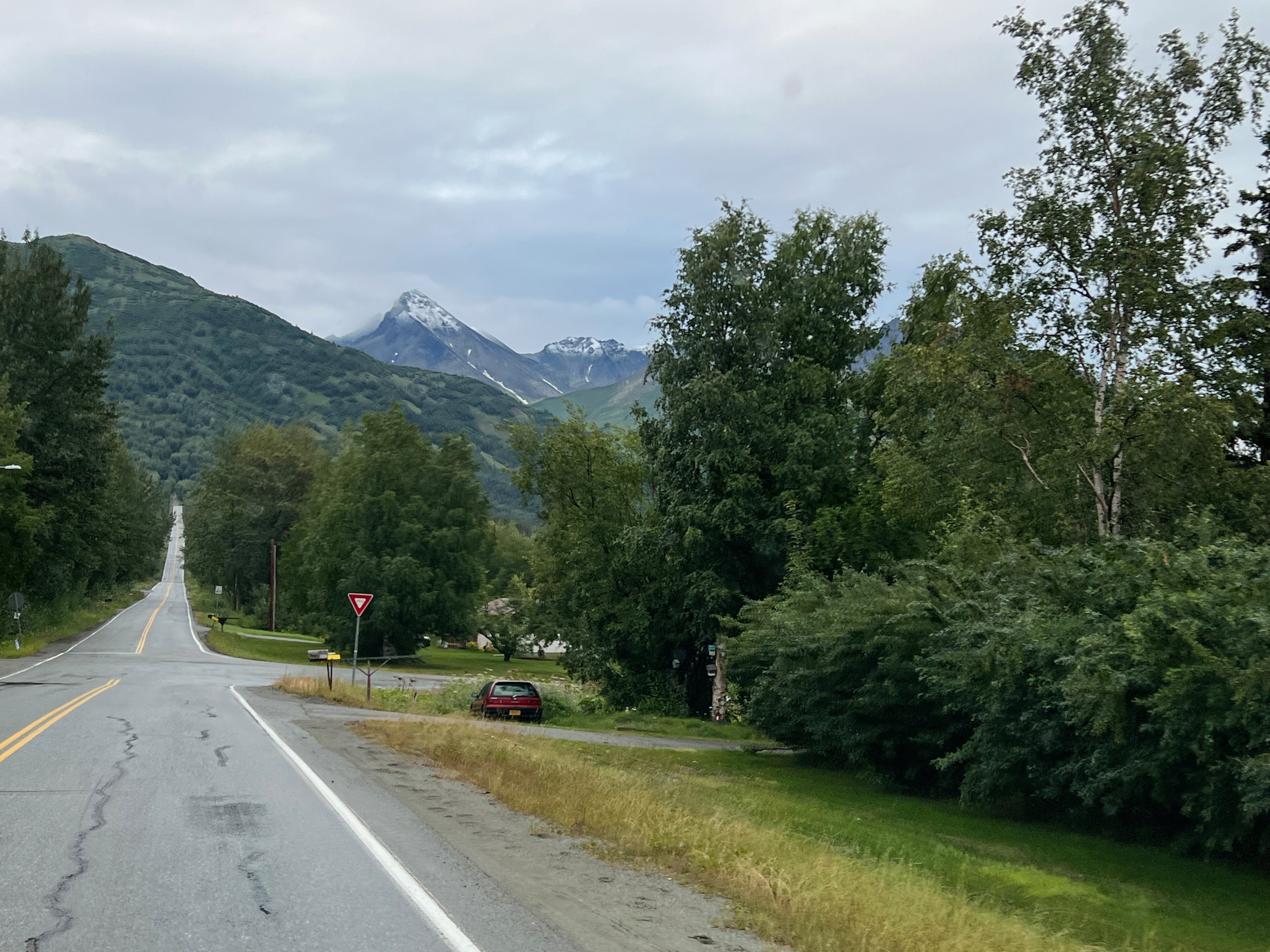
Morning brought blue skies and puffy white clouds, so we headed for Hatcher Pass. After crossing back over the Matanuska River, we were soon in the famed farmland of the Mat-Su Valley.


It was steep going down the other side of Hatcher Pass, too.

And it was beautiful.

We exited Hatcher Pass Road at Willow, had the pleasure of passing through Wasilla again, and turned east on the Glenn Hwy at Anchorage.

It was only 11 AM. We knew we wanted to go to Valdez, at least a 5.5-hour, 300-mile drive. But we weren't really inclined to push it. So we decided to just play it by ear. What else is new?

We were soon gaping at views of the Matanuska River and Valley, with the Chugach Mountains to the south and the Talkeetna Mountains to the north.

A couple of hours later, Doug, as he so's great at, caught something out of the corner of his eye. We found a pullout high above the river, got out and looked at the awesome landscape, and decided to backtrack.
.jpeg)
Sure enough, Doug had seen folks camped along the river. Unfortunately, it turned out to be a private campground. Undeterred, Doug backtracked some more, and we discovered Matanuska Rd.
.jpeg)
Soon, we were boondocking right on the river, though it took Doug some maneuvering to get the van angled so the wind wouldn't pound it. Unfurling the awning was out of the question.

Alaska is the best for free camping spots. You can park almost anywhere, as long as you aren't in the road. Doug uses pullouts when he's alone, because he takes off as soon as he wakes up. But when traveling together, we prefer to be in a scenic spot and take a little more time in the morning.
Cold as it was, Marilyn did some scouting for a spot to dip her bucket in the river for water to pour over her head.

She succeeded, against her better judgment, then spilled the water climbing back up the short slippery bank. She thought better of trying again.


Late that evening, we watched as a rafting party turned into the stream, loaded their gear and themselves into a van and trailer, and headed to warmer surroundings.


Doug took this amazing photo at 2:00 AM.

We got an early start the next morning. For miles we had views of the sprawling Matanuska Glacier: 27 miles long and, at its terminus, 4 miles wide.

Unfortunately, access to walk to the glacier is somehow on private land, but there are great views from Glenn Hwy and Matanuska Glacier State Recreation Site.

We still weren't sure if we wanted to make the 180-mile roundtrip drive to McCarthy-Kennicott, 120 of it on a 1-lane dirt road, but we knew we wanted to go to Valdez again. So we continued northeast toward Glennallen, where we'd turn south on the Richardson Hwy.
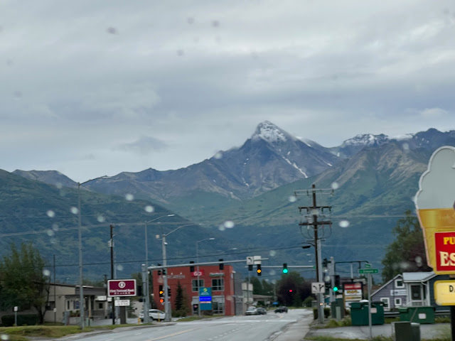
After 3 grand days in Seward on the Kenai Peninsula, we returned to family camp at JBER, the military base on the north side of Anchorage, to do laundry. The next morning, we drove the short 43 miles northeast to Palmer, where Marilyn's brother-in-law David spent much of his youth. We were going to visit his sister, Mary Nan, and her husband, John, who now live in the family home.

Downtown Palmer with Lazy Mountain behind.
Mary Nan had recommended we drive up Hatcher Pass, but folks in town said driving the steep, 1-lane, curvy road that day, what with the fog and rain, would be too dangerous.

Hatcher Pass Rd.
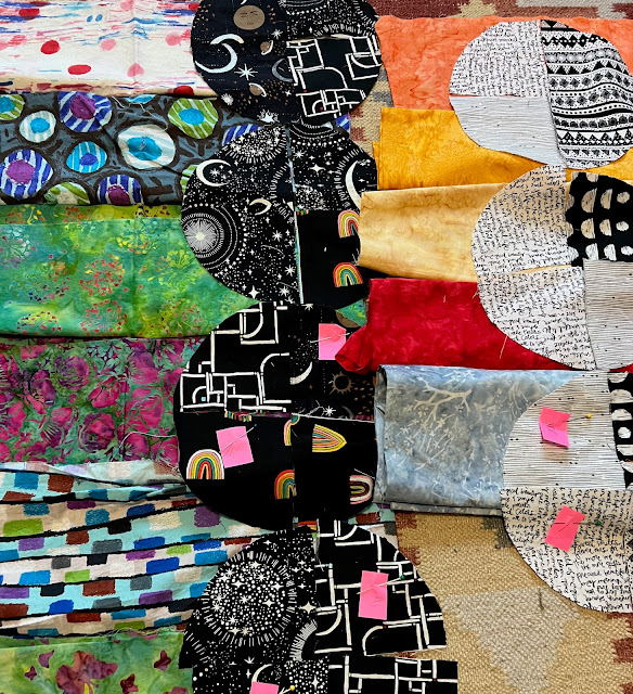
So Marilyn whiled away the time in the local quilt shop (hm, wonder if she spent any money...) while Doug walked about town in the rain and found a used book store.

Some of the fabric Marilyn was obliged to buy in quilt shops in Canada & Alaska; laying out for a quilt at home.
Palmer is in the rich Matanuska-Susitna, or Mat-Su, Valley. Those gigantic Alaska cabbages we've all seen in pictures? They're from the Mat-Su Valley. Take fertile soil, add nearly 24-hour-a-day sunshine for a few months, and voila! The world record for largest cabbage, set in 2012 at the Alaska State Fair, which takes place in Palmer each fall, still stands: 138.25 pounds.

At the 2022 state fair, the winner weighed in at a mere 84.05 lb.
Palmer has about 6,000 residents, making it a pretty large town by Alaska standards. Remember, Alaska is huge--it's as wide as the entire lower 48. Texas, California, and Montana fit inside it, with room to spare. But the state has only 750,000 residents. Half of them live in Anchorage.

Under the 1930s New Deal, the federal government moved 200-plus farming families from Michigan, Wisconsin, and Minnesota to the Mat-Su Valley. They were provided a home, a barn, 40 acres, and a $3,000 loan.
David and Mary Nan's parents arrived in Palmer much later, moving from Minnesota in 1963--just in time for the 1964 earthquake. It was Good Friday, 5:30 PM, when the largest earthquake ever recorded in North America, a 9.2, struck Alaska.

The earthquake and subsequent tsunami caused destruction from Alaska to Los Angeles and led to the establishment of the West Coast and Alaska Tsunami Warning Center in Palmer. We'll write a little more about the earthquake in our post on Valdez.

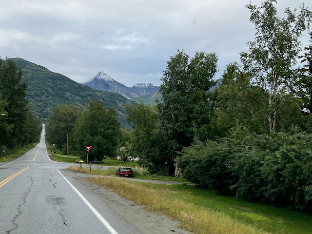
In late afternoon, we left Palmer, crossed the Matanuska River, which empties into the Knik Arm of Cook Inlet, and drove up to Lazy Mountain. It was here that David, Mary Nan, and two more brothers grew up, their dad the town’s GP, and their mom an occupational therapist.
Across the Matanuska River from Palmer headed for Lazy Mountain.
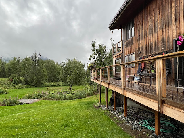
The spacious home and yard were built by their parents for Alaska's long days of summer and long nights of winter.
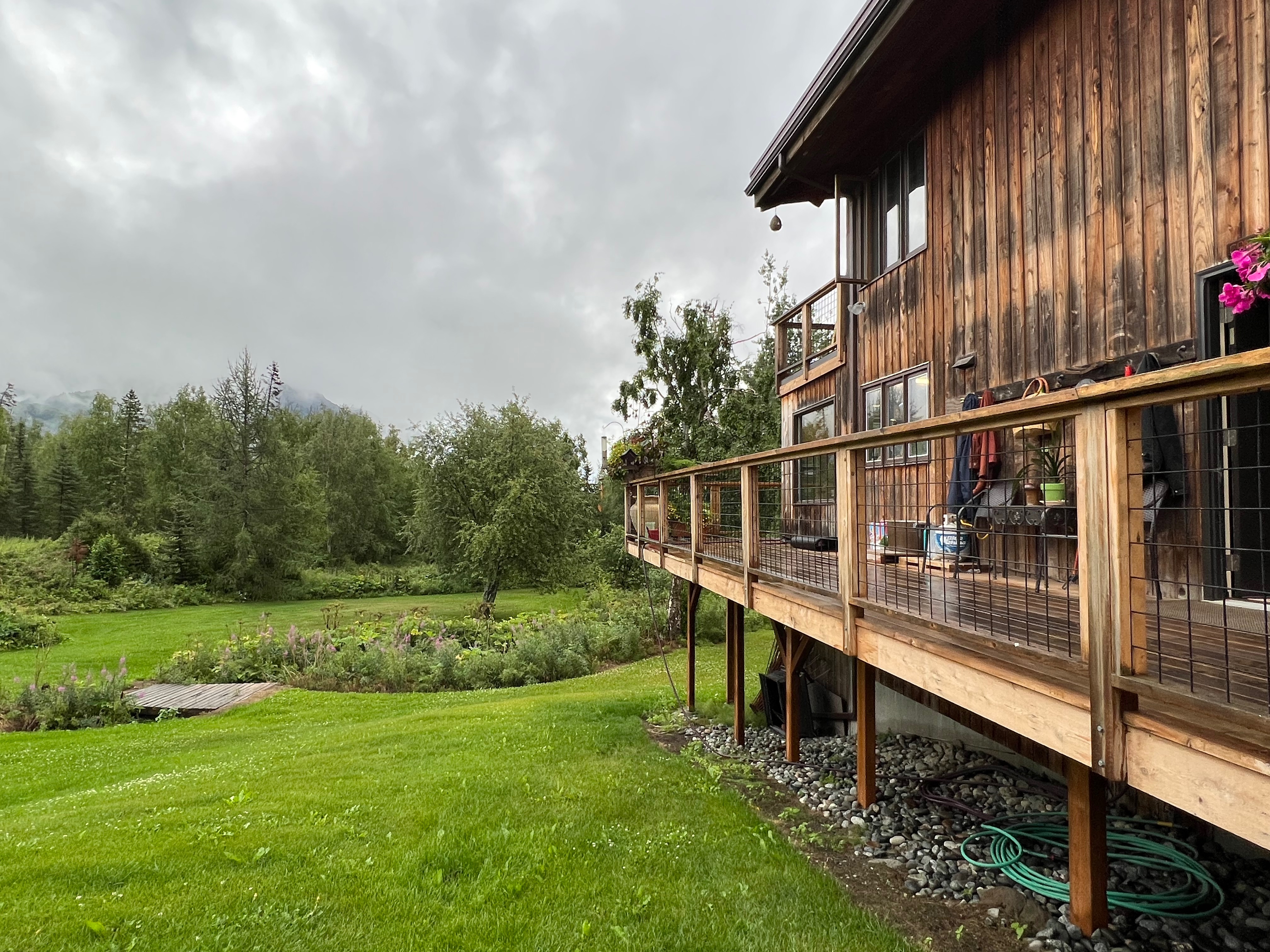
What an idyllic location!

As kids, they watched moose come into the yard.
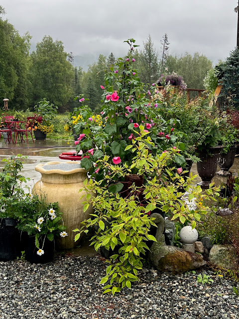
Mary Nan has an amazing green thumb.

Flowers & whimsical sculptures abound in the gardens & pots.

Patio off deck with huge pots of gorgeous flowers.

Everywhere you look there are pots spilling over with flowers & garden art.

Northern Monkshood?
.jpeg)
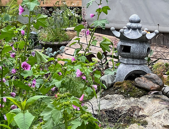
Marilyn loved the Japanese lantern near the hollyhocks.

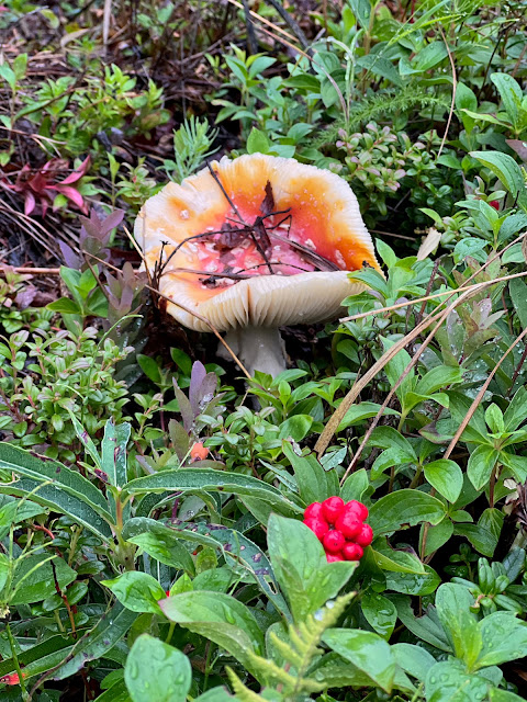
All the rain was encouraging wonderful mushrooms out of the ground, another of Marilyn's favorites.
After an amazing wild salmon dinner and hours of wonderful conversation and stories of Mary Nan and John's experiences growing up, living, and working in Alaska, we headed to bed in the van. We were parked in their driveway turnaround, a wonderful flat spot...

...surrounded by gardens...

...with the sound of the stream trickling muscially behind us all night long.

Stream running through the back yard.
Morning brought blue skies and puffy white clouds, so we headed for Hatcher Pass. After crossing back over the Matanuska River, we were soon in the famed farmland of the Mat-Su Valley.

Rolling green fields dotted with rolled bales of hay.
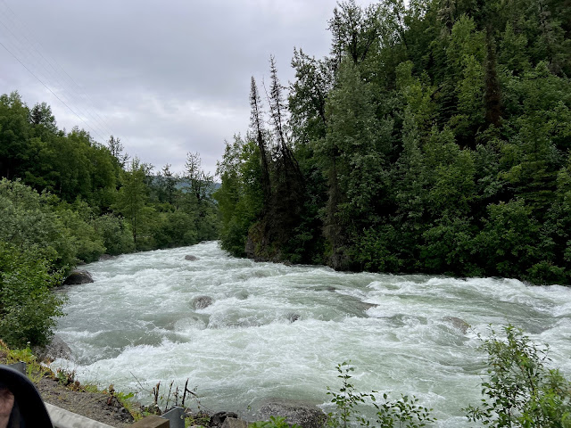
The little Susitna River raged alongside the road.
We began to climb toward Hatcher Pass.

At the beginning of the 20th century, Robert Lee Hatcher discovered gold here in the Talkeetna Mountains at about 3,500 feet and made a lode claim.

Lode mining is not an individual operation, as it requires miles of tunnels and heavy equipment. Two mining companies were formed, the Alaska Free Gold Mine and the Independence Mine. Pre-WWI, the mines were combined into the Alaska-Pacific Consolidated Mining Company. "Boomtown" housed the 200 mine workers, including 22 families, and 8 children attended the Territorial School in the bunkhouse.

After WWII, during which all gold mining in the US was shut down, the mine reopened and operated until 1951.

Today the area is the Independence Mine State Historic Park, offering a self-guided tour of the mine camp, hiking, winter sports, a Visitors Center, a snack shop, and a gift shop.
The park sits on a hairpin turn, and as we pulled out, this sign greeted us:

It was only another 330 feet to the top, but it was a steep 330 feet.
.jpeg)

Little Susitna River swollen by rain.
We began to climb toward Hatcher Pass.
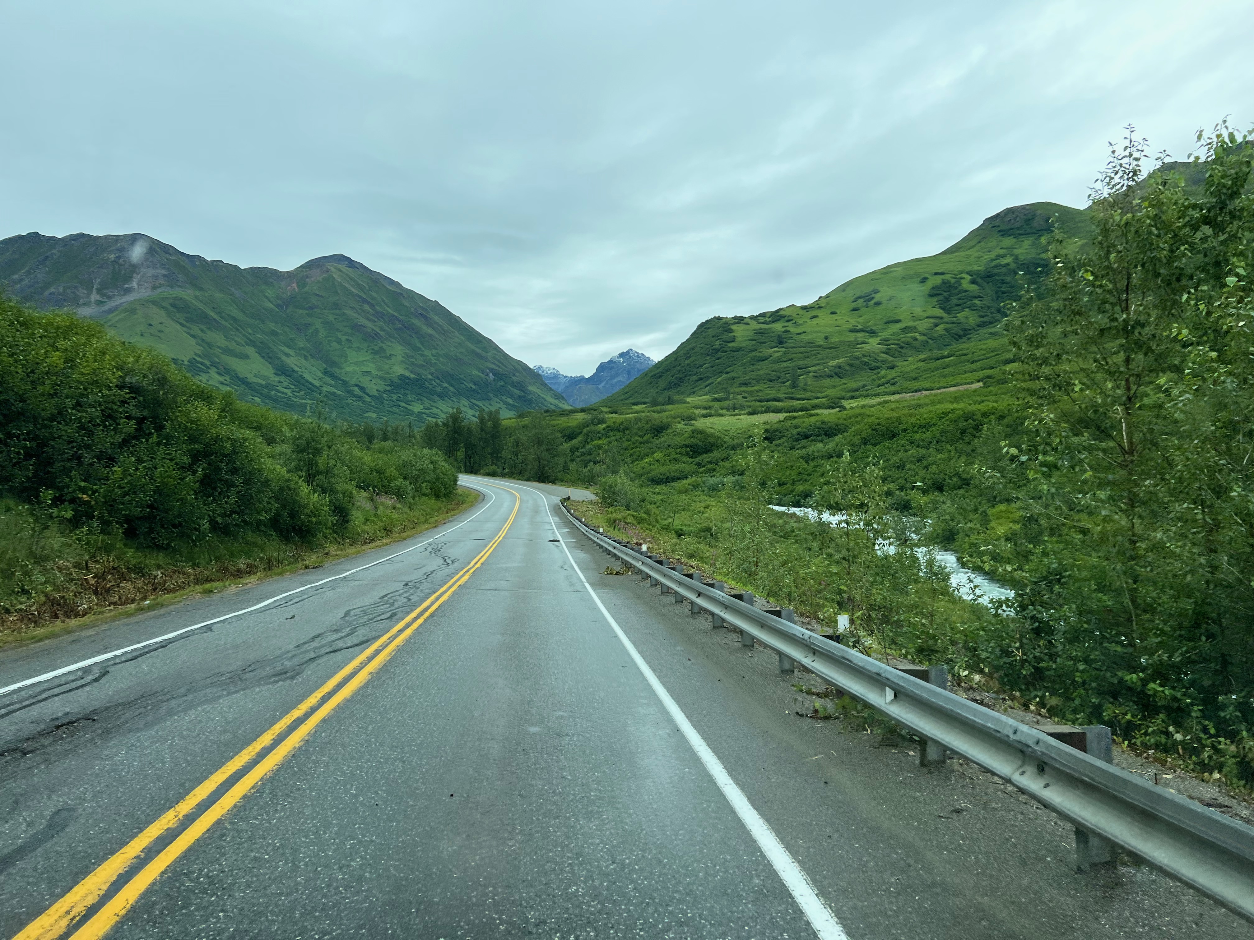
Heading up to Hatcher Pass.
At the beginning of the 20th century, Robert Lee Hatcher discovered gold here in the Talkeetna Mountains at about 3,500 feet and made a lode claim.

Little Susitna River, pink fireweed, white yarrow.
Lode mining is not an individual operation, as it requires miles of tunnels and heavy equipment. Two mining companies were formed, the Alaska Free Gold Mine and the Independence Mine. Pre-WWI, the mines were combined into the Alaska-Pacific Consolidated Mining Company. "Boomtown" housed the 200 mine workers, including 22 families, and 8 children attended the Territorial School in the bunkhouse.

Buildings of former Independence Gold Mine; note piles of tailings.
After WWII, during which all gold mining in the US was shut down, the mine reopened and operated until 1951.

Former mine housing. Looking toward Palmer & Chugach Mountains.
Today the area is the Independence Mine State Historic Park, offering a self-guided tour of the mine camp, hiking, winter sports, a Visitors Center, a snack shop, and a gift shop.
The park sits on a hairpin turn, and as we pulled out, this sign greeted us:
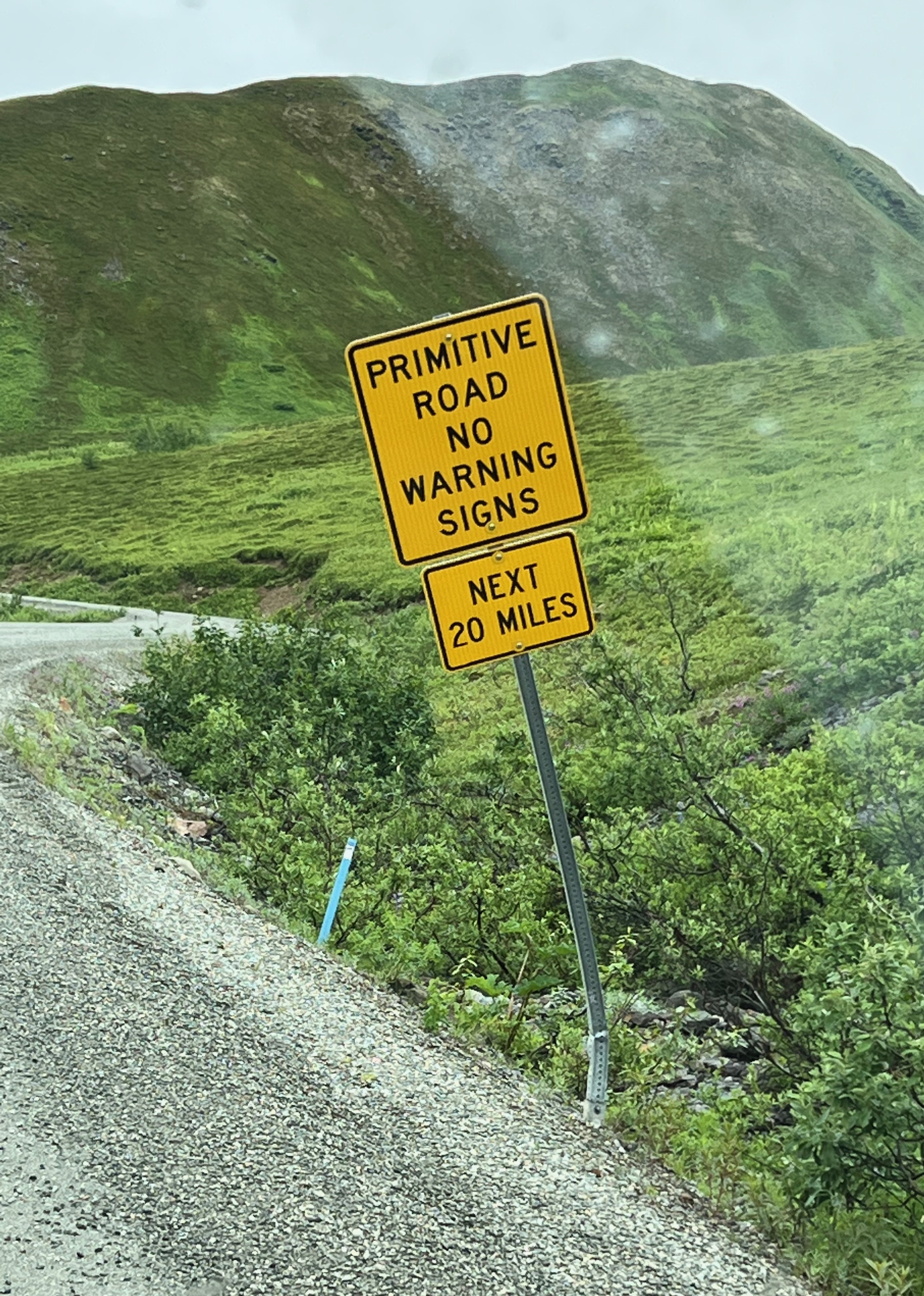
A sign that Doug likes--another adventure!
Leaving the gold mine park to head to the pass.
It was only another 330 feet to the top, but it was a steep 330 feet.
.jpeg)
The climb from Independence Mine to Hatcher Pass isn't far, but it's steep & the road turns to gravel. Note the ice on the side of the road.

Summitt Lake is off to the left.

We made it!

It was cold at Hatcher Pass!

A pond-size puddle & snow alongside the road.
It was steep going down the other side of Hatcher Pass, too.

Just a little hairpin curve.
And it was beautiful.

Fireweed & green hills.
We exited Hatcher Pass Road at Willow, had the pleasure of passing through Wasilla again, and turned east on the Glenn Hwy at Anchorage.

Back on the Parks Hwy, looking south toward Anchorage.
It was only 11 AM. We knew we wanted to go to Valdez, at least a 5.5-hour, 300-mile drive. But we weren't really inclined to push it. So we decided to just play it by ear. What else is new?

Matanuska River & Chugach Mountains.
We were soon gaping at views of the Matanuska River and Valley, with the Chugach Mountains to the south and the Talkeetna Mountains to the north.

Matanuska River along Glenn Hwy.
A couple of hours later, Doug, as he so's great at, caught something out of the corner of his eye. We found a pullout high above the river, got out and looked at the awesome landscape, and decided to backtrack.
.jpeg)
Chugach Mountains.
Sure enough, Doug had seen folks camped along the river. Unfortunately, it turned out to be a private campground. Undeterred, Doug backtracked some more, and we discovered Matanuska Rd.
.jpeg)
We couldn't get to the spot where the white RVs are in the picture, but Matanuska Rd took us to great spots on this side of the stream that cut through the riverbank.
Soon, we were boondocking right on the river, though it took Doug some maneuvering to get the van angled so the wind wouldn't pound it. Unfurling the awning was out of the question.

Boondocking on the Matanuska River.
Alaska is the best for free camping spots. You can park almost anywhere, as long as you aren't in the road. Doug uses pullouts when he's alone, because he takes off as soon as he wakes up. But when traveling together, we prefer to be in a scenic spot and take a little more time in the morning.
Cold as it was, Marilyn did some scouting for a spot to dip her bucket in the river for water to pour over her head.

Marilyn scouting a bucket-dipping spot.
She succeeded, against her better judgment, then spilled the water climbing back up the short slippery bank. She thought better of trying again.

Marilyn's bucket dipping spot. Would you take a short but steep, rocky, & slippery path to a raging, glacier-fed river to prove you could get some water out of it to pour over your head on a cold, windy day???

Doug exploring the river.
Late that evening, we watched as a rafting party turned into the stream, loaded their gear and themselves into a van and trailer, and headed to warmer surroundings.

Stream separating us from private camping. Rafters pulled out of the river into the stream late in the evening.

Van viewed from the highway.
Doug took this amazing photo at 2:00 AM.
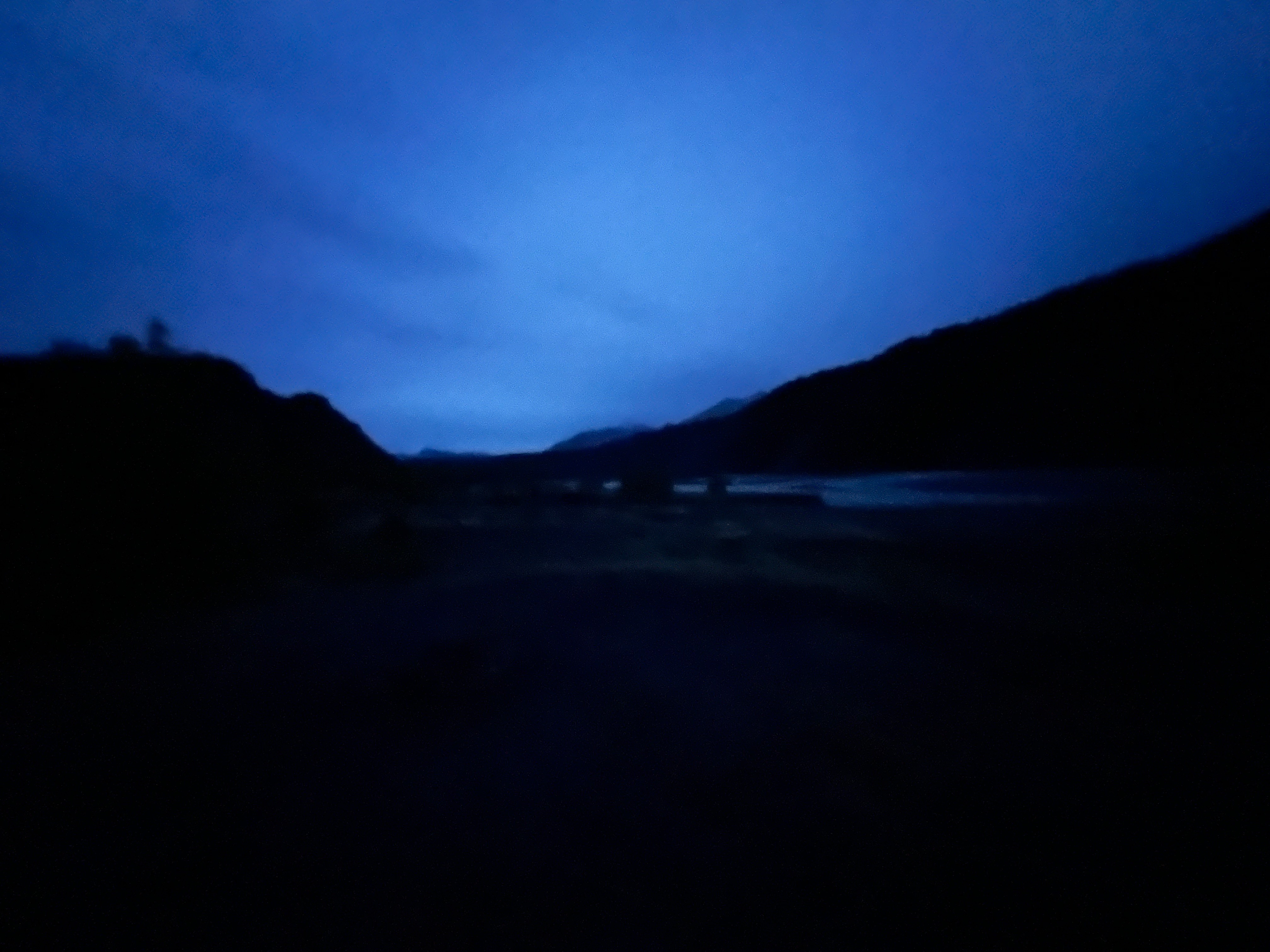
2:00 AM on the Matanuska River.
We got an early start the next morning. For miles we had views of the sprawling Matanuska Glacier: 27 miles long and, at its terminus, 4 miles wide.

Matanuska Glacier.
Unfortunately, access to walk to the glacier is somehow on private land, but there are great views from Glenn Hwy and Matanuska Glacier State Recreation Site.

4-mile-wide terminus of Matanuska Glacier seen from Glennallen Hwy.
We still weren't sure if we wanted to make the 180-mile roundtrip drive to McCarthy-Kennicott, 120 of it on a 1-lane dirt road, but we knew we wanted to go to Valdez again. So we continued northeast toward Glennallen, where we'd turn south on the Richardson Hwy.
Great story. Thanks. Steve
ReplyDeleteThank you!
DeleteAmazing pictures!! Thank you
ReplyDeleteThank you so much!
DeletePretty sure it's a lot colder and very dark there today...
ReplyDeleteYep. Not sure we'd be Alaska winter people--we think it's cold at 62. But plenty of folks we talked to basically said, "What? It get's cold. Big deal." :-)
DeleteMore and more great pix! And the Lazy Mountain home: what a wonderful place to grow up.
ReplyDeleteThanks, Scott! Yea, Lazy Mountain is beautiful--but they sitll have winter;-)
Delete