Alaska/Canada 2022-8: Klondike Loop 5 - Dempster Highway to the Arctic Circle
June 29-July 2, 2022
Dilemma #1: The Dempster Highway.
Imagine driving to the Arctic Ocean, a 1,151-mile round trip, on an all-dirt road, including small ferries across two rivers. It sounds enticing, yet did we really wish to bounce our van that far? Add, the last half after the Arctic Circle has the tendency to puncture tires, due to the jagged rock, often called shrapnel, that was used as a road bed.
Doug bought Wild Peak tires in 2021, and added a matching spare before the trip. In Whitehorse and Dawson City, we talked to folks who had made the trek to the Arctic Circle, or Inuvik, or Tuktoyaktuk. Travelers ranged from the truly awesome bicyclists to the wannabe explorers in giant box vehicles originally designed as support vehicles for desert driving in the Paris-Dakar road race.
Lastly we spoke with a couple of drivers who had just returned. One in a RV experienced one flat on the road and awoke the morning after his return to two flats. Another gent, who was driving a van like ours, had done the roundtrip up the Dempster—after having a tire shredded just past the Arctic Circle, returning 560 miles to Whitehorse for a complete set of new tires, then starting over. Other than the tires and extra time, he'd had no problems—and no dust inside the van.
Alert to any unusual sounds, about two hours into the trip we stopped to check out a rear end noise.
No problem uncovered, we continued on.
On the way back, Doug would patiently stop so Marilyn could take pictures of wildflowers—only to find they were everywhere in Tombstone Campground.
Road maintenance is constant due to permafrost and wear and tear.
Caribou have since ancient times been integral to the Tr'ondëk Hwëch'in way of life and culture.
Fiber optic cable was being laid along the Dempster to the towns that until the 20th century were isolated, reachable only on foot or by dog sled.
Eagle Plains is the first town on the Dempster Highway, about midway between the beginning of the highway and Inuvik.
Doug realized his mistake and offered to take her picture by the sign, but somehow she rejected going outside a third time. So there's no WE ARE HERE pic of us at the Arctic Circle, but Doug did present us with a certificate!
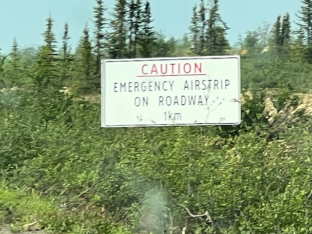
Not far south of the Arctic Circle, a long straightaway section of the Dempster serves as an emergency airstrip. It's a bit wider and has landing markers and a wind sock.
The Yukon.ca Dempster Highway Travelogue is a great mile-by-mile description, with many maps and lots of additional information on the geography, flora, fauna, and the like.
Dilemma #1: The Dempster Highway.
When we visited Dawson City in 2017, we read of a dirt road called the Dempster Highway that ran from near Dawson City, Yukon Territory, to Inuvik, Northwest Territories, but we did not have enough time to consider whether to do it.
In 2019, the road was extended 94 miles from Inuvik to Tuktoyaktuk (Tuk) on the Beaufort Sea, part of the Arctic Ocean.
The Dempster Highway.
Imagine driving to the Arctic Ocean, a 1,151-mile round trip, on an all-dirt road, including small ferries across two rivers. It sounds enticing, yet did we really wish to bounce our van that far? Add, the last half after the Arctic Circle has the tendency to puncture tires, due to the jagged rock, often called shrapnel, that was used as a road bed.
We went back and forth. Did we want the experience or the checkmark? Maybe we'd just go to Tombstone Mountain Territorial Park, only 44 miles of dirt road, to at least experience the Dempster. Did we need a second spare tire? We attempted to get a spare tire carrier before we left so we'd have two spares, but they were all on back order. Yes, we were in a dilemma.
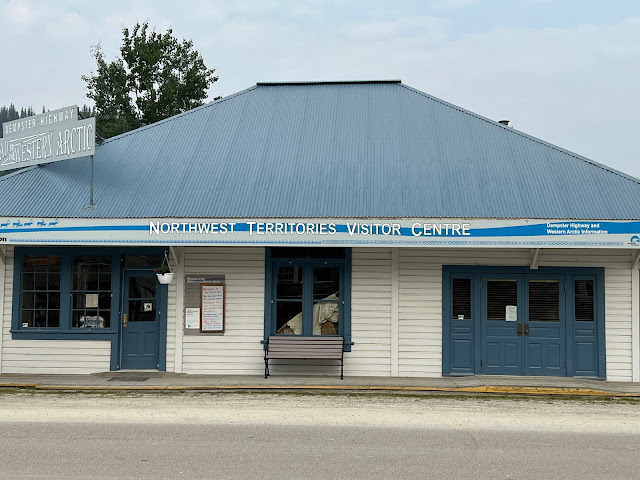
Northwest Territories Visitor Center, Dawson City
Once in Dawson city we each spoke with the ranger, a First Nations native of Inuvik, at the Northwest Territories Visitor Center. She counseled checking the weather/road condition report posted outside daily and said the road had been good.
Weather/Road Conditions, Dempster Highway
Doug bought Wild Peak tires in 2021, and added a matching spare before the trip. In Whitehorse and Dawson City, we talked to folks who had made the trek to the Arctic Circle, or Inuvik, or Tuktoyaktuk. Travelers ranged from the truly awesome bicyclists to the wannabe explorers in giant box vehicles originally designed as support vehicles for desert driving in the Paris-Dakar road race.
Expedition RV that had completed the Dempster Hwy. Note we are to the right. Can't fathom needing anything so huge.
A bicyclist on the Dempster. In 2017, Doug met a young couple in BC who had bicycled the Dempster to Inuvik, then scored a trip back in a pickup.
This Promaster in our Dawson campground gave us pause as it had dust inside and out from the Dempster. We concluded something had been left ajar or was not well-sealed.
We decided we were in...whatever "in" was.
With distances between outposts of "civilization" so vast in Canada and Alaska, mileposts and kilometer posts are very helpful.
By the time we crossed the Klondike River to begin the Dempster, it was already 11:30 AM.
Passing the sign at the start of the Dempster we still weren't certain what we'd do.
Dempster Hwy: 252 miles to the Arctic Circle, 456 miles to Inuvik, 547 miles to Tuktoyaktuk on the Arctic Ocean.
When we reached Tombstone Mountain Campground at 44 miles up the Dempster, we didn't turn in...
...so we were off to the Arctic Circle, 274 miles from Dawson City, 249 of it dirt. As the sun did not set until after midnight, we were in no hurry.
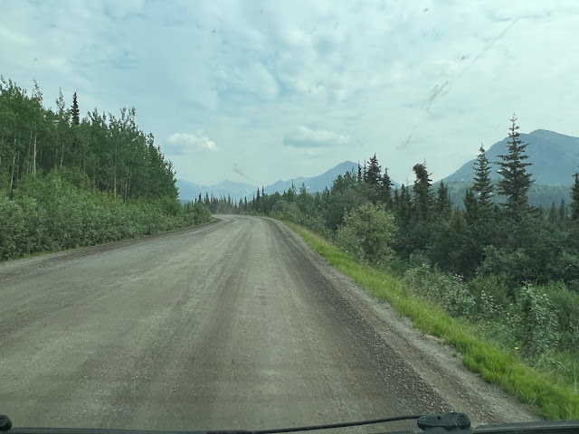
The road looked endless.
Sadly, it was smoky from fires near Fairbanks, AK, but the scenery was still awesome.
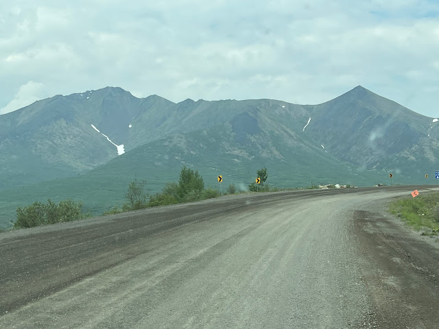
We would realize on our return trip that the views around Tombstone Mountain Territorial Park were the most beautiful of the entire run.
Tombstone Mountain Territorial Park
It was clear enough to see the dirt highway far in the distance.
As the trees grew sparser, Marilyn thought we were getting close! Not quite...we'd only been on the Dempster 35 minutes of about 5 hours.
So green!
Ice on the banks of the Blackstone River.
The colors of the hillsides change with the light.
106 km down. 399 to go.
Blackstone River again.
Losing the road in the distance.
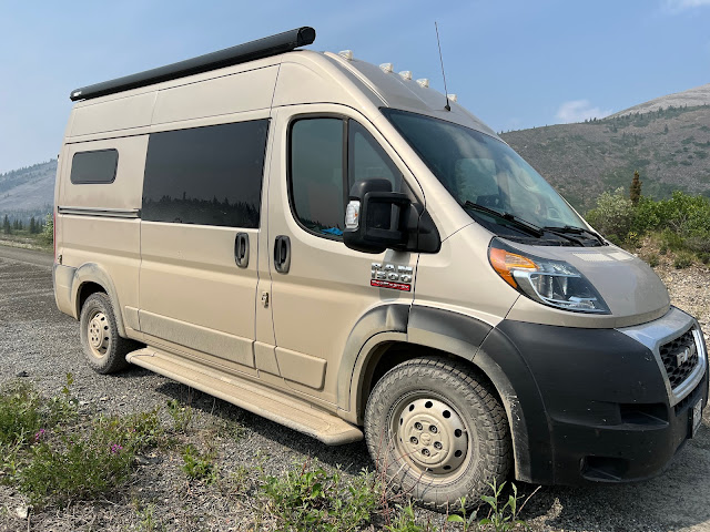
The side trim and running boards were black when we started.
Unlike the totally brown sides, the front and rear still had some black.
Green meadows & wildflowers.
It's so exciting to see the road disappear around the turn and over the edge.
Mineral deposits make Engineer Creek red and yellow.
Crossing the Olgivie River where Engineer Creek flows into it.
The scraper's first pass created windrows...
...which Doug had to maneuver...
...but at least they were gravel, not snow.
Sections of the Dempster were built 8 to 12 feet above the surrounding tundra, which helps prevent the cracks, dips, and bumps permafrost can cause.
Roadbed 8-12' above tundra to help counteract the effects of permafrost.
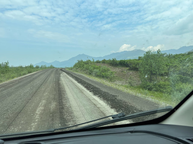
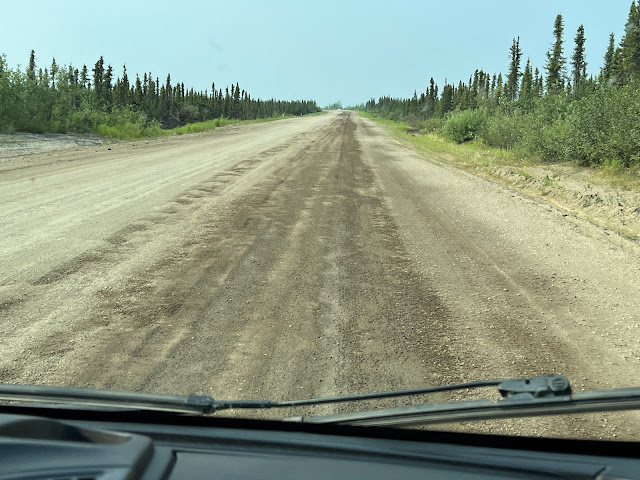
The highway is at times comfortable to drive at about 40 mph.
Dirt roads in the far north are often better than paved roads, which acquire cracks, bumps, dips, and potholes due to permafrost.
Other times a combination of washboard and potholes found Doug going much slower and seeking a route around the obstacles.
Doug is expert at maneuvering on rough roads, but sometimes, the road wins.
There wasn't a lot of traffic, but encountering oncoming vehicles, especially semi-trucks and the dust they kicked up, could be interesting.
Basically whiteout in wake of passing semi.
Fortunately we did not have to follow a vehicle but can say our cabin air filter was rather black when we changed it.
We left our own long plume of dust behind.
The Tr'ondëk Hwëch'in were the original inhabitants of the region. They regained ownership of their land from Canada in 1988.
Permission to hunt must be granted by the First Nation.
"Please hunt only the caribou that you need."
Like the Western US, forest fires have devastated millions of acres in Canada. Weakened surviving trees have been prey in the US to the bark beetle and in Canada the spruce beetle.
Devastation from wildfire...
...and the spruce beetle.
Despite the smoky haze, we could see the faint line of the highway far in the distance.
Machines simultaneously cut and mulched grass, brush, and small trees along the roadside...
...clearing a path for the cable...
...which was undergrounded by a machine.
More devastated forest.
Nearly to the night's camp at Eagle Plains.
Arriving at Eagle Plains about 5:00 PM.
Like everywhere in the Yukon and Alaska, whenever gas and water are available, you get them, irrespective of the cost. And if your larders aren't full, you get food, too.
Eagle Plains: 229 miles from beginning of Dempster Highway. 22 miles south of Arctic Circle.
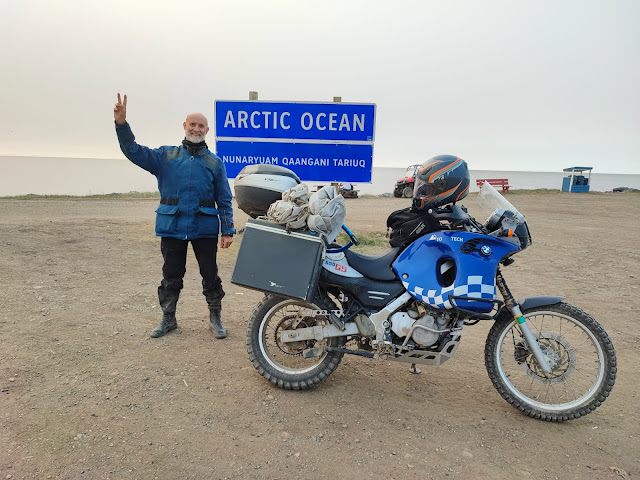
Many motorcyclists travel the Dempster. At Eagle Plains, we met Henry on his return from the Arctic Ocean. Unfortunately, his bike later broke down and was being shipped to Vancouver for repairs.
We hope someday to take Henry up on his offer that we will "always have a friend in Spain."
Three motorcyclists arrived at the campground around 11:00 PM. Night is not much more than dusk this far north.
We left early the next morning to drive the last 22 miles to the Arctic Circle.
6:30 AM, the sun all but concealed by smoke.
22 miles to the Arctic Circle.
Driving on the long, dirt Dempster takes concentration.
Crossing the Eagle River.
Would we ever get there?
Or would we drop off the edge of the world?
When construction of the Dempster Highway reached the Arctic Circle in 1977, a sign was erected.
Workers added this marker.
For a few summers, Henry Waldron greeted travelers who ventured to the Arctic Circle on the Dempster. A former highway worker, he wore a tuxedo and recited Robert Service poetry.
We arrived at the Arctic Circle 6/30/22, 8:56 AM! It was both exciting and a bit sad, as smoke concealed the grand vistas. We were greeted by swarms of mosquitoes.
Marilyn got out to take pictures but quickly returned to the van, along with a myriad of her new BFFs. Doug swatted while Marilyn donned a long sleeve shirt and mosquito net headgear, ventured out again, got a few pictures, and escaped back to the van.
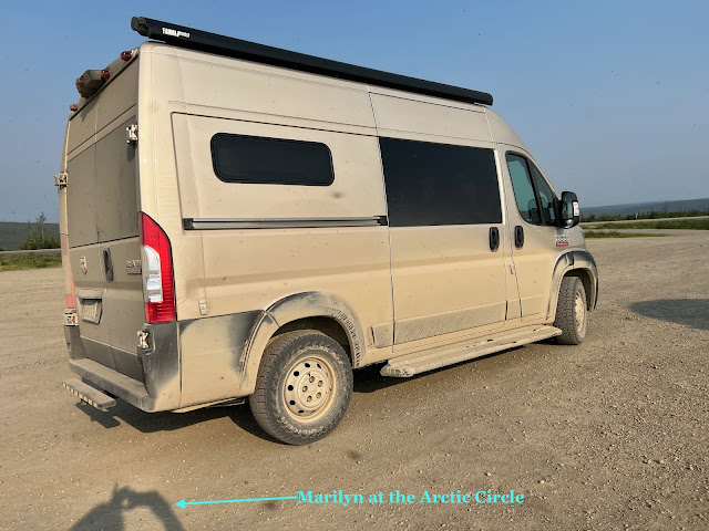
Marilyn's shadow at the Arctic Circle.
Doug at the Arctic Circle.
Doug realized his mistake and offered to take her picture by the sign, but somehow she rejected going outside a third time. So there's no WE ARE HERE pic of us at the Arctic Circle, but Doug did present us with a certificate!
And now dilemma #2: did we wish to drive an additional 300 miles to Tuktoyaktuk to say we had dipped our toe in the Arctic Ocean? Besides the time, miles, and further rattling of the van, there was the potential for a flat, and changing a tire while dancing with mosquitoes did not sound particularly charming. That sealed the deal, so we did a 180 and headed back to Eagle Plains. We topped off with gas and smiled. Now Doug only had to drive 230 miles back down the Dempster.
Heading back down the Dempster
Now we were looking for bumps, dips, oncoming vehicles, animals, and airplanes!
No kidding!
Unfortunately for Doug, not one landed during our trek.
We were rewarded for not going on to the Arctic Ocean when just before Eagle Plains, we saw what we thought were two musk oxen crossing the road from Marilyn's side. Upon seeing us, they did an abrupt 180 and headed back into the bush. To my amazement Marilyn was able to snap two blurry pictures of them.
1st musk ox was down in the bush when Marilyn's camera found it.
2nd musk ox was hurrying off the road. Considering their size, it was amazing how fast they moved, with quite a swish of the hips, made more pronounced by their long hair.
At the Tombstone Nature Center we shared our sighting with the rangers. Guess we were blessed, for none of the rangers had seen a musk ox in the wild. They promptly recorded the sighting and copied the pictures. Likewise, when we told the ranger at the NW Territories Visitor Center in Dawson, she called the Inuvik ranger to report it.
215 more miles back to Dawson.
The road...
...the landscape...
...the sky.
Nearing Tombstone Mountain Territorial Park Campground.
When we got to the turnoff for Tombstone Mountain Territorial Park Campground, we decided why not stay the night. It was so gorgeous, we stayed two. More on that in our next post.
Our site on the North Klondike River at Tombstone Mountain Territorial Park Campground.
The Yukon.ca Dempster Highway Travelogue is a great mile-by-mile description, with many maps and lots of additional information on the geography, flora, fauna, and the like.






.jpeg)










.jpeg)
.jpeg)



.jpeg)


Good thing Doug was concentrating at the wheel. So many distractions—scenery, dust, other vehicles, smoke, skeeters.
ReplyDeleteIndeed! Imagine if there’d been an airplane!
DeleteSo exciting. Glad the mosquitoes didn’t devour you.
ReplyDeleteAppreciate your comment.
DeleteLoved reading this and seeing your pictures!!
ReplyDeleteThank you so much! Really glad you enjoy it.
DeleteAs an Navy vet isn't there an initiation like crossing the equator that you have to accomplish for crossing the Arctic Circle? Steve
ReplyDeleteI think he skipped it as being devoured by mosquitoes might have gotten in the way.
DeleteWow! Loved reading this whole saga! What an adventure. And so cool to get a glimpse of the musk ox!
ReplyDeleteIt really was. Glad you enjoyed reading. Thank you for letting us know
DeleteA trip of a lifetime (or two)! Those skeeters rule the land and keep you hopping! Good show
ReplyDeleteThanks goodness for our door and window screens, mosquito spray, etc, to help fend them off!
DeleteSo nice to have met with you folks , a big thank you and wishing you both safe travels
ReplyDeleteYou, too! And thanks for reading and following! Safe travels to you, as well.
Delete