Southwest 2021-16: Goosenecks State Park, Monument Valley, Pahreah, and the Fog-Snow-Rain-Hail-Sleet Day
March 22-23, 2021
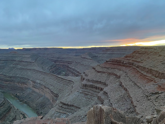
When we arrived at Goosenecks State Park after driving down the Moki Dugway, we paid $5 to enter. The campsites near the entrance didn't entice us, but as we drove down the dirt road along the edge of the canyon carved by the San Juan River, we came to numerous sites we could definitely see staying in.
We picked a site and parked about 10 feet from the edge of the canyon— a 1,000-foot drop—between the Goosenecks of the San Juan River, for which the park is named. Doug walked back to the pay booth and paid an additional $5 to camp for the night. Talk about expensive lodgings!
Like the Colorado, the San Juan River twists and winds its way from its source at 14,000 feet until it flows into the Colorado 360 miles later at what is now Lake Powell. The Goosenecks are 6 miles long but cover a distance as the crow flies of 1.5 miles.
It was quite windy—the theme of our trip—so Doug turned the van broadside to the wind so the cargo door side would be protected, as would we, sitting outside.


Marilyn walked toward the end of the spit of land, thinking she'd go to the end. But when the air is so clear, distances are deceiving, and she turned back long before the end.
Not saying it was windy, but when the wind slamming into the side of the van woke Doug around midnight on a DARK night, Marilyn was already awake. We were both imagining the wind tumbling us over the edge of the canyon. Not that that would happen, but we both agreed it would be good if Doug moved the van to face into the wind. Then, of course, Marilyn imagined Doug would simply drive us over the edge. But somehow, he managed to wake himself to an alert state and execute a 270-degree turn, putting the van into the wind.
We left Goosenecks and drove to Mexican Hat Rock, for which Mexican Hat UT is named.
From there, we drove along 89, which would eventually take us to Kanab UT.
We were driving through Monument Valley Tribal Park, which is on the Navajo Reservation and operated by them. Though it remains closed, we saw several small tour buses.
The formations within the paid area are at a distance from the road, but those along the road are equally awe-inspiring.

To prove the van's (and Doug's) feat, we needed to record the van descending from the campsite. With Doug driving, Marilyn stood outside taking pictures—as it started to hail.
Arrived in Kanab, we checked in at the campground we had reserved, did laundry, and got take-out hamburgers and fries from the drive-in across the street.
All aboard!
When we arrived at Goosenecks State Park after driving down the Moki Dugway, we paid $5 to enter. The campsites near the entrance didn't entice us, but as we drove down the dirt road along the edge of the canyon carved by the San Juan River, we came to numerous sites we could definitely see staying in.
Is this what they call living on the edge?
We picked a site and parked about 10 feet from the edge of the canyon— a 1,000-foot drop—between the Goosenecks of the San Juan River, for which the park is named. Doug walked back to the pay booth and paid an additional $5 to camp for the night. Talk about expensive lodgings!
Satellite view of the Goosenecks of the San Juan River. Green arrows point to the Goosenecks and to our campsite on the edge of the Goosenecks.
Like the Colorado, the San Juan River twists and winds its way from its source at 14,000 feet until it flows into the Colorado 360 miles later at what is now Lake Powell. The Goosenecks are 6 miles long but cover a distance as the crow flies of 1.5 miles.
Doug standing at the Goosenecks.
There was a labyrinth, connected to a mini-labyrinth, right next to our campsite!

Marilyn successfully navigated both labyrinths!

Those rock formations are much further away than they look.
It's hard to get perspective when surrounded by such massive nature. The canyon dwarfs the van. The rock formation in the distance, which looks huge, is massive up close. The small white spot about halfway between our van and the rock formation is an RV.
Van at the Goosenecks of the San Juan River.
The van the next morning, after Doug turned it 270 degrees in the black of night.
Sunrise over the Goosenecks.
The morning clouds, with that menacing curl on the right, may have been a clue as to what lay ahead for us that day...
What to say? Mexican Hat Rock is amazing!
We left Goosenecks and drove to Mexican Hat Rock, for which Mexican Hat UT is named.
Monument Valley
As we approached the grand formations in Monument Valley, we noticed they had dressings of snow.
As we got closer, fog rolled over the formations, increasing the sense mystery and spirituality.
Rock formation dressed in fog.
Monument Valley is in both Utah and Arizona, so going through it on 89, we crossed into Arizona.
More intriguing formations, also shrouded in fog.
We passed horses a number of times that more than likely were wild.
Not only was it foggy, but it had begun to snow. We were, after all, at about 5,000 feet in March.

The driving got exciting.

More amazing formations, rich with the colors of the Colorado Plateau.
Then it warmed up a bit, and the snow turned to rain.
Bridge across Glen Canyon Dam on Colorado River.
At Page AZ, we drove across the Glen Canyon Dam. The website of the Glen Canyon Institute provides a good history of the dam and reminds us of Kevin Fedarko's excellent 2013 book The Emerald Mile: The Epic Story of the Fastest Ride in History Through the Heart of the Grand Canyon, which provides a thorough telling of the geology, history, and uses of the Colorado River.

Though we've camped along the Colorado River in numerous places, read books about it, and witnessed the effects of its diversion on the lush agriculture of our home state of California, it's still difficult to fathom that every drop of this 1,450-mile-long river, which averages 300 feet across and 20 feet deep, is committed via the 1922 Colorado River Compact among 23 Native American tribes, Mexico, and 7 US states.
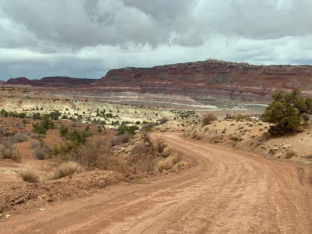
Our destination was the Pareah town site, which was six miles down the sometimes-excellent-sometimes-a-bit-rough-sometimes-downright-ornery dirt Pareah River Valley Road.

The Glen Canyon dam on the Colorado River creates Lake Powell, but crossing the bridge that day it was amazing how low the lake was, showing a large "bathtub ring."
Typical of our trip through the Southwest, the rock formations and colors were stunning.
Soon after Page, we crossed back into Utah, where Doug had another side trip in mind. It required finding a not-very-well-marked dirt road—which he did, of course.
Driving Pareah River Valley Road to the Pareah (Paria) town site.
As always in this part of the country, the vistas were more than worth the drive.

Who wouldn't want to live here? It's gorgeous!
The town of Pareah was settled along the Pareah River by Mormons in 1865. It eventually comprised 47 families and 20 Paiute Indians. Frequent flooding led to the demise of the community after a few decades.
Beginning in the 1930s, the ghost town of Pareah was used as a movie set for Westerns.
...but not before Doug found the flat spot where he had once camped in the VW Westy and wanted to see if the van could make it up. Clearly, it could.
Beginning in the 1930s, the ghost town of Pareah was used as a movie set for Westerns.
Rapidly-approaching dark clouds as we explored the old town site.
With ominous clouds moving toward us, we decided we should probably head back to the main road...
Van made it up to Doug's former campsite.
Doug drives. Marilyn takes pics outside in the hail.
To prove the van's (and Doug's) feat, we needed to record the van descending from the campsite. With Doug driving, Marilyn stood outside taking pictures—as it started to hail.
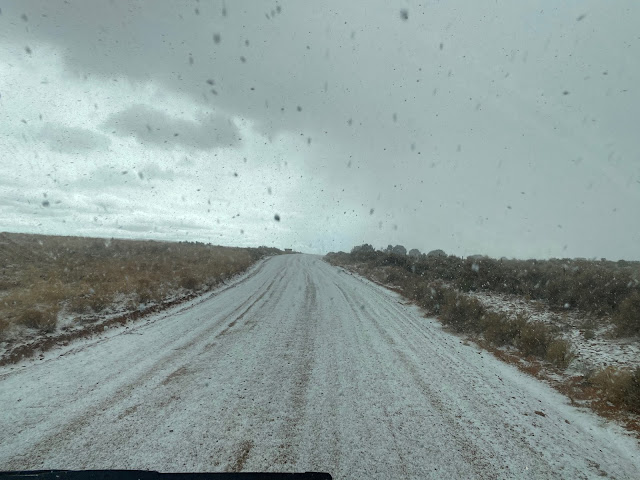
From fog to snow to rain to hail.
The dirt road became white with hail as we drove back to the main road. As Doug said, "Just another white-knuckle experience."
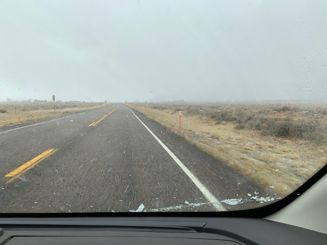
Back on the main road, the temp outside dropped to 32, and it continued to hail...
...and then the the hail changed to sleet...
...and the sleet changed to rain. Fortunately we had replaced the van's stock tires with snow tires before leaving on this trip.
It was quite a day for us Central Californians who are accustomed to 275 days a year of sun and temps that rarely go below 60.
So we plugged in the van and turned on the heater, showered night and morning, and the next morning continued to work our way west toward home.
Next up: Valley of Fire and Red Rock Canyon, Las Vegas, and Rhyolite Cemetery


Comments
Post a Comment
We love hearing from our readers! If you wish your comment not to be "Anonymous," you can sign into your Google account or simply leave your name at the end of your comment. Thanks!