Southwest 2021-13: Moab, Utah: Dead Horse Point and Grandstaff Trail
March 19-20, 2021
Doug had heard of Dead Horse Point, also near Moab, so off we went. A few miles past the entrance to Arches National Park we turned west on 313 and followed it for 22 miles to Dead Horse Point.
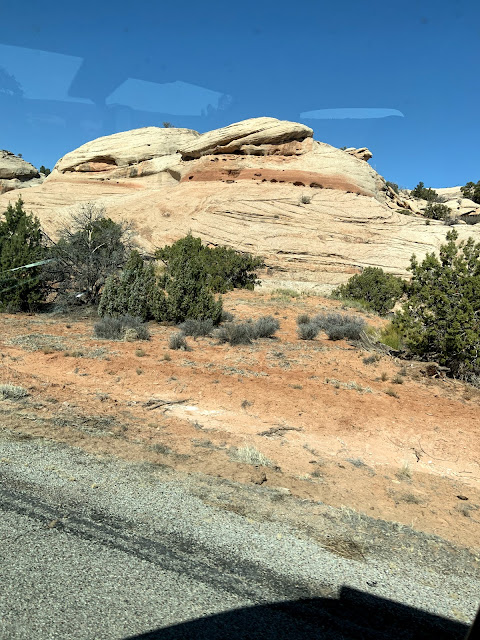
Like Arches National Park, the formations on
nearby 313 were also stunning.
Passing colorfully striped cliffs typical of the area, 313 climbs steeply and goes through several switchbacks the first fewmiles. Then it travels across the top of a mesa.
The Colorado Plateau that encompasses this area was created by centuries of accumulation of sediment—the layers of color seen in the cliffs—brought by wind and water, plus volcanic eruptions and erosion.
La Sal Mountains
At about 15 miles on 313, you can go straight, to Canyonlands National Park Island in the Sky Visitor Center, or turn left as we did, to go to Dead Horse Point.

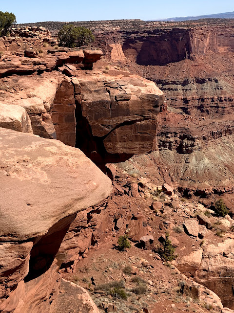
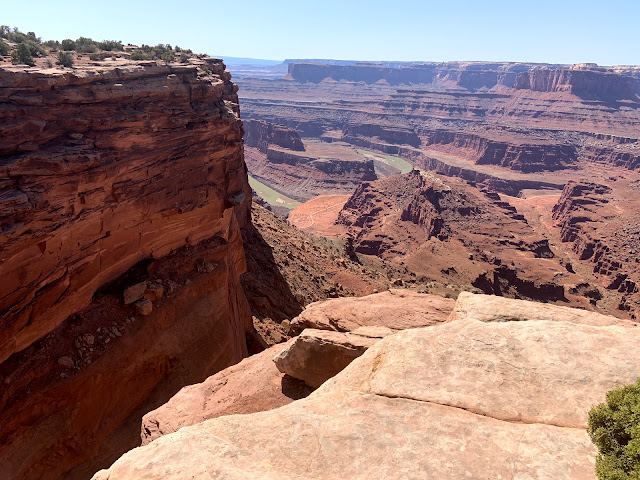
The Infamous Neck and Dead Horse Point
Bright Blue Areas Are Solar Evaporation Ponds
from the nearby Mine
Marring the view are bright blue ponds that use the sun, water, and blue dye to extract potash to convert to fertilizer.

Marilyn decided about halfway there that going on would not be wise, given the terrain we'd already traversed.
We rested while, enjoying the sounds of wind and rippling water.
We encountered a few groups who had rappelled from the cliffs and were taking the trail back to the road.
It was clear on our way back down the trail that the half marathon was over and the road had been reopened, for we ran into more and more people.
We saw a few vehicles on the 4WD drive road far below crossing Shafer Basin. Obviously Doug was ready to go.
Potash Road begins a few miles north of Moab off 191 and goes to several BLM campsites along the Colorado River. There are also petroglyphs, dinosaur tracks, rock climbing areas, and arches. At 15 miles, it becomes the 4WD road across Shafer Basin, seen in the picture above, ending at Island in the Sky in Canyonlands National Park.

Twin Buttes, driving back down the hill
to the main road to Moab.
Our last day in Moab was the day of the Canyonlands Half Marathon, which is run on the River Road where we were camped at Grandstaff Campground. That meant the road would be closed. Grandstaff Trail starts across the street from the campground, and the previous days, the two parking lots for the trailhead had been jammed. So half-marathon day was the perfect day to hike the trail!
Marilyn picks her way along Grandstaff Trail.
The 4.4-mile out-and-back trail requires lots of balance crossing multiple streams on stones and edging up and down along rocks, which might be wet, slippery, muddy, and/or sandy.
The trail passes by this cave.
At the end of Grandstaff Trail is a view of 243-foot-long Morning Glory Bridge, which looks like an arch, but is technically a bridge because it was formed by water flowing uner it. An arch is formed by weathering processes.
Resting area with shade and sounds of the stream below.
Doug taking it easy when we decided not to go further.
Amazing and colorful rock formations are everywhere,
not just in the nearby national parks.
Around 5:oo PM, our friends' daughter and 9-year-old grandson headed out to do the Grandstaff Trail. They made the 4.5-mile roundtrip hike to Morning Glory Bridge in about 90 minutes. Ah, to be younger.
The next day, we'd regrettably have to leave Moab and head south.


Comments
Post a Comment
We love hearing from our readers! If you wish your comment not to be "Anonymous," you can sign into your Google account or simply leave your name at the end of your comment. Thanks!