Canada/Alaska 2019-8: Dawson Creek, BC, to Whitehorse, YT
It was July 6, and we were on the Alaska Highway Mile 0, at Dawson Creek, British Columbia, destination Whitehorse, Yukon Territory, 1297 kilometers (806 miles).
We've begun to speak metric a bit, but not without translation.
In 2017, Doug drove from Skagway, Alaska, to Watson Lake, Yukon, after I flew home from Haines, AK, but the Dawson Creek-Watson Lake portion was new to us both.
The Mile Post is the bible of Alaska travel, noting every town, pullout, river, creek, bridge, road surface, wildlife area, etc.
It notes a detour to the Kiskatinaw Bridge on the Old Alaska Highway at mile 17, a beautiful swoop, with a slant from outside to inside, the only original timber bridge on the AlCan still in use.
But even though we're meandering, too many detours will not get us where we're going.As its license plate aptly notes, British Columbia is beautiful. We think the fields of yellow are sorghum.
As in Northern US states where winters are long and summers short, we encountered a lot of road construction on our trip.
Canada is so vast. When you are on a road, it's the only road there is. Doug contrasts it to backpacking in the Sierras when even if you are in the wilderness, there's always a road not far away.
Steep downhill on a curve--natural roller coaster!
We stopped in Fort St. John for awning parts and a new driver's side windshield wiper to replace the one we'd bought two weeks before--and spotted this couple.
Black spruce, identifiable by their "top knot."
Even though burned, you can still see the top knots. In Canada, wildfires are generally allowed to burn, which is healthy for a forest. Control is exercised only to protect towns and cultural and historic sites.
Swaths of fireweed border the road on both sides.
Doug is so supportive of my quilt habit. In Fort Nelson a Mile Post ad led us up a dirt road on First Nations land to Ye Old Quilt Shoppe. Mentioning the ad got me a 10% off the little I bought--I usually know at first glance if I like a quilt store.
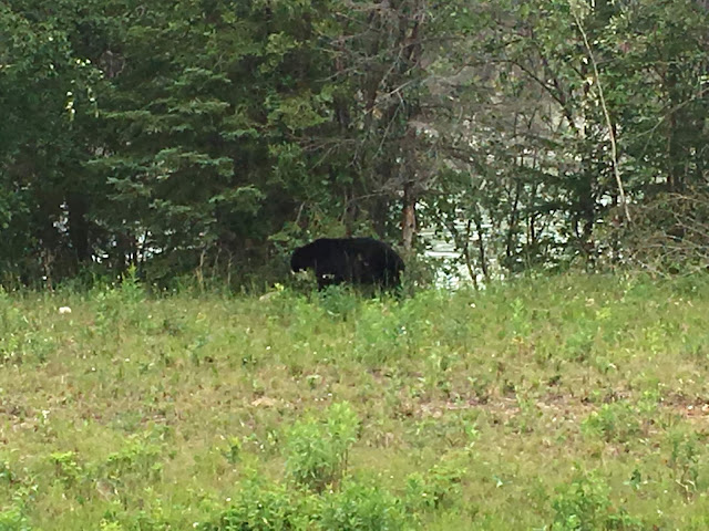
Our first bear!
And another black bear!
There are brown bears and black bears. Brown means grizzly, identified by a hump between the shoulders and in shades from blonde to very dark brown.
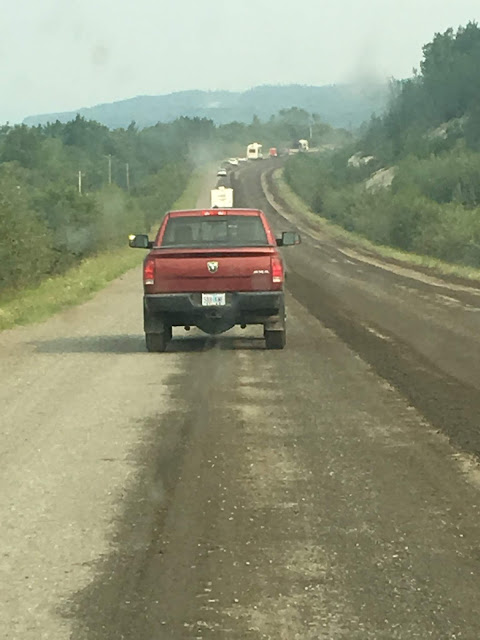
Many roads are chip seal, gravel that is "glued" to the surface with oil, followed by sweeping the gravel that didn't stick to the side. It decreases mileage and is the cause of many a cracked windshield.
With 443 kilometers (266 miles) to go to Watson Lake, and already having driven 587 (365) from Grande Prairie, AB, we began to look for a place to boondock.
We set up our chairs, propped up our feet, and toasted her son.
After a night of camping in the rain, we just dressed, lowered the top, and headed out, without making the bed or coffee.
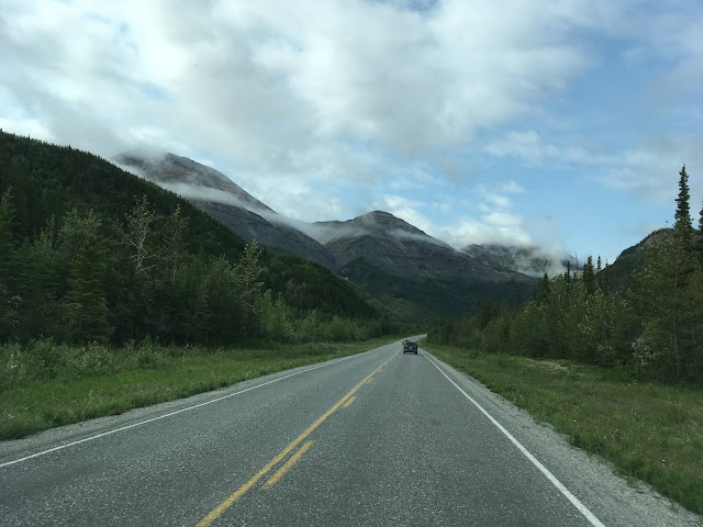
More beautiful scenery, and the rain stopped.
Another bridge with metal grating for the deck, tricky for the many motorcycles and bikes.
This one crossed the Racing River.
Mountains, lakes, and rivers define so much of the geography of northwest Canada. Many bodies of water are glacier fed, which gives them their emerald and turquoise hues.
The rock formations with their glacial scarring also cause us to just be in awe mile after mile.
And the clouds, with their changing patterns and colors that conceal and reveal the landscape!
We stopped for coffee at Tetsa River Services, another wide spot in the road with a restaurant, campground, restroom guard dog...
...and clever use for old shoes.
By the time we reached the Muncho ("big lake") Lake viewpoint, the sun was out. So we opened up the van, put the towels, quilt, and comforter on the railings to dry...
...and had a leisurely lunch looking toward Honeymoon Island. The lake is at least 400' deep, with some reports it's 730' feet at its deepest point.
We so enjoyed chatting with Marilyn, Nicky, and Twyla, Mennonite women traveling to Alaska and tent camping.
Dried out, we departed Muncho Lake to continue our drive through the Northern Rockies.
Crossing the Lower Liard ("poplar") River suspension bridge, built by American Bridge Co of Ambridge, PA, down the Ohio River from Marilyn's home town Coraopolis, and a Toronto firm.

Just after a sign to watch for wood bison, once thought to be extinct, we saw another black bear.
Unlike most look-for-wildlife-signs we've seen, the wood bison (bison bison athabasae) one did not disappoint. We came across a large herd, with many young ones.
They were not in the least fazed by our proximity, but perhaps we should have been....
Then came another bear.
And then another herd of bison, who decided as we approached it was time to cross the highway. You don't argue with very large creatures.
We first entered the Yukon Territory at Contact Creek, Km 917 (Mi 570) of the Alaska Highway (from Km/Mi 0 at Dawson Creek, BC). The AlCan crosses back and forth between BC and YT multiple times over 292 km (182 mi) before sticking to the Yukon at Km 1,210 (Mi 752).
Watson Lake is known for its Sign Post Forest. A US Army soldier from Illinois working on construction of the Alaska Highway in 1942 posted the first sign--now there are over 75,000.
There's also a grocery-gas station-restaurant-laundromat-restrooms-showers facility. For trappers, hunters, fishermen, and the southern Yukon, Watson Lake is a communication, distribution, and supply center.
Spying a VW camper--not this one, but you get the idea--we were soon chatting with owner Brian and 16-year-old Junco--"like the bird" he said--father/son, who were headed home to Sonoma, CA, after birding in Alaska and Canada. Their trip was reminiscent of Doug and Andrew's trip when Andrew was 16. Two elderly Yukon residents also stopped to chat with about their experiences and love of the Yukon.
Two hours later, we left Watson Lake to boondock. Mosquitoes deterred us from a riverbank, but we found a great spot on a gravel bar concealed from the highway.
2:45 AM: the sun was still (or again?) on the horizon.
Early the next morning, within 30 minutes of each other, we saw two porcupines crossing the road, which begs the question, "Why did the porcupine cross the road?"
Another metal grate bridge, across Nisutlin Bay into Teslin.
Road construction made the drive slower and the car dirtier, but we rarely had to wait long when stopped by the flag man--or often, woman. By 10:00 AM, the horizon was brownish due to wildfires to the north.
The road parallels the Yukon River nearing Whitehorse, the capital of the Yukon Territory.
We settled in at Robert Service City Campground on the south end of Whitehorse. In 2017, we met Denis and Cristianne from Québec here, when Doug went over to check out their Safari Condo poptop. We had a delightful evening at their site--our site this time!
Happy campground restroom!
An "old-fashioned" street in Whitehorse.
Of the 38,300 people who live in the 184,000-square-mile Yukon Territory, 28,500 reside in Whitehorse.
Typical far north scene: electric cord in car engine and outlets on street to plug in and keep engine warm.
We walked from the campground across a bridge to an island in the Yukon River then across a second bridge and up the hill to the hydroelectric dam.
The dam claims to have the longest wooden fish ladder in the world.
Colorful fish fence at dam.
First Nations fish spear made of willow, moose hide, and goat horn.
Model of First Nations fish wheel.
We saw fishwheels in 2017 on the Copper River in Alaska. Fish swim into the baskets then fall into the wooden box as the currents turn the wheel.
The public painted the salmon to commemorate the 50th anniversary of the Whitehorse Rapids Fishway.
This giant desk on a Whitehorse street corner commemorates the "Bard of the North," Robert Service, who arrived in the Yukon in 1904.
Some of Robert Service's famous characters.
We stayed a third day in Whitehorse, ever hopeful the fires could be controlled and the smoke would dissipate so we could still travel to Dawson City and across the Top of the World Highway, tracing our 2017 route in reverse. But sadly it was not to be.
So on July 11, we headed south to Carcross, YT.


Comments
Post a Comment
We love hearing from our readers! If you wish your comment not to be "Anonymous," you can sign into your Google account or simply leave your name at the end of your comment. Thanks!