Alaska/Canada 2017-13: 3 Glaciers & an Earthquake - Mat-Su Valley & Valdez
After 10 days on the Kenai Peninsula, we played tourist and regrouped at JBER (Joint Base Elmendorf Richardson) in Anchorage—laudry, showers, groceries.
On July 27, just over a month since we’d boarded the ferry in Bellingham, we left Anchorage for the third and last time and turned northeast on Alaska 1, here, the Glenn Hwy, destination Valdez. We had planned to make the 300-mile trip in 2 days, but ended up doing it in 1.
Alaska 1 runs through the southern end of the MatSu (Matanuska-Susitna) Valley, Alaska's farming capital, with the Alaska Range to the north and the Chugach Mountains to the south.
About 50 miles from Anchorage, the highway goes through Palmer, where my brother-in-law David grew up. With a population of 7,000, it's Alaska's 10th largest city. The population of the whole state is less than 750,000. You have to go to #18 Seattle on the list of the largest cities in the US before you reach one that has fewer people than the entire state of Alaska.
The Glenn Highway follows the Matanuska River until about 100 miles from Anchorage, when the river turns southeast toward its headwaters. The terrain was unlike any we’d yet seen in Alaska and equally stunning. The smooth highway climbed and descended through forests and past the Matanuska Glacier.
Interestingly—and somewhat annoyingly—the entry to walk to Matanuska Glacier is on private land. We opted not to pay the fee.
A little beyond Eureka Summit, 3,322 feet, at milepost 153, we stopped and had a lovely picnic at a wayside. The air was warm, the breeze gentle, as we munched and stretched.
We’d thought to stop for the night in the vicinity of Glennallen, but there being little there, we turned south on Alaska 4, the Richardson Hwy, toward Valdez.
At Copper Center, we stopped at Wrangell-St. Elias National Park headquarters. It’s the largest national park in the US—6 times the size of Yellowstone. In fact, the 4 largest national parks are in Alaska: Wrangell-St. Elias, Gates of the Artic, Denali, and Katmai.
The vast majority of Wrangell-St. Elias is back country. There are 2 roads into the park, both largely unpaved. Nabesna Rdd from the north is 42 miles long. McCarthy Road off Richardson Hwy is the west entrance to Wrangell-St Elias. We debated whether we to drive the 60-mile-long dirt McCarthy Rdd to Kennecott Copper Mine. When we learned at the ranger station that the road actually begins at Chitina, 33 miles of paved road into the park, we decided to postpone our visit to a future Alaska trip.
I was curious why the leaves of the aspen trees in the area were gray. I learned from a ranger that due to recent warmer than usual winters: 1) the worm that attacks aspen leaves each year is not dying off as usual and is putting the trees at risk; 2) the permafrost is melting, causing roads throughout the state not just to undulate but to heave and split; and 3) polar bears are searching for food further south and are at times mating with grizzlies. The once-rare occurrence is now creating a new species, known variously as a pizzly or a grolar.
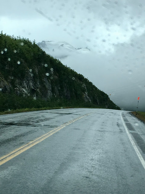
The day that began warm and balmy turned rainy and foggy as we continued south to Valdez.
What with the rain and fog, we caught only glimpses of the beauty of the surrounding mountains en route to Valdez.
Add to the rain and fog the oil trucks barreling between Valdez and Deadhorse and frequent stops for road construction and it was rather a white knuckle drive for a bit—not only for our stoic driver, but also for his somewhat skittish passenger!
We stayed 3 days in Valdez, with our home base at Bayside RV Park, which much to our delight allowed no generators at any time, day or night.
It seemed each place we traveled through in Alaska was more stunningly beautiful than the last. The mountains surrounding Valdez appeared and disappeared in the lowering and lifting fog, presenting a constant series of awesome views.
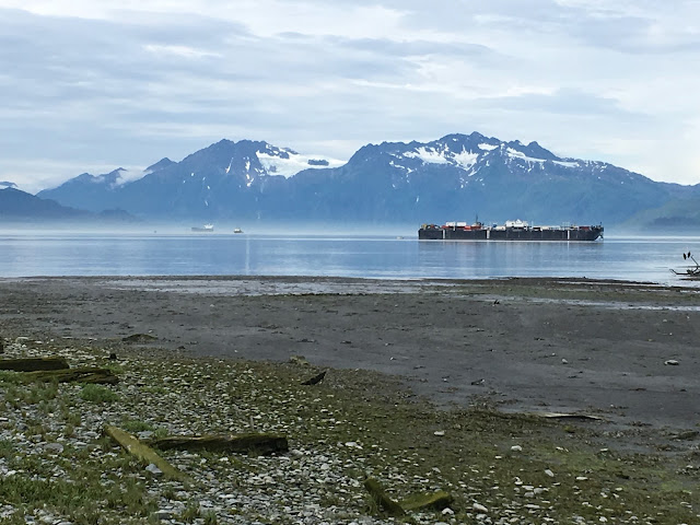
Valdez sits on a deep fjord of Prince William Sound and is a major port. After settling the van on a site, we went out to explore the town. It's a small town, easily walked from one end to the other.
We drove around Port Valdez to the other side to Solomon Gulch Hatchery.
At the hatchery parking lot, 2 rangers were on hand to protect grizzlies, who are regular visitors, from the people who gather to watch the seals and grizzlies fishing. With thousands of salmon returning to the hatchery to spawn, it's easy fishing.
We watched as salmon climbed the fish ladders at Solomon Gulch Fish Hatchery
Not all the salmon returning to spawn at the hatchery can be accommodated. The sight of hundreds of fish perishing in the water seemed appalling. We wondered if they could be harvested to donate.
At the end of Dayville Rd, offlimits to visitors, is the oil refinery, the final destination of all the oil that flows from Prudhoe Bay through the Alaska Pipeline.
Back at the Valdez docks, we bought pink salmon, which Chef Doug cooked outside on the camp stove. Our neighbor, also traveling in a Traverse, though hers was newer, joined us for a delicious feast.
We also became friends in the campground with a German couple, Bernie and Marion, whom we were to run into again later in our travels. They'd had their rig shipped to Nova Scotia. When I commented it had been a long drive to Alaska, Bernie quipped, "We only had to travel through two countries."
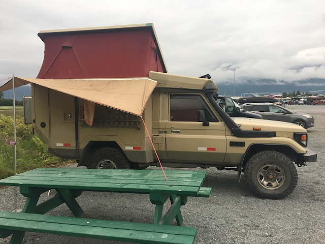
We saw many similar vehicles, as well as others of similar design but much larger, mostly from Europe. We could never quite fathom the desire or need for such a huge vehicle.

We didn't fully appreciate the beauty of this region until we drove out, the drive in having been shrouded in near white-out conditions of rain and fog.
In the early 20th century, when copper was discovered in the Wrangell Mountains, a battle ensued over who would finish the railroad first from the mines to the coast. One route was to be through what W R Abercrombie dubbed Keystone Canyon after his home state of Pennsylvania, the Keystone State.(Marilyn recogized the name right off, being from Pennsylvania herself.) The tunnel being cut through solid rock was never finished. Cordova, not Valdez, became the eventual port for shipping copper from Kennicott Copper Mines to Tacoma for smelting.
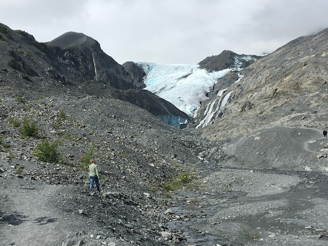
Further up the road we saw a sign and parking lot for Worthington Glacier. The pictures can only begin to convey the feeling of standing in front of the huge blue leading edge of the glacier and watching and listening to its melting water pouring over huge rocks.
A while later, back on the road, Doug told me to turn around and look behind us. What we had not seen driving to Valdez, due to the rain and fog, was the immense Worthington Glacier spreading across the mountains and visible for miles.
JBER, Anchorage, 10:45 PM.
We played tourist...
On July 27, just over a month since we’d boarded the ferry in Bellingham, we left Anchorage for the third and last time and turned northeast on Alaska 1, here, the Glenn Hwy, destination Valdez. We had planned to make the 300-mile trip in 2 days, but ended up doing it in 1.
Alaska 1 runs through the southern end of the MatSu (Matanuska-Susitna) Valley, Alaska's farming capital, with the Alaska Range to the north and the Chugach Mountains to the south.
Alaska Highway 1, here, the Glenn Hwy winds its way through the MatSu Valley.
About 50 miles from Anchorage, the highway goes through Palmer, where my brother-in-law David grew up. With a population of 7,000, it's Alaska's 10th largest city. The population of the whole state is less than 750,000. You have to go to #18 Seattle on the list of the largest cities in the US before you reach one that has fewer people than the entire state of Alaska.
Seward to Valdez to Little Tok River
Alaska's larger cities, such as Fairbanks and Anchorage, have all the amenities and curses of home. The medium, like Wasilla or Palmer, have available most of what a traveller may need. The smallest may have a convenience store and a single gas pump.
The Alaska State Fair takes place in Palmer. The growing season is short, but the summer days are long. Cool weather crops thrive here. One year, the winning cabbage at the fair weighed 79 pounds!
The Alaska State Fair takes place in Palmer. The growing season is short, but the summer days are long. Cool weather crops thrive here. One year, the winning cabbage at the fair weighed 79 pounds!
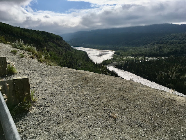
Looking down at the Matanuska River from the highway.
The Glenn Highway follows the Matanuska River until about 100 miles from Anchorage, when the river turns southeast toward its headwaters. The terrain was unlike any we’d yet seen in Alaska and equally stunning. The smooth highway climbed and descended through forests and past the Matanuska Glacier.
The forested Matanuska River Valley.
Matanuska Glacier seen from Glenn Highway.
Interestingly—and somewhat annoyingly—the entry to walk to Matanuska Glacier is on private land. We opted not to pay the fee.
We were fascinated by the pointed hills on the edge of Matanuska Glacier.
Driving the Glenn Hwy.
Interesting cloud...
A little beyond Eureka Summit, 3,322 feet, at milepost 153, we stopped and had a lovely picnic at a wayside. The air was warm, the breeze gentle, as we munched and stretched.
Braided Matanuska River. Looking back at Matanuska Glacier.
We’d thought to stop for the night in the vicinity of Glennallen, but there being little there, we turned south on Alaska 4, the Richardson Hwy, toward Valdez.
At Copper Center, we stopped at Wrangell-St. Elias National Park headquarters. It’s the largest national park in the US—6 times the size of Yellowstone. In fact, the 4 largest national parks are in Alaska: Wrangell-St. Elias, Gates of the Artic, Denali, and Katmai.
Fishwheels are placed near the bank of rivers. Fish swim into the basket as the wheel goes round.
The vast majority of Wrangell-St. Elias is back country. There are 2 roads into the park, both largely unpaved. Nabesna Rdd from the north is 42 miles long. McCarthy Road off Richardson Hwy is the west entrance to Wrangell-St Elias. We debated whether we to drive the 60-mile-long dirt McCarthy Rdd to Kennecott Copper Mine. When we learned at the ranger station that the road actually begins at Chitina, 33 miles of paved road into the park, we decided to postpone our visit to a future Alaska trip.
Food cache.
I was curious why the leaves of the aspen trees in the area were gray. I learned from a ranger that due to recent warmer than usual winters: 1) the worm that attacks aspen leaves each year is not dying off as usual and is putting the trees at risk; 2) the permafrost is melting, causing roads throughout the state not just to undulate but to heave and split; and 3) polar bears are searching for food further south and are at times mating with grizzlies. The once-rare occurrence is now creating a new species, known variously as a pizzly or a grolar.
Worm tracks in Aspen leaves are beautiful but deadly.
Alaska Pipeline along Richardson Hwy en route to its terminus in Valdez.
The day that began warm and balmy turned rainy and foggy as we continued south to Valdez.
Clouds, rains, & fog replaced the morning's sun.
Add to the rain and fog the oil trucks barreling between Valdez and Deadhorse and frequent stops for road construction and it was rather a white knuckle drive for a bit—not only for our stoic driver, but also for his somewhat skittish passenger!
Near white-out conditions on the passes driving to Valdez.
We stayed 3 days in Valdez, with our home base at Bayside RV Park, which much to our delight allowed no generators at any time, day or night.
View out the back of the van across a meadow & the waters of Port Valdez.
It seemed each place we traveled through in Alaska was more stunningly beautiful than the last. The mountains surrounding Valdez appeared and disappeared in the lowering and lifting fog, presenting a constant series of awesome views.
View from the front of the van.
Valdez sits on a deep fjord of Prince William Sound and is a major port. After settling the van on a site, we went out to explore the town. It's a small town, easily walked from one end to the other.
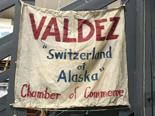
The drive through the mountains to Valdez had reminded me of a long ago drive through the Swiss Alps. The road was curvy and steep. When the fog lifted a bit, the views of waterfalls, glaciers, and canyons were amazing. My impression was borne out by this banner in the Old Valdez Museum:
We are not fishermen, but people travel from all over the US to fish for halibut and salmon in Alaska in the summer.
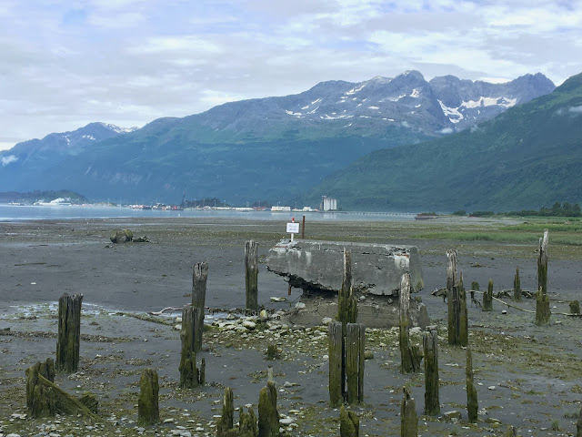
The original town of Valdez is 4 miles away from today's Valdez. It was destroyed by the 1964 Good Friday earthquake and tsunami.
The had been built on glacial silt. When the earthquake hit, the soil slid into the sea and caused a 30-foot-high tsunami. The 32 people who had gone to the dock to greet the supply ship all perished.
There's a self-guided walking tour down the old streets, past locations of various buildings with photos and history of the area.
After careful studies of the soils, a new town was built 4 miles away. Many buildings were new, but some that had survived the disaster were moved to the new town.
We also visited Glacier Lake, which is fed by Valdez Glacier.
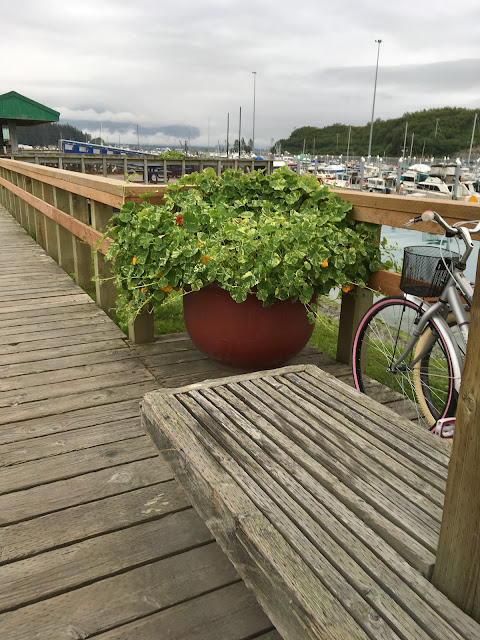
Valdez harbor.
We are not fishermen, but people travel from all over the US to fish for halibut and salmon in Alaska in the summer.
Well, maybe Doug didn't catch this one, but we sure ate some delicious halibut!
The original town of Valdez is 4 miles away from today's Valdez. It was destroyed by the 1964 Good Friday earthquake and tsunami.
Meadow in what used to be Old Town Valdez.
The had been built on glacial silt. When the earthquake hit, the soil slid into the sea and caused a 30-foot-high tsunami. The 32 people who had gone to the dock to greet the supply ship all perished.
Remains of Old Town Valdez docks.
Glaciated mountains across from Old Town Valdez.
Doug & remains of dock pilings.
Site of Old Town Valdez.
Old Town Valdez—fireweed.
Looking at the new town of Valdez, built in 1966-'68.
After careful studies of the soils, a new town was built 4 miles away. Many buildings were new, but some that had survived the disaster were moved to the new town.
We also visited Glacier Lake, which is fed by Valdez Glacier.
Marilyn at Glacier Lake.
Little icebergs float in the lake.
Note kayakers on left & further back between the icebergs on left. The river runs through a canyon between the cliffs.
The river continues from the lake down the hill to Port Valdez.
The incredible views were constantly changing with the clouds & light.
Marilyn holding glacial ice.
We drove around Port Valdez to the other side to Solomon Gulch Hatchery.
Moose in the meadow along Richardson Hwy. We also saw a grizzly munching on berries.
At the hatchery parking lot, 2 rangers were on hand to protect grizzlies, who are regular visitors, from the people who gather to watch the seals and grizzlies fishing. With thousands of salmon returning to the hatchery to spawn, it's easy fishing.
Freshwater stream coming down from Solomon Lake into Port Valdez saltwater.
Seals salmon fishing. Seagulls wait for the spoils.
We watched as salmon climbed the fish ladders at Solomon Gulch Fish Hatchery
Salmon in fish ladder.
Not all the salmon returning to spawn at the hatchery can be accommodated. The sight of hundreds of fish perishing in the water seemed appalling. We wondered if they could be harvested to donate.
At the end of Dayville Rd, offlimits to visitors, is the oil refinery, the final destination of all the oil that flows from Prudhoe Bay through the Alaska Pipeline.
Looking toward the Valdez oil refinery.
Back at the Valdez docks, we bought pink salmon, which Chef Doug cooked outside on the camp stove. Our neighbor, also traveling in a Traverse, though hers was newer, joined us for a delicious feast.
A fellow traveler's newer gray Traverse & our blue one.
We also became friends in the campground with a German couple, Bernie and Marion, whom we were to run into again later in our travels. They'd had their rig shipped to Nova Scotia. When I commented it had been a long drive to Alaska, Bernie quipped, "We only had to travel through two countries."
Bernie & Marion's rig they'd had shipped from Germany to Nova Scotia.
We saw many similar vehicles, as well as others of similar design but much larger, mostly from Europe. We could never quite fathom the desire or need for such a huge vehicle.

We didn't fully appreciate the beauty of this region until we drove out, the drive in having been shrouded in near white-out conditions of rain and fog.
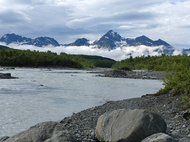
Lowe River along Richardson Hwy outside Valdez.
Horsetail Falls.
Bridal Veil Falls.
In the early 20th century, when copper was discovered in the Wrangell Mountains, a battle ensued over who would finish the railroad first from the mines to the coast. One route was to be through what W R Abercrombie dubbed Keystone Canyon after his home state of Pennsylvania, the Keystone State.(Marilyn recogized the name right off, being from Pennsylvania herself.) The tunnel being cut through solid rock was never finished. Cordova, not Valdez, became the eventual port for shipping copper from Kennicott Copper Mines to Tacoma for smelting.
Unfinished tunnel for never completed railroad from Kennicott to Valdez.
Further up the road we saw a sign and parking lot for Worthington Glacier. The pictures can only begin to convey the feeling of standing in front of the huge blue leading edge of the glacier and watching and listening to its melting water pouring over huge rocks.
There's a glacier up there!
Marilyn on the short trail to the glacier.
Doug almost to the toe.
Worthington Glacier--just another day in Alaska with all the senses constantly stimulated.
Worthington Glacier from the road.
Next up: Would we or wouldn't we drive the McCarthy Road?














.heic)






Comments
Post a Comment
We love hearing from our readers! If you wish your comment not to be "Anonymous," you can sign into your Google account or simply leave your name at the end of your comment. Thanks!