Alaska/Canada 2017-18: Skagway & Dyea
On my last day in Alaska, Doug and I took the 30-minute fast ferry from Haines to Skagway.
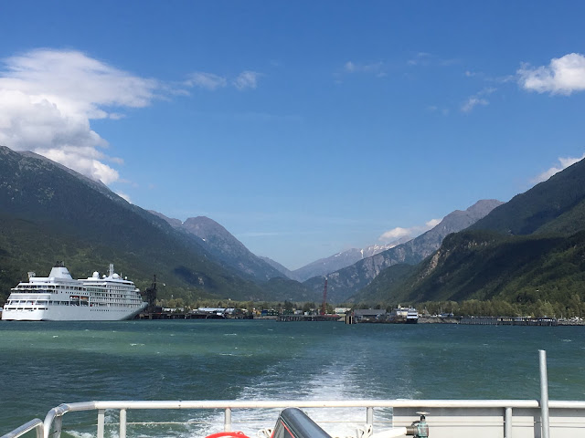
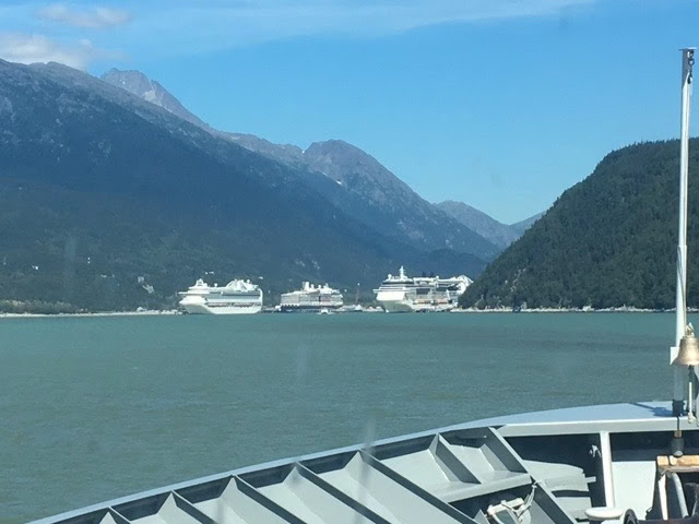
Rounding a bend, Skagway's port came into view, with 2 large and 1 medium cruise ships docked, meaning over 10,000 people were milling about the small town: 4,000 per large ship and 2,000 for the smaller one.
Dyea sits on the other side of the Taiya River from Skagway, 10 miles by the mostly dirt road connecting the two towns. The link has a history of Dyea before and after the Klondike Gold rush and great pictures from that time.
Whether arriving in Skagway to take the White Pass Trail or in Dyea to take the Chilkoot Trail, each Klondiker was required by the Canadian government to carry provisions weighing up to 2,000 pounds. On the Chilkoot Trail, up to 30 trips were required to get all the provisions to the top. On the White Pass Trail, horses were used to haul supplies. Unfortunately for the early Klondikers, the railroad and sternwheelers came along after their time.
Beginning in 1897, Dyea's population grew to as many as 8,000. By 1900 the population was 250.
The 33-mile Chilkoot Trail is maintained for recreational use, though check the conditions before you go. We did not hike it—even if it had crossed our minds, it would require appropriate backpacking equipment.
Thought to be a better route than the Chilkoot Trail as it was at a lower elevation, the White Pass Trail instead was turned into a mud pit by rains. Jack London called it the "Dead Horse Trail." The link provides a history and historic photos of the trail.
After 6 weeks and 4,000 miles, my back was telling me it was time to get off the road for a while. (My neck fusion in 2013 decreased the flexibility of my spine.) Much as I would have liked to continue the road trip all the way home, it seemed wiser to fly home.
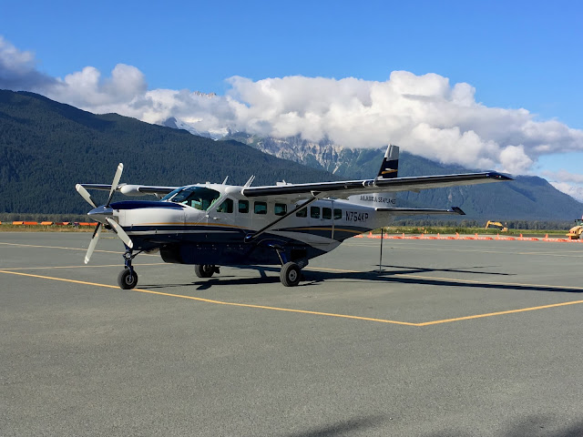
My departure from Alaska was a memorable coda to our trip. I was disappointed, however, to learn that my flight with Alaska Seaplanes would not be on a seaplane.
But I did get to be the co-pilot! When the pilot asked for someone to sit in the co-pilot's seat, I immediately volunteered. David, an Australian, graciously ceded the position to me, saying since they'd flown in a small plane across Australia, I should have the experience. They kindly sent me their photos as in my excitement I neglected to get my phone out before I stored my purse. Instructed not to touch anything, I clenched my hands together the whole flight to ensure that in my excitement I wouldn't.
From Juneau I flew to Seattle then on to Fresno.
After I was in the air, Doug washed Old Blue to get some of the grime off—soon to be replaced by new dirt—then they boarded the fast ferry for Skagway.
This 50-foot rig was told to back down the ferry ramp, then once on the boat do a hard 90-degree turn.
Doug drove the 10 miles to Dyea to take a look at the area and camped there that night. The next day he began to work his way north to the Yukon to pick up the road that would take him east and south through British Columbia and back to the lower 48. As it turned out, he would go further east into Alberta due to the unusual number of wildfires in the Western US and Canada.
Next: Doug's journey home.
As usual, I stayed outside coming & going, chatting with a French backpacker on the return. I love ferries, the wind in my hair and stinging my eyes and nose, the scenery scrolling by, the bow cutting the water & the wake behind.
View from the fast ferry.
Rounding a bend, Skagway's port came into view, with 2 large and 1 medium cruise ships docked, meaning over 10,000 people were milling about the small town: 4,000 per large ship and 2,000 for the smaller one.
Cruise ships brought up to 10,000 people to Skagway that day.
The people that pour off the ships seem mostly to go to the shops, especially jewelry stores, and saloons, all mostly owned by the cruise lines. We talked with employees who said they are in Skagway for the summer then somewhere such as the Caribean during the winter. And I confess, Doug bought me a jacket and I made some purchases in a quilt shop.
We did the self-guided walking tour, which includes Skagway's historic district. Walking through a small park we marveled at the salmon swimming up a very small, shallow stream to spawn.
Skagway sits at the north end of Taiya Inlet on Lynn Canal. The name in Tlingit is said to mean "stiffly wind-rippled water." Dyea, the other port Klondikers arrived at en route to the Yukon, is on the other side of the Taiya River.
We did the self-guided walking tour, which includes Skagway's historic district. Walking through a small park we marveled at the salmon swimming up a very small, shallow stream to spawn.
White Pass & Yukon Route offeres roundtrip excursions to White Pass Summit.
Skagway sits at the north end of Taiya Inlet on Lynn Canal. The name in Tlingit is said to mean "stiffly wind-rippled water." Dyea, the other port Klondikers arrived at en route to the Yukon, is on the other side of the Taiya River.
State St, Skagway.
Side street in Skagway.
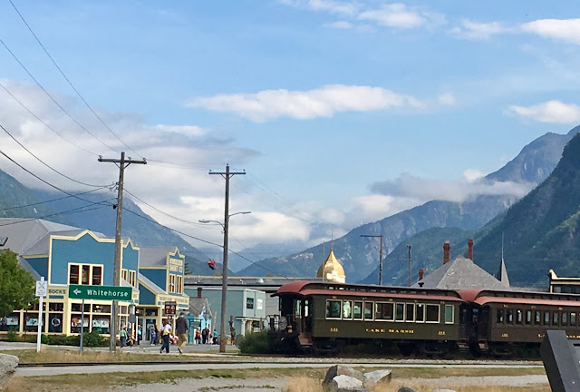
Rotary snow plow on front of White Pass & Yukon Route train.
A taste of Skagway during the Klondike Gold Rush.
Skagway lodgings.
At the summit. Cruise passengers getting ready to ride down to Skagway. It's rather steep in places.
Wood sidewalks and the White Pass and Yukon Railroad brought to mind Skagway's role in the Klondike Gold Rush. When they arrived in Skagway by ship from Seattle and other ports, prospectors took the White Pass Trail. If they arrived in Dyea, they had to slog across a couple of miles of mud flats to the town and then on to Chilkoot Trailhead. Both ended at Bennett Lake, where the gold seekers built boats and rafts of anything available to navigate the Yukon River 560 miles to Dawson City.
Chilkoot Trail from Dyea & White Pass Trail from Skagway to Bennett Lake.
6) Skagway. 7) White Pass. 8) Dyea. 9) Chilkoot Pass Trailhead. 10) Chilkoot Pass. 11) Lindeman. 12) Lindeman Lake. 13) Bennett. 14) Bennett Lake. 15) Caribou Crossing (Carcross). 16) Lutak. 17) to Haines. 18) Taiya Inlet.
Dyea sits on the other side of the Taiya River from Skagway, 10 miles by the mostly dirt road connecting the two towns. The link has a history of Dyea before and after the Klondike Gold rush and great pictures from that time.
2-lane dirt Dyea Rd along Taiya River.
Whether arriving in Skagway to take the White Pass Trail or in Dyea to take the Chilkoot Trail, each Klondiker was required by the Canadian government to carry provisions weighing up to 2,000 pounds. On the Chilkoot Trail, up to 30 trips were required to get all the provisions to the top. On the White Pass Trail, horses were used to haul supplies. Unfortunately for the early Klondikers, the railroad and sternwheelers came along after their time.
It was 2 miles over mudflats from the water to the Dyea townsite.
Dyea today. Within a decade of the gold rush, the town's population was 3. Now it is just a few posts.
Dyea then and now.
The 33-mile Chilkoot Trail is maintained for recreational use, though check the conditions before you go. We did not hike it—even if it had crossed our minds, it would require appropriate backpacking equipment.
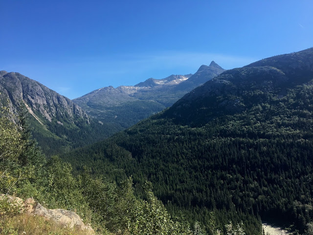
On the road, beautiful now but back then the Chilkoot Pass was a killer to the Argonauts.
Thought to be a better route than the Chilkoot Trail as it was at a lower elevation, the White Pass Trail instead was turned into a mud pit by rains. Jack London called it the "Dead Horse Trail." The link provides a history and historic photos of the trail.
Terrain of the White Pass Trail.
After 6 weeks and 4,000 miles, my back was telling me it was time to get off the road for a while. (My neck fusion in 2013 decreased the flexibility of my spine.) Much as I would have liked to continue the road trip all the way home, it seemed wiser to fly home.
Coffee in Haines on our way to the airport.
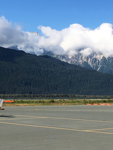
Haines airport.
My departure from Alaska was a memorable coda to our trip. I was disappointed, however, to learn that my flight with Alaska Seaplanes would not be on a seaplane.
The 30-minute hop from Haines to Juneau was in a 12-passenger single engine planes.
But I did get to be the co-pilot! When the pilot asked for someone to sit in the co-pilot's seat, I immediately volunteered. David, an Australian, graciously ceded the position to me, saying since they'd flown in a small plane across Australia, I should have the experience. They kindly sent me their photos as in my excitement I neglected to get my phone out before I stored my purse. Instructed not to touch anything, I clenched my hands together the whole flight to ensure that in my excitement I wouldn't.
Marilyn in the copilot seat. The pilot looked 15. We were relived upon landing in Juneau to hear his colleagues tease him about it being his 29th birthday.
It was a perfect day, warm and clear, as we lifted into the blue & flew over Lynn Canal. It felt like we could almost reach out & touch the glaciers.
Glacier coming down the mountain to the lake.
Approaching Juneau, we flew through valleys with forested hillsides.
I gawked the entire flight, craning my neck to take in everything.
Approaching Juneau.
Juneau from the airport.
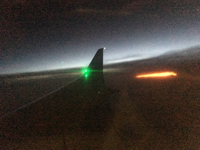
By the time we were flying over Oregon it was night. I wasn't in Alaska anymore.
After I was in the air, Doug washed Old Blue to get some of the grime off—soon to be replaced by new dirt—then they boarded the fast ferry for Skagway.
Pedestrian & vehicle fast ferry that runs between Haines and Skagway.
This 50-foot rig was told to back down the ferry ramp, then once on the boat do a hard 90-degree turn.
Backing onto the ferry with the help of the crew.
After a few consultations with the ferry crew, including one time a worker reached in to the truck to change a move, the rig made it.
Next in line, a 40-foot RV
Arriving in Skagway. Picture shows 3 mega cruise ships. A 4th is around the bend. Was told over 4,000 on each. Downtown Skagway was awash with people.
Next: Doug's journey home.
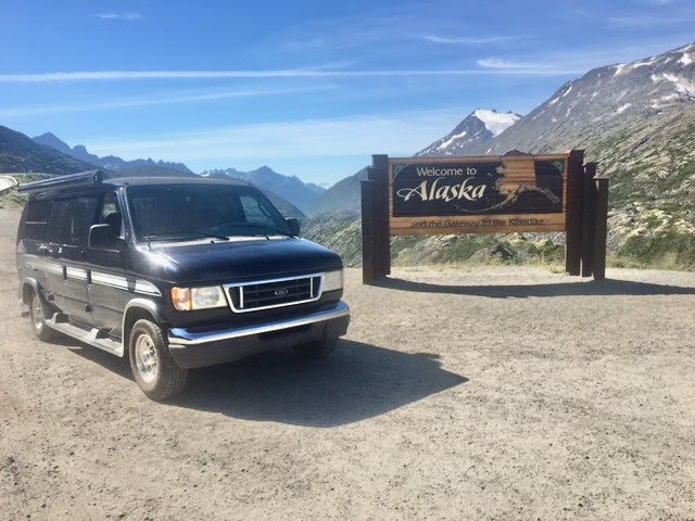
Our Ford Traverse poptop. Doug would be back in Alaska in about a week.




.heic)








Comments
Post a Comment
We love hearing from our readers! If you wish your comment not to be "Anonymous," you can sign into your Google account or simply leave your name at the end of your comment. Thanks!