Southwest Spring 2016-4: Shiprock, New Mexico, to the Snow
After we left Chaco Canyon, site of the wonderful (and free!) barbecue (see my 4/23/16 blog), we headed toward Farmington, New Mexico, with the goal of getting as close to Ship Rock as possible, and I think we succeeded.
We didn't make it to Ouray as planned due to snow.
Climbing this over-4-mile-long wall of exposed lava from an era millions of years ago, I was amazed by the enormity of it all.
Perhaps I have read too many Tony Hillerman books, but there is just something about Ship Rock and the dike that will draw me back to sit on top of the wall and reflect on it all.
Marilyn checked in with family and friends on her phone while I wandered and pondered, until it was time to head west and see where the road would take us. We had not made any camping plans as it was to be a totally spontaneous day. We found ourselves climbing up an amazing road with every turn showing a smaller Ship Rock in our rear view mirrors.
Resuming our journey, we decided to head east toward Mesa Verde. Remember, our goal on this trip was to meander, and going west to find ourselves later going east was good. We arrived too late to get any maps, but thanks to a family we met while admiring Shiprock, we drove to the just-opened second campground loop and had a campsite with no neighbors. After dinner we popped the top, set up the bedding, and were cozy under our down comforter, as the temps dropped to near freezing. The next morning after coffee and oatmeal, we drove up to Mesa Verde.
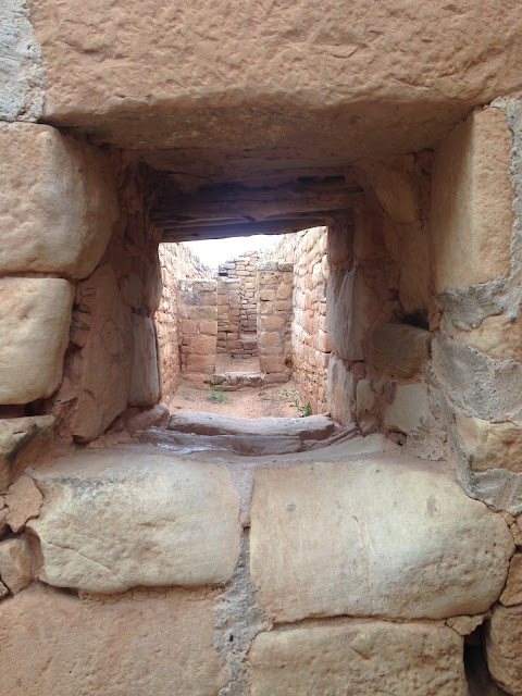
It's impossible to fathom how the Anasazi conceived and accomplished the building of towns in the cliffs. I shall let the pictures speak for the amazing sites we encountered. There is a myriad of books and websites on the Anasazi, such as Crystalinks and Desert USA.
Pitrooms were used both for ceremonies and as living quarters. The pitrooms represented a transition from pithouse to kiva, the latter being mainly for ceremonies.
We noted the alignment of windows and doorways in the Sun Temple, a feature also of Incan architecture we'd seen in Peru. In Incan structures, the alignment was for communication and protection.
As they say, things work out for the best. We had to pass on the one Mesa Verde tour that was open as it required climbing ladders and crawling through small spaces. Since Marilyn’s back prevents her from doing either of these, fortunately we moved on. I say fortunately because thirty minutes after the tour commenced, snow began falling, and there we were, nestled inside the van heading down the hill, not climbing ladders amid snow flurries.
Since the campground had no showers, we decided to splurge. Marilyn came up with a great motel on the outskirts of Cortez, Colorado, the White Eagle Inn. The innkeeper greeted us with a smile, the room was lovely, the shower was amazing, and soon we were clean and headed to dinner, well actually to do our laundry and to Subway, which was next door. I sneaked out, got the van’s oil changed, checked with the Colorado Tourist Office for our next destination, and we returned to the motel.
We had to eat here, in honor of my mother and her brother
We turned back south in the van now covered with over an inch of snow and building. The dirt was white, the trees were white, and the road was becoming whiter.
Back in Cortez in our warm motel room, we didn't realize that snow would play yet another part in our journey.
Next post: A drive up the Moki Dugway, a long drive to Capitol Reef National Park, and SNOW.
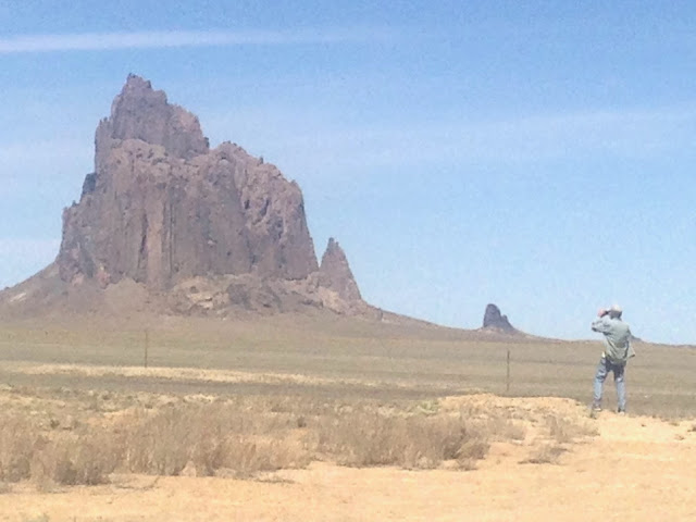
Doug looking at Ship Rock.
We didn't make it to Ouray as planned due to snow.
Ship Rock is a 1,500-foot-tall volcanic plug, the remains of a volcano that geologists believe erupted over 30 million years ago. It was rather formidable to see as we drove along its southern side. As we got closer, I was overwhelmed by the large dike that heads south from it.
Ship Rock & lava wall
Climbing this over-4-mile-long wall of exposed lava from an era millions of years ago, I was amazed by the enormity of it all.
Doug climbing dike that extends 4 miles from Ship Rock
Perhaps I have read too many Tony Hillerman books, but there is just something about Ship Rock and the dike that will draw me back to sit on top of the wall and reflect on it all.
Note size of our van on left looking down from Shiprock lava wall.
Lava wall & Shiprock.
Soon we topped 9,000 feet then headed down and took a turn to the north toward Four Corners.
In the past when I stopped at Four Corners, I put my feet in all four states by standing on a small brass marker enclosed in cement, took a picture of the feat, and drove off. But this time we found organization: the Navajo people realized that we tourists would pay to have a picture, and in our case they were right: $10 each for the joy of the picture.
Doug at Four Corners
Marilyn standing in Utah, Colorado, New Mexico, & Arizona
Spruce Tree House storage houses in the cliffs.
Spruce Tree House.
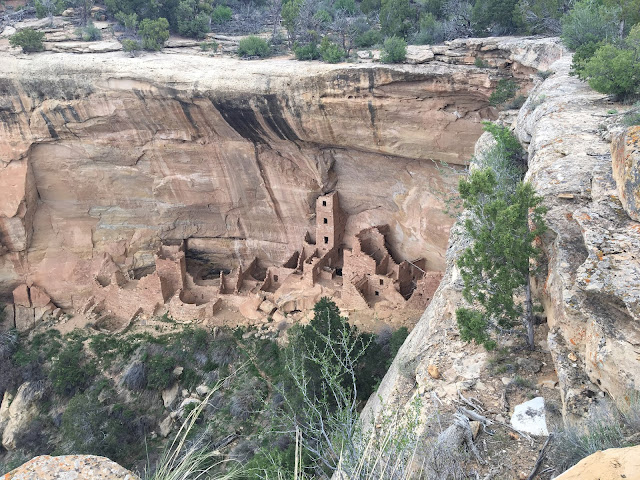
Square Tower House.
SquareTower House.
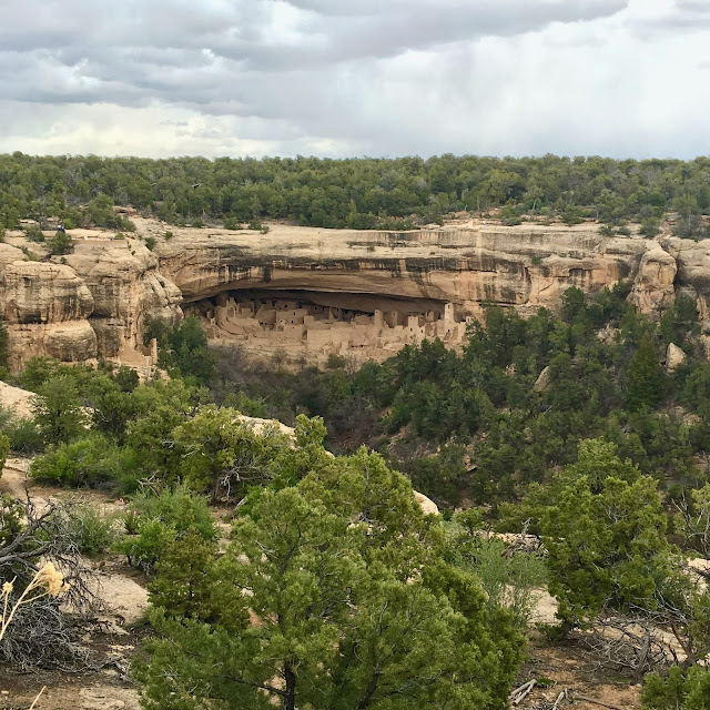
Cliff Palace House
Cliff Palace House
Pitroom.
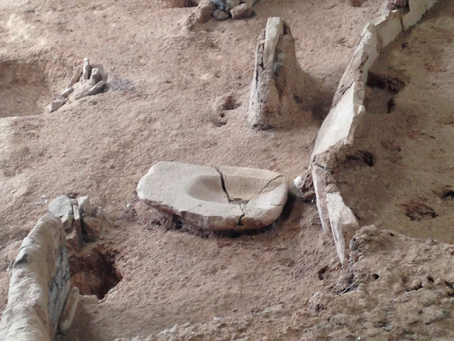
Metate for grinding.
Sun Temple.
Snow flurries as we left Mesa Verde.
Since the campground had no showers, we decided to splurge. Marilyn came up with a great motel on the outskirts of Cortez, Colorado, the White Eagle Inn. The innkeeper greeted us with a smile, the room was lovely, the shower was amazing, and soon we were clean and headed to dinner, well actually to do our laundry and to Subway, which was next door. I sneaked out, got the van’s oil changed, checked with the Colorado Tourist Office for our next destination, and we returned to the motel.
The next morning we made the decision to head further east toward Durango and hopefully up to Ouray, so told the innkeeper we would like to spend another night. But first, breakfast. My mother was named Janelle, her brother Jack, and when we saw Jack and Janelle's Country Kitchen in Cortez, I had no option but to breakfast there. Once inside, we met Jack—Janelle was in San Diego with an ill brother—had a great breakfast, and promised to return on our next visit.
We had to eat here, in honor of my mother and her brother
Then it was east to Durango.
After exploring Durango, we decided to venture north toward Ouray and the Million Dollar Highway. It's called that according to one legend because it cost a million dollars a mile to build in the 1920s, what with its narrow lanes and hairpin curves that climb steeply along the sides of cliffs. As we crested the first 9,000-foot pass, we noted snow flurries, but they were intermittent. By the second pass, the flurries seemed a bit more serious, and the green hillsides were getting a dusting of white.
What to say, this California driver is not checked out on Snow 101, but on we went toward Silverton.
En route Durango to Silverton
We dropped down into town, found a coffee shop, and relaxed over hot chocolate—until we looked out and saw that all was going white, including the visibility. The Million Dollar Highway would have to wait for the next trip.
Leaving Silverton.
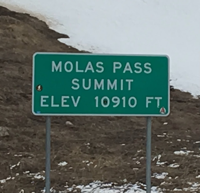
Once over the passes, we stopped for pictures.
It's snowing!
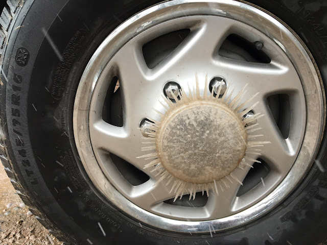
Spinning icicles
I got pelted by a flying snowball!
Next post: A drive up the Moki Dugway, a long drive to Capitol Reef National Park, and SNOW.










Looks great! Making note of places to visit, and looking forward to the next installment :-)
ReplyDeleteDan
Thanks, Dan!
ReplyDelete