Joshua Tree National Park: February 2010
February 13-15, 2010

Joshuea Tree in burned landscape from 2009 fire. San Bernardino Mountains behind Palm Springs in distance.
We then spend too much time driving back and forth across the bridge over the highway before concluding there is nowhere else to overnight in the van in Barstow. Back on CA 247, we figure we’ll just drive the rest of the way to Joshua Tree.
But a half hour down the road, Doug asks, “What do you see on that hill over there?” Voilà! RVs are circled and the campfire is glowing in an OHV (off highway vehicle) recreation area. We drive down the dirt road past the RVs and soon are fast asleep in our double sleeping bag.

At 7:00 the next morning, Doug turns on the motor to warm the van. We get back on 247 and heat water in our portable electric. Breakfast is at Cafe 247 in Lucerne Valley and is so delicious we keep the menu for our travel files.
An hour after breakfast, we’re at Joshua Tree. We luck out and find an open campsite at the first “full” campground we enter, Hidden Valley. We’ve learned that full is as of the last check, and often not current. We pull a folding chair and plastic red and white gingham tablecloth from the bus to visibly claim our site, which is in a rock- climbing cove. We are surrounded by young climbers, a mellow, friendly breed.
Typical Joshua Tree sight.
An hour after breakfast, we’re at Joshua Tree. We luck out and find an open campsite at the first “full” campground we enter, Hidden Valley. We’ve learned that full is as of the last check, and often not current. We pull a folding chair and plastic red and white gingham tablecloth from the bus to visibly claim our site, which is in a rock- climbing cove. We are surrounded by young climbers, a mellow, friendly breed.

Hidden Valley Campground

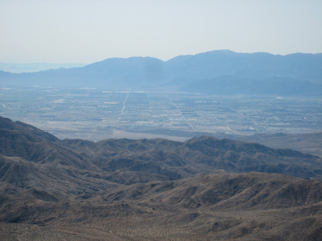
San Bernardino Mountains from Keys View.
As we look southeast, I recall vacations from college in Claremont, 35 miles east of Los Angeles at the foot of Mt.
Baldy, to my future sister-in-law’s home in Coachella, near the Salton Sea.

Salton Sea from Keys View.
How grand were those warm winter and spring days of riding bareback; drinking date shakes in nearby Indio, home of the National Date Festival; and walking under black skies brushed with infinite stars.
Indio from Keys View.

San Andreas Fault from Keys View.
Joshua Tree lies in two distinct biologic zones, with most trails and campsites in the western zone, the Mojave Desert, which lies above 3,000 feet. The eastern zone and the desert area south of the park are in the Colorado Desert, which lies below 3,000 feet. There is of course no distinct line, but the Mojave Desert is characterized by the Joshua tree, a type of yucca that may grow to 40 feet tall but grows only 1 inch a year.

Joshua Trees burned in 2009 fire.
The Joshua tree owes its name to Mormons crossing the Mojave Desert in the mid-19th century. The plants reminded them of the Biblical story of Joshua raising his arms in prayer. The May 2009 fire at Joshua Tree left large swathes of the landscape burned.

With Doug’s bad knee, we pick what we hope will be a doable trail for the day, the Desert Queen Mine and Wash Trail. Often one must do a little additional sleuthing with written trail descriptions, and we miss the easy .3 mile walk down to the wash, taking instead a steeper, rockier trail, which Doug’s knee doesn’t much like.
Joshua Tree burned in 2009 Fire.
With Doug’s bad knee, we pick what we hope will be a doable trail for the day, the Desert Queen Mine and Wash Trail. Often one must do a little additional sleuthing with written trail descriptions, and we miss the easy .3 mile walk down to the wash, taking instead a steeper, rockier trail, which Doug’s knee doesn’t much like.

Missing the easy trail, we took the steep, rocky way down instead.

Desert Queen Mine and Wash Trail--finding a trail in a wash can be tricky.
We walk part-way up the road to an old mine shaft, then descend back to the wash, which soon becomes too rocky.

Doug looking into old mine shaft.

Old mining equipment.

Another old mine shaft, gated to protect explorers from themselves.

Beautiful dikes in rocks along trail.

We decide to try the road again, continuing uphill past the mine shaft, and are soon rewarded with gorgeous vistas: the weather is perfect and the air sparkling clear.


Hard to beat a sparkling clear day and the vistas.


After the hike, we drive to nearby Twentynine Palms for additional water, then take the dirt Hidden Valley Road rather than the main road back to our campground. With night coming on, the temperature has dropped to the low forties. After a simple meal of ramen, crackers, and cheese, we stroll the campground loops, read awhile, and leave the night to the young climbers gathered at their various picnic tables.
The next day we hike to Lost Horse Mine, a pleasant and popular 4-mile roundtrip hike on a clear trail with just 400 feet of elevation gain.


The fire of May 2009 left the entire area blackened and looking like an otherworldly landscape. There is little left of the usual juniper, yucca, Joshua trees, Parry’s nolina (bear grass), and agave, but here and there signs of life peek from the ashes.
Burned landscape along Lost Horse Mine Trail.
The fire of May 2009 left the entire area blackened and looking like an otherworldly landscape. There is little left of the usual juniper, yucca, Joshua trees, Parry’s nolina (bear grass), and agave, but here and there signs of life peek from the ashes.

Joshua tree that exploded in the fire.

Rebirth of a yucca after the fire.

View of cinder cone along Geology Road from Lost Horse Mine Trail.


The vistas on another spectacularly sunny and clear day are grand.

One of our favorite activities is to poke around old foundations and the ubiquitous dumps of homesteaders—no trash pickup in those days—more to try to guess who lived in an area and how they lived than to hunt for treasure. As we discover various rock foundations down the hill from the mine, we try to imagine what the buildings were and who worked and lived in them.

Foundation below Lost Horse Mine

Remains of lives lived.
We do one last walk before darkness falls. It’s our final night, until next time, at Joshua Tree. First we follow the Barker Damn Nature Trail past magnificent natural stone work and the manmade Barker Damn of the early 1900s.


Finally, we walk to nearby Wallstreet Mill, which processed the ore from the Desert Queen Mine. Along the way stands the painted marker indicating the spot where the owner of the mine and mill shot and killed his neighbor in an ongoing feud.

Behind barbed wire stand the remains of mill buildings and a homestead. The area is littered with rusted old cars and other debris.


After wandering among the palms and then along a path
to look at the upheaval of the San Andreas Fault, just yards away, we must again head for home.

San Andreas Fault at Thousand Palms Oasis

Heading home until next time...
Sources and Information
• Joshua Tree National Park
• "Joshua Tree," National Park Service Brochure, 2009.
• Bill Cunningham and Polly burke, Best East Day Hikes: Joshua Tree (Guilford, CT: Falcon Guide, 2000).
• Thousands Palms Oasis Preserve
Comments
Post a Comment
We love hearing from our readers! If you wish your comment not to be "Anonymous," you can sign into your Google account or simply leave your name at the end of your comment. Thanks!